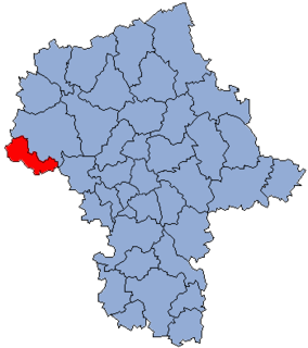
Antoninów is a village in the administrative district of Gmina Gostynin, within Gostynin County, Masovian Voivodeship, in east-central Poland. It lies approximately 11 kilometres (7 mi) north-east of Gostynin and 105 km (65 mi) west of Warsaw.
Bolesławów is a village in the administrative district of Gmina Gostynin, within Gostynin County, Masovian Voivodeship, in east-central Poland. It lies approximately 6 kilometres (4 mi) north-east of Gostynin and 104 km (65 mi) west of Warsaw.
Dąbrówka is a village in the administrative district of Gmina Gostynin, within Gostynin County, Masovian Voivodeship, in east-central Poland. It lies approximately 8 kilometres (5 mi) north-west of Gostynin and 115 km (71 mi) west of Warsaw.
Emilianów is a village in the administrative district of Gmina Gostynin, within Gostynin County, Masovian Voivodeship, in east-central Poland. It lies approximately 8 kilometres (5 mi) north-east of Gostynin and 104 km (65 mi) west of Warsaw.
Gaśno is a village in the administrative district of Gmina Gostynin, within Gostynin County, Masovian Voivodeship, in east-central Poland. It lies approximately 4 kilometres (2 mi) east of Gostynin and 104 km (65 mi) west of Warsaw.
Halinów is a village in the administrative district of Gmina Gostynin, within Gostynin County, Masovian Voivodeship, in east-central Poland. It lies approximately 6 kilometres (4 mi) south of Gostynin and 106 km (66 mi) west of Warsaw.
Jaworek is a village in the administrative district of Gmina Gostynin, within Gostynin County, Masovian Voivodeship, in east-central Poland. It lies approximately 5 kilometres (3 mi) east of Gostynin and 103 km (64 mi) west of Warsaw.
Kazimierzów is a village in the administrative district of Gmina Gostynin, within Gostynin County, Masovian Voivodeship, in east-central Poland. It lies approximately 8 kilometres (5 mi) north of Gostynin and 110 km (68 mi) west of Warsaw.
Kiełpieniec is a village in the administrative district of Gmina Gostynin, within Gostynin County, Masovian Voivodeship, in east-central Poland. It lies approximately 7 kilometres (4 mi) south-east of Gostynin and 103 km (64 mi) west of Warsaw.
Osiny is a village in the administrative district of Gmina Gostynin, within Gostynin County, Masovian Voivodeship, in east-central Poland. It lies approximately 10 kilometres (6 mi) south-west of Gostynin and 112 km (70 mi) west of Warsaw.
Sieraków is a village in the administrative district of Gmina Gostynin, within Gostynin County, Masovian Voivodeship, in east-central Poland. It lies approximately 6 kilometres (4 mi) south of Gostynin and 108 km (67 mi) west of Warsaw.
Stanisławów is a village in the administrative district of Gmina Gostynin, within Gostynin County, Masovian Voivodeship, in east-central Poland. It lies approximately 5 kilometres (3 mi) south-east of Gostynin and 104 km (65 mi) west of Warsaw.
Strzałki is a village in the administrative district of Gmina Gostynin, within Gostynin County, Masovian Voivodeship, in east-central Poland. It lies approximately 3 kilometres (2 mi) west of Gostynin and 109 km (68 mi) west of Warsaw.
Wrząca is a village in the administrative district of Gmina Gostynin, within Gostynin County, Masovian Voivodeship, in east-central Poland. It lies approximately 7 kilometres (4 mi) north-west of Gostynin and 113 km (70 mi) west of Warsaw.
Zieleniec is a village in the administrative district of Gmina Gostynin, within Gostynin County, Masovian Voivodeship, in east-central Poland. It lies approximately 10 kilometres (6 mi) west of Gostynin and 116 km (72 mi) west of Warsaw.
Zwoleń is a village in the administrative district of Gmina Gostynin, within Gostynin County, Masovian Voivodeship, in east-central Poland. It lies approximately 6 kilometres (4 mi) east of Gostynin and 102 km (63 mi) west of Warsaw.
Legarda is a village in the administrative district of Gmina Gostynin, within Gostynin County, Masovian Voivodeship, in east-central Poland. It lies approximately 3 kilometres (2 mi) north-east of Gostynin and 105 km (65 mi) west of Warsaw.
Mochty-Smok is a village in the administrative district of Gmina Zakroczym, within Nowy Dwór Mazowiecki County, Masovian Voivodeship, in east-central Poland.
Kąpiel is a village in the administrative district of Gmina Czerniejewo, within Gniezno County, Greater Poland Voivodeship, in west-central Poland. It lies approximately 3 kilometres (2 mi) east of Czerniejewo, 13 km (8 mi) south-west of Gniezno, and 41 km (25 mi) east of the regional capital Poznań.

Zawada is a village in the administrative district of Gmina Biskupiec, within Nowe Miasto County, Warmian-Masurian Voivodeship, in northern Poland. It lies approximately 6 kilometres (4 mi) east of Biskupiec, 15 km (9 mi) north-west of Nowe Miasto Lubawskie, and 77 km (48 mi) south-west of the regional capital Olsztyn.