
Gwizdów is a village in the administrative district of Gmina Modliborzyce, within Janów Lubelski County, Lublin Voivodeship, in eastern Poland. It lies approximately 13 kilometres (8 mi) south-west of Modliborzyce, 16 km (10 mi) west of Janów Lubelski, and 70 km (43 mi) south of the regional capital Lublin.
Topola is a village in the administrative district of Gmina Izbica, within Krasnystaw County, Lublin Voivodeship, in eastern Poland. It lies approximately 6 kilometres (4 mi) north-east of Izbica, 10 km (6 mi) south of Krasnystaw, and 59 km (37 mi) south-east of the regional capital Lublin.
Majdan Borowski Pierwszy is a village in the administrative district of Gmina Rudnik, within Krasnystaw County, Lublin Voivodeship, in eastern Poland. It lies approximately 5 kilometres (3 mi) north of Rudnik, 17 km (11 mi) south-west of Krasnystaw, and 47 km (29 mi) south-east of the regional capital Lublin.
Borówek is a village in the administrative district of Gmina Żółkiewka, within Krasnystaw County, Lublin Voivodeship, in eastern Poland. It lies approximately 7 kilometres (4 mi) north-east of Żółkiewka, 20 km (12 mi) south-west of Krasnystaw, and 43 km (27 mi) south-east of the regional capital Lublin.
Rożki is a village in the administrative district of Gmina Żółkiewka, within Krasnystaw County, Lublin Voivodeship, in eastern Poland. It lies approximately 2 kilometres (1 mi) north-west of Żółkiewka, 27 km (17 mi) west of Krasnystaw, and 41 km (25 mi) south-east of the regional capital Lublin.
Wólka is a village in the administrative district of Gmina Żółkiewka, within Krasnystaw County, Lublin Voivodeship, in eastern Poland. It lies approximately 3 kilometres (2 mi) east of Żółkiewka, 23 km (14 mi) south-west of Krasnystaw, and 43 km (27 mi) south-east of the regional capital Lublin.
Krzywie is a village in the administrative district of Gmina Dzierzkowice, within Kraśnik County, Lublin Voivodeship, in eastern Poland. It lies approximately 3 kilometres (2 mi) south-east of Terpentyna, 8 km (5 mi) north-west of Kraśnik, and 46 km (29 mi) south-west of the regional capital Lublin.
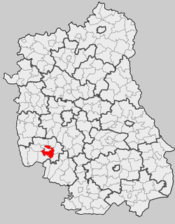
Gościeradów is a village in Kraśnik County, Lublin Voivodeship, in eastern Poland. It is the seat of the gmina called Gmina Gościeradów. It lies approximately 17 kilometres (11 mi) west of Kraśnik and 59 km (37 mi) south-west of the regional capital Lublin.
Liśnik Duży is a village in the administrative district of Gmina Gościeradów, within Kraśnik County, Lublin Voivodeship, in eastern Poland. It lies approximately 6 kilometres (4 mi) east of Gościeradów, 11 km (7 mi) west of Kraśnik, and 53 km (33 mi) south-west of the regional capital Lublin.
Marynopole is a village in the administrative district of Gmina Gościeradów, within Kraśnik County, Lublin Voivodeship, in eastern Poland. It lies approximately 7 kilometres (4 mi) east of Gościeradów, 12 km (7 mi) south-west of Kraśnik, and 56 km (35 mi) south-west of the regional capital Lublin.
Mikulin is a village in the administrative district of Gmina Kraśnik, within Kraśnik County, Lublin Voivodeship, in eastern Poland. It lies approximately 6 kilometres (4 mi) south-west of Kraśnik and 50 km (31 mi) south-west of the regional capital Lublin.
Pasieka is a village in the administrative district of Gmina Kraśnik, within Kraśnik County, Lublin Voivodeship, in eastern Poland. It lies approximately 2 kilometres (1 mi) east of Kraśnik and 44 km (27 mi) south-west of the regional capital Lublin.
Dębowiec is a village in the administrative district of Gmina Trzydnik Duży, within Kraśnik County, Lublin Voivodeship, in eastern Poland. It lies approximately 4 kilometres (2 mi) north of Trzydnik Duży, 7 km (4 mi) west of Kraśnik, and 50 km (31 mi) south-west of the regional capital Lublin.
Owczarnia is a village in the administrative district of Gmina Trzydnik Duży, within Kraśnik County, Lublin Voivodeship, in eastern Poland. It lies approximately 6 kilometres (4 mi) east of Trzydnik Duży, 4 km (2 mi) south of Kraśnik, and 49 km (30 mi) south-west of the regional capital Lublin.
Zielonka is a village in the administrative district of Gmina Trzydnik Duży, within Kraśnik County, Lublin Voivodeship, in eastern Poland. It lies approximately 5 kilometres (3 mi) south-east of Trzydnik Duży, 10 km (6 mi) south of Kraśnik, and 54 km (34 mi) south-west of the regional capital Lublin.
Bęczyn is a village in the administrative district of Gmina Urzędów, within Kraśnik County, Lublin Voivodeship, in eastern Poland. It lies approximately 2 kilometres (1 mi) west of Urzędów, 10 km (6 mi) north-west of Kraśnik, and 43 km (27 mi) south-west of the regional capital Lublin.
Popkowice is a village in the administrative district of Gmina Urzędów, within Kraśnik County, Lublin Voivodeship, in eastern Poland. It lies approximately 6 kilometres (4 mi) east of Urzędów, 8 km (5 mi) north of Kraśnik, and 38 km (24 mi) south-west of the regional capital Lublin.
Zdrapy is a village in the administrative district of Gmina Wilkołaz, within Kraśnik County, Lublin Voivodeship, in eastern Poland. It lies approximately 3 kilometres (2 mi) south of Wilkołaz, 12 km (7 mi) north-east of Kraśnik, and 34 km (21 mi) south-west of the regional capital Lublin.
Świerczyna is a village in the administrative district of Gmina Zakrzówek, within Kraśnik County, Lublin Voivodeship, in eastern Poland. It lies approximately 5 kilometres (3 mi) east of Zakrzówek, 16 km (10 mi) east of Kraśnik, and 37 km (23 mi) south of the regional capital Lublin.
Nikodemów is a village in the administrative district of Gmina Zakrzew, within Lublin County, Lublin Voivodeship, in eastern Poland. It lies approximately 5 kilometres (3 mi) north-west of Zakrzew and 37 km (23 mi) south of the regional capital Lublin.


