Bielsko-Biala Voivodeship was a unit of administrative division and local government in Poland from 1975 to 1998, superseded by Silesian Voivodeship and Lesser Poland Voivodeship. Its capital city was Bielsko-Biała.
Gmina Wadowice is an urban-rural gmina in Wadowice County, Lesser Poland Voivodeship, in southern Poland. Its seat is the town of Wadowice, which lies approximately 38 kilometres (24 mi) south-west of the regional capital Kraków.
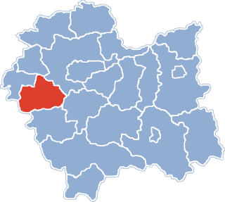
Gmina Brzeźnica is a rural gmina in Wadowice County, Lesser Poland Voivodeship, in southern Poland. Its seat is the village of Brzeźnica, which lies approximately 14 kilometres (9 mi) north-east of Wadowice and 25 km (16 mi) south-west of the regional capital Kraków.
Gmina Lanckorona is a rural gmina in Wadowice County, Lesser Poland Voivodeship, in southern Poland. Its seat is the village of Lanckorona, which lies approximately 16 kilometres (10 mi) east of Wadowice and 27 km (17 mi) south-west of the regional capital Kraków.
Gmina Stryszów is a rural gmina in Wadowice County, Lesser Poland Voivodeship, in southern Poland. Its seat is the village of Stryszów, which lies approximately 11 kilometres (7 mi) south-east of Wadowice and 35 km (22 mi) south-west of the regional capital Kraków.

Wysoka is a village in the administrative district of Gmina Wadowice, within Wadowice County, Lesser Poland Voivodeship, in southern Poland. It lies approximately 9 kilometres (6 mi) north-east of Wadowice and 30 km (19 mi) south-west of the regional capital Kraków.
Barwałd Górny is a village in the administrative district of Gmina Kalwaria Zebrzydowska, within Wadowice County, Lesser Poland Voivodeship, in southern Poland. It lies approximately 4 kilometres (2 mi) west of Kalwaria Zebrzydowska, 10 km (6 mi) east of Wadowice, and 31 km (19 mi) south-west of the regional capital Kraków.
Barwałd Średni is a village in southern Poland, located in the administrative district of Gmina Kalwaria Zebrzydowska within Wadowice County, Lesser Poland Voivodeship. It lies approximately 6 kilometres (4 mi) west of Kalwaria Zebrzydowska, 8 km (5 mi) east of Wadowice, and 33 km (21 mi) south-west of the regional capital Kraków.

Brody is a village in the administrative district of Gmina Kalwaria Zebrzydowska, within Wadowice County, Lesser Poland Voivodeship, in southern Poland. It lies approximately 2 kilometres (1 mi) east of Kalwaria Zebrzydowska, 15 km (9 mi) east of Wadowice, and 28 km (17 mi) south-west of the regional capital Kraków.
Bugaj is a village in the administrative district of Gmina Kalwaria Zebrzydowska, within Wadowice County, Lesser Poland Voivodeship, in southern Poland.
Leńcze is a village in the administrative district of Gmina Kalwaria Zebrzydowska, within Wadowice County, Lesser Poland Voivodeship, in southern Poland. It lies approximately 5 kilometres (3 mi) north-east of Kalwaria Zebrzydowska, 16 km (10 mi) east of Wadowice, and 24 km (15 mi) south-west of the regional capital Kraków.

Przytkowice is a village in the administrative district of Gmina Kalwaria Zebrzydowska, within Wadowice County, Lesser Poland Voivodeship, in southern Poland. It lies approximately 6 kilometres (4 mi) north of Kalwaria Zebrzydowska, 14 km (9 mi) east of Wadowice, and 25 km (16 mi) south-west of the regional capital Kraków.
Stanisław Dolny is a village in the administrative district of Gmina Kalwaria Zebrzydowska, within Wadowice County, Lesser Poland Voivodeship, in southern Poland. It lies approximately 6 kilometres (4 mi) north-west of Kalwaria Zebrzydowska, 10 km (6 mi) east of Wadowice, and 29 km (18 mi) south-west of the regional capital Kraków.
Zarzyce Małe is a village in the administrative district of Gmina Kalwaria Zebrzydowska, within Wadowice County, Lesser Poland Voivodeship, in southern Poland. It lies approximately 8 kilometres (5 mi) north-east of Kalwaria Zebrzydowska, 20 km (12 mi) east of Wadowice, and 22 km (14 mi) south-west of the regional capital Kraków.

Zarzyce Wielkie is a village in the administrative district of Gmina Kalwaria Zebrzydowska, within Wadowice County, Lesser Poland Voivodeship, in southern Poland. It lies approximately 5 kilometres (3 mi) north-east of Kalwaria Zebrzydowska, 17 km (11 mi) east of Wadowice, and 25 km (16 mi) south-west of the regional capital Kraków.

Zebrzydowice is a village in the administrative district of Gmina Kalwaria Zebrzydowska, within Wadowice County, Lesser Poland Voivodeship, in southern Poland. It lies approximately 6 kilometres (4 mi) north-west of Kalwaria Zebrzydowska, 10 km (6 mi) east of Wadowice, and 29 km (18 mi) south-west of the regional capital Kraków.
Jastrzębia is a village in the administrative district of Gmina Lanckorona, within Wadowice County, Lesser Poland Voivodeship, in southern Poland. It lies approximately 5 kilometres (3 mi) north-east of Lanckorona, 20 km (12 mi) east of Wadowice, and 25 km (16 mi) south-west of the regional capital Kraków.
Komorowo is a village in the administrative district of Gmina Rościszewo, within Sierpc County, Masovian Voivodeship, in east-central Poland. It lies approximately 3 kilometres (2 mi) north-west of Rościszewo, 8 km (5 mi) north-east of Sierpc, and 114 km (71 mi) north-west of Warsaw.