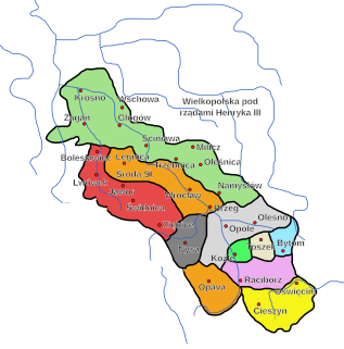
The Duchy of Oświęcim, or the Duchy of Auschwitz, was one of many Duchies of Silesia, formed in the aftermath of the fragmentation of Poland.

The Duchy of Zator was one of many Duchies of Silesia.
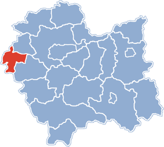
Gmina Przeciszów is a rural gmina in Oświęcim County, Lesser Poland Voivodeship, in southern Poland. Its seat is the village of Przeciszów, which lies approximately 12 kilometres (7 mi) east of Oświęcim and 40 km (25 mi) west of the regional capital Kraków.

Baczków is a village in the administrative district of Gmina Bochnia, within Bochnia County, Lesser Poland Voivodeship, in southern Poland. It lies approximately 4 kilometres (2 mi) north of Bochnia and 36 km (22 mi) east of the regional capital Kraków.

Głębowice is a village in the administrative district of Gmina Osiek, within Oświęcim County, Lesser Poland Voivodeship, in southern Poland. It lies approximately 5 kilometres (3 mi) east of Osiek, 14 km (9 mi) south-east of Oświęcim, and 46 km (29 mi) west of the regional capital Kraków.

Harmęże is a village in the administrative district of Gmina Oświęcim, within Oświęcim County, Lesser Poland Voivodeship, in southern Poland. It lies approximately 8 kilometres (5 mi) south-west of Oświęcim and 57 km (35 mi) west of the regional capital Kraków. The village has a population of 613.
Stawy Monowskie is a village in the administrative district of Gmina Oświęcim, within Oświęcim County, Lesser Poland Voivodeship, in southern Poland. It lies approximately 9 kilometres (6 mi) south-east of Oświęcim and 44 km (27 mi) west of the regional capital Kraków.
Przeciszów is a village in Oświęcim County, Lesser Poland Voivodeship, in southern Poland. It is the seat of the gmina called Gmina Przeciszów. It lies approximately 12 kilometres (7 mi) east of Oświęcim and 40 km (25 mi) west of the regional capital Kraków.

Graboszyce is a village in the administrative district of Gmina Zator, within Oświęcim County, Lesser Poland Voivodeship, in southern Poland. It lies approximately 6 kilometres (4 mi) south of Zator, 20 km (12 mi) south-east of Oświęcim, and 38 km (24 mi) west of the regional capital Kraków.
Grodzisko is a village in the administrative district of Gmina Zator, within Oświęcim County, Lesser Poland Voivodeship, in southern Poland. It lies approximately 5 kilometres (3 mi) south of Zator, 19 km (12 mi) south-east of Oświęcim, and 36 km (22 mi) west of the regional capital Kraków.
Laskowa is a village in the administrative district of Gmina Zator, within Oświęcim County, Lesser Poland Voivodeship, in southern Poland. It lies approximately 3 kilometres (2 mi) south-east of Zator, 19 km (12 mi) south-east of Oświęcim, and 35 km (22 mi) west of the regional capital Kraków.
Łowiczki is a village in the administrative district of Gmina Zator, within Oświęcim County, Lesser Poland Voivodeship, in southern Poland. It lies approximately 4 kilometres (2 mi) south-west of Zator, 16 km (10 mi) south-east of Oświęcim, and 39 km (24 mi) west of the regional capital Kraków.
Palczowice is a village in the administrative district of Gmina Zator, within Oświęcim County, Lesser Poland Voivodeship, in southern Poland. It lies approximately 17 km (11 mi) east of Oświęcim and 36 km (22 mi) west of the regional capital Kraków.
Rudze is a village in the administrative district of Gmina Zator, within Oświęcim County, Lesser Poland Voivodeship, in southern Poland. It lies approximately 2 kilometres (1 mi) south-east of Zator, 18 km (11 mi) south-east of Oświęcim, and 36 km (22 mi) west of the regional capital Kraków.
Smolice is a village in the administrative district of Gmina Zator, within Oświęcim County, Lesser Poland Voivodeship, in southern Poland. It lies approximately 5 kilometres (3 mi) north-east of Zator, 17 km (11 mi) east of Oświęcim, and 34 km (21 mi) west of the regional capital Kraków.
Trzebieńczyce is a village in the administrative district of Gmina Zator, within Oświęcim County, Lesser Poland Voivodeship, in southern Poland. It lies approximately 3 kilometres (2 mi) south-east of Zator, 19 km (12 mi) south-east of Oświęcim, and 35 km (22 mi) west of the regional capital Kraków.
Polanka Wielka is a village in Oświęcim County, Lesser Poland Voivodeship, in southern Poland. It is the seat of the gmina called Gmina Polanka Wielka. It lies approximately 10 kilometres (6 mi) south-east of Oświęcim and 46 km (29 mi) west of the regional capital Kraków.