Otto Karhi Park is a public park in the Pokkinen district in the city centre of Oulu, Finland. The park has been named after Otto Karhi, a politician from Oulu.

Oulun Energia Areena or Oulu Ice Hall is an arena in the Raksila district of Oulu, in Finland. It is primarily used for ice hockey, and is the home arena of Kärpät. It opened in 1975 and holds 6,614 people. The arena's former name was Raksilan jäähalli. The name was changed to Oulun Energia Areena in 2006, after a sponsorship deal with Oulun Energia, an energy company based in Oulu.
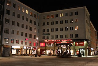
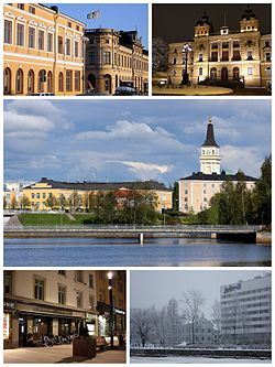
The Rotuaari is a pedestrian zone in the Pokkinen district in Oulu, Finland. The area, together with the Oulu Market Square, is being managed by the city centre shopkeeper association Oulun Liikekeskus ry. The main entrance to the Oulu Stockmann department store is located on Rotuaari.

Myllytulli is a neighbourhood of the city centre area of Oulu, Finland.

Intiö is a neighbourhood of the city centre area of Oulu, Finland. It is located on the southern bank of the Oulu River in between Myllytulli and Värttö neighbourhoods.

Raksila is a neighbourhood of the city centre area of Oulu, Finland. It is bounded by the Oulu railway station to the west, the Oulu Cemetery in the Intiö neighbourhood to the north, the Finnish national road 4 to the east and the Finnish national road 22 to the south.

Toppilansaari is a neighbourhood in the Tuira area in the city of Oulu, Finland. It is located on the south side of the Toppilansalmi strait. Toppilansaari was separated from the Hietasaari district while it was rezoned to residential development in the early 2000s. The westernmost part of the neighbourhood was the location for the Finnish Housing Fair in 2005. The Möljä Bridge over the Toppilansalmi strait connects Toppilansaari with the Toppila neighbourhood. The bridge was completed in 2012.

Hollihaka is a district of the city centre area of Oulu, Finland. It is bounded by the estuary of the Oulujoki river to the west, the Vanhatulli district to the north, the Leveri district to the east and the Nuottasaari district to the south. Together with the two latter districts, Hollihaka forms a neighbourhood called Heinäpää.
Vihreäsaari is an uninhabited island and a neighbourhood in the Tuira area in the city of Oulu, Finland. It is separated from the Hietasaari island by the Johteensalmi strait.

Vaara is a district of the city centre area of Oulu, Finland. Together with the districts of Pokkinen and Vanhatulli, Vaara forms the central business district of Oulu. It is bounded by the districts of Raksila to the east, Pokkinen to the west, Myllytulli to the north and Vanhatulli to the south.

Haukipudas is a district of Oulu, Finland. Together with Jokikylä and Martinniemi districts, it forms the Haukipudas area. Haukipudas is located in the river delta of the Kiiminkijoki river. It is bounded by the Bothnian Bay in the west, National road 4 in the east, Martinniemi district in the north and Kello district in the south. The district was established in 2013 when the Haukipudas municipality together with Kiiminki, Oulunsalo and Yli-Ii municipalities were merged with the city of Oulu.

Kiiminki is a district of Oulu, Finland. Together with Alakylä, Hannus and Huttukylä districts, it forms the Kiiminki area. The center of the district is located where the National road 20 crosses the Kiiminkijoki river. The district was established in 2013 when the Kiiminki municipality together with Haukipudas, Oulunsalo and Yli-Ii municipalities were merged with the city of Oulu.

Oulun Suomalaisen Yhteiskoulun Lukio is a Finnish-language upper secondary school in Oulu, Finland. The school is located in the Kuusiluoto neighbourhood in the Vanhatulli district in the central Oulu.

Kontinkangas is a district of Oulu, Finland. It is located to the east of the National road 4 and to the north of the National road 22 about two kilometers from the city centre. Its neighbouring districts are Kaukovainio, Raksila, Peltola and Oulunsuu.

Karjasilta is a district in the Höyhtyä area in the city of Oulu, Finland. The district close to the city centre is bordered by the Raksila district to the north, Finnish national road 4 to the east, the Vanhatulli and Limingantulli districts to the west and the Nokela and Höyhtyä districts to the south.

Oulujoki is a former municipality of Finland. The municipality had a population of 5,230 (1963) and covered a land area of 606.1 square kilometres (234.0 sq mi). Its neighbouring municipalities were Kempele, Kiiminki, Muhos, Oulu, Tyrnävä, Utajärvi and Ylikiiminki. The municipality was named after the river Oulujoki.

Martinniemi is a district of Oulu, Finland. Together with Haukipudas and Jokikylä districts, it forms the Haukipudas area. Martinniemi is located in north of the river delta of the Kiiminkijoki river. It is bounded by the Bothnian Bay in the west, the Jokikylä district in the east, the Ii municipality in the north and the Kiiminkijoki river and the Haukipudas district in the south. The district was established in 2013 when the Haukipudas municipality together with Kiiminki, Oulunsalo and Yli-Ii municipalities were merged with the city of Oulu.