
Pioneer Island is part of the Severnaya Zemlya group in the Russian Arctic. It measures 1,527 km2 (590 sq mi) in area. The island was discovered by Georgy Ushakov and Nikolay Urvantsev during their 1930-32 expedition.

San Miguelito is a city and district (distrito) of Panamá Province in Panama. The population according to the 2000 census was 293,745; the latest official estimate is 375,409. The district covers an area of 50.1 km². San Miguelito district is completely enclaved within Panama District and it is included in the Panama City Metropolitan Area.
Babine River Corridor Provincial Park is a provincial park in British Columbia, Canada, located to the north of Hazelton. The park was established by Order-in-Council in 1999 and is approximately 15,339 hectares in area.

Mokrance is a village and municipality in Košice-okolie District in the Kosice Region of eastern Slovakia.

The Kraburi River, also Kra or Pak Chan River, is the boundary river between Thailand and Myanmar at the Kra Isthmus of the Malay Peninsula. The river has its source in the Tenasserim Hills and flows into the Andaman Sea near the Thai town of Ranong and Kawthaung, Myanmar.

Trnkov is a village and municipality in Prešov District in the Prešov Region of eastern Slovakia.
Hemmadi or Hemmady is a village on the banks of Chakra river. The village is located in Kundapura taluk of Udupi district .The village is situated on National Highway 66,a road from here goes to Kollur via Vandse. Historical Sri Lakshminarayana temple is located in the heart of the village. Agriculture is the main economic source, people also follow horticulture.
This is a list of points in the Philippines that are farther north, south, east, or west than any other location in the country. Also included are extreme points in elevation, extreme distances, and other points of geographic interest.
Suryty is a village in the administrative district of Gmina Lidzbark Warmiński, within Lidzbark County, Warmian-Masurian Voivodeship, in northern Poland. It lies approximately 10 kilometres (6 mi) south of Lidzbark Warmiński and 29 km (18 mi) north of the regional capital Olsztyn.
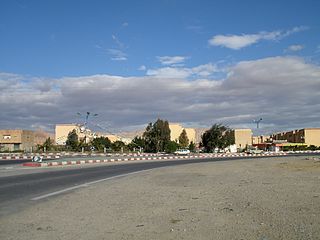
El Outaya is a town and commune in Biskra Province, Algeria. According to the 1998 census it has a population of 8,787.
Donja Crnuća is a village in the municipality of Gornji Milanovac, Serbia. According to the 2002 census, the village has a population of 323 people.
Panevlje is a village in the municipality of Vranje, Serbia. According to the 2002 census, the village has a population of 209 people.
Jeffries Glacier is a glacier between Lenton Bluff and the Maro Cliffs, flowing northwest for at least 8 nautical miles (15 km) through the Theron Mountains of Antarctica. It was first mapped in 1956–57 by the Commonwealth Trans-Antarctic Expedition and named for Peter H. Jeffries, a meteorologist with the advance party of the expedition in 1955–56.
Kalapet is a legislative assembly constituency in the Union territory of Puducherry in India. Kalapet assembly constituency covers the enclave of Kalapet and is a part of the Puducherry.
German submarine U-741 was a Type VIIC U-boat built by F Schichau GmbH of Danzig and commissioned on 10 April 1943.
Javor is a village situated in Novi Pazar municipality in Serbia.
Maddulapalli is a village of jagtial district pegadapalli mandal Assembly constituency : Dharmapuri assembly constituency Lok Sabha constituency : Peddapalli parliamentary constituency, Telangana state of India.
ERB-79 is a synthetic estrogen and a selective agonist of the ERβ. It is a racemic mixture, with the active enantiomer being ERB-26. ERB-79 shows more than 484-fold selectivity for transactivation of the ERβ over the ERα. Its EC50 value for the ERβ is 0.448 nM (14.52% of the potency of estradiol) and for the ERα is 79 nM (0.03% of the potency of estradiol). It has no antagonistic activity at either receptor. ERB-79 is active in preclinical models of arthritis. The chemical structure of ERB-79 does not appear to have been disclosed.
Hastinapuram is a neighbourhood of Hyderabad. It is located towards Nagarjuna Sagar highway road. Its neighbouring areas are B.N. Reddy Nagar, Vanasthali Puram and LB Nagar. Also NGO colony, Christian colony. The area is divided into four parts, East Hastinapuram, West Hastinapuram, South Hastinapuram and Central Hastinapuram. LB Nagar will be the nearest station of Hyderabad Metro Train. Tourism destinations like Ramoji Film City, and Mount Opera are located within 10–15 km. The distance to Hyderabad Airport is 25 km. G.Surya Prakash, the Legend lives in Hastinapuram.