
The Rome Metro is a rapid transit system that operates in Rome, Italy. It started operation in 1955, making it the oldest in the country.

The Via Valeria was an ancient Roman road of Italy, the continuation north-eastwards of the Via Tiburtina from Tibur. It probably owed its origin to Marcus Valerius Messalla, censor in 154 BC. A second Via Valeria, the Via Valeria of Sicily, connected Messina and Siracusa on the island of Sicily.

Venezia Santa Lucia is the central station of Venice in the north-east of Italy. It is a terminus and located at the northern edge of Venice's historic city . The station is one of Venice's two most important railway stations; the other one is Venezia Mestre, a mainline junction station on Venice's mainland district of Mestre. Both Santa-Lucia and Mestre stations are managed by Grandi Stazioni and they are connected to each other by Ponte della Libertà.

Line A of the Rome Metro runs across the city from the north-west terminus of Battistini to the south-east terminus at Anagnina. It intersects with Line B at Termini and with Line C at San Giovanni. The line is marked orange on metro maps.
The Via Sublacensis was a Roman road constructed to connect Nero's palace in present-day Subiaco to Rome, splitting off from the Via Valeria near Varia, about 10 km northeast of Tivoli.

Line C is a Rome Metro line which runs from Monte Compatri-Pantano in the eastern suburbs of Rome, in Italy, to San Giovanni near the city centre, where it meets Line A. It is the third metro line to be built in the city and the first to be fully automated.
Ponte Mammolo is an above ground station on line B of the Rome Metro in the Ponte Mammolo district of Rome. It is on the road which links Viale Palmiro Togliatti to Via Tiburtina, and nearby is the river Aniene.

Piramide is a station on Line B of the Rome Metro. It was opened on 10 February 1955 and is sited on Piazzale Ostiense just outside Porta San Paolo, in the Ostiense quarter. Its atrium houses mosaics that have won the Artemetro Roma by Enrico Castellani (Italy) and Beverly Pepper. The station has escalators.

Garbatella is a station on the Line B of the Rome Metro. It was opened in 1990 and is located behind the former Mercati Generali di Roma, on the via Ostiense in the Ostiense quarter. It replaces the old Garbatella station 200m away, whose entrance was on Piazza Giancarlo Vallauri.

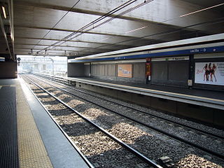
Basilica San Paolo is a station on the Line B of the Rome Metro. It was opened in 1955 and is located at the intersection between Viale Giustiniano Imperatore and Via Gaspare Gozzi, behind the Basilica of Saint Paul Outside the Walls in the Ostiense quarter. It is also one of three Metro stations also served by the Rome-Lido railway line.

Marconi is a station on line B of the Rome Metro. It is located at the point where the via Ostiense passes under the viale Guglielmo Marconi, after which it is named. Its exits are located on viale Marconi and via Ostiense.

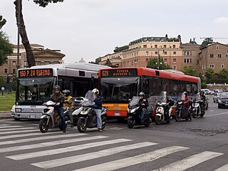
The Rome tramway network composed of 6 tram lines operating in the city of Rome, Italy, part of the Rome’s public transport network. The current tram system in Rome, is a leftover from what once was the largest tram system in Italy. The system is owned and operated by Azienda Tranvie e Autobus del Comune di Roma.
Rome has an extensive internal transport system and is one of the most important road, rail and air hubs in Italy.

Municipio I is an administrative subdivision of the municipality of Rome, encompassing the centre of the city.

Roma Tuscolana railway station is a major station serving the city and comune of Rome, Italy. It forms part of the Pisa–Livorno–Rome railway and the Rome–Fiumicino railway.

ATAC S.p.A. is an Italian publicly owned company running most of the local public transportation services, paid parking and incentive parking lots in Rome. More specifically, the company handles, on behalf of Roma Capitale Authority, the entire tramway, trolleybus network and metro lines, as well as most of the bus lines in the city. It also operates, on behalf of the Administrative Region of Lazio, three railways: Roma-Civita Castellana-Viterbo, Roma-Giardinetti and Roma-Lido. ATAC S.p.A., with its 2,200-kilometer-wide public transport network, its over 8,500 busses and 70,000 parking stalls, is currently one of the biggest public transportation companies in Europe and the largest in Italy.
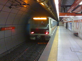
Re di Roma is a train station on the Rome Metro. It is on Line A and is located in Appio Latino, between San Giovanni and Ponte Lungo stations.
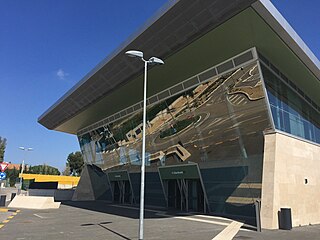
Giardinetti is an underground station of Line C of the Rome Metro. It is located along the Via Casilina, at the intersection with Via degli Orafi and Via della Fattoria di Torrenova, in the Roman district of Giardinetti, near the Grande Raccordo Anulare. Construction of the station started in 2007 and it was opened on 9 November 2014. The homonymous terminus of the Rome–Giardinetti railway line was relocated within 500 metres from the Metro station.

The Rome–Fiumicino railway is an urban railway line in Rome.

Municipio Roma VII is the seventh administrative subdivision of the Municipality of Rome (Italy).
