| Line B | |||
|---|---|---|---|
| | |||
 A CAF MB/400 train in Termini Station | |||
| Overview | |||
| Status | In use | ||
| Owner | ATAC | ||
| Locale | Rome, Italy | ||
| Termini |
| ||
| Stations | 26 | ||
| Service | |||
| Type | Rapid transit | ||
| System | Rome Metro | ||
| Operator(s) | ATAC | ||
| Daily ridership | 156,590 (2023) [1] | ||
| History | |||
| Opened | 9 February 1955 | ||
| Technical | |||
| Line length | 18.151 km (11.279 mi) plus B1 branch of 5,5 km [2] | ||
| Character | Underground and Elevated | ||
| Track gauge | 1,435 mm (4 ft 8+1⁄2 in) | ||
| Electrification | Overhead lines | ||
| |||

Metro Line B in Rome

2km
1.2miles
1.2miles
26
Rebibbia
25
P.Mammolo
24
S.M.Soccorso
23
Pietralata
22
Monti
Tiburtini
Tiburtini
21
Quintiliani
20
Tiburtina
19
Jonio
18
Conca d'Oro
17
Libia
16
Sant'Agnese
15
Bologna (Rome Metro)
14
Policlinico
13
Castro Pretorio
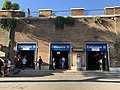
12
Termini
11
Cavour
10
Colosseo
9
Circo Massimo
8
Piramide
7
Garbatella
6
San Paolo
5
Marconi
4
EUR Magliana
3
EUR Palasport
2
EUR Fermi
1
Laurentina
Line B is a metro line serving Rome, Italy, and part of the Rome Metro. Despite its name, Line B was the first line to be built in the city. It crosses Rome diagonally from north-east, starting at Rebibbia and at Jonio stations, to south, terminating at Laurentina, in the EUR district. It crosses Line A at Termini station. The line has 26 stations and is shown in blue on Metro maps.