Poonchh, Jhansi

Last updated

Poonchh
village
Poonchh
India Uttar Pradesh location map.svg
Red pog.svg
Poonchh
Location in Uttar Pradesh and in India
India location map.svg
Red pog.svg
Poonchh
Poonchh (India)
Coordinates: 25°49′18″N79°02′04″E / 25.8216°N 79.0344°E / 25.8216; 79.0344
CountryFlag of India.svg  India
State Uttar Pradesh
District Jhansi
Tehsil Moth
Elevation
285 m (935 ft)
Population
 (2011) [1]
  Total7,518
Time zone UTC+5:30 (IST)
PIN Code
284306

Poonchh is a historic village in the Indian state of Uttar Pradesh. It is situated on national highway 27 in Moth Tehsil in the district of Jhansi, India.

Contents

It is situated near the river Betwa (5 kilometres (3.1 mi) far in the west of river Betwa) at an average elevation of 285 metres (935 ft). It is about 500 kilometres (310 mi) from the national capital New Delhi and 250 kilometres (160 mi) from the state capital Lucknow.

Poonchh is well connected to all other major towns in Uttar Pradesh by road and railway networks. It is situated on the east–west corridor (NH27), 70 kilometres (43 mi) from Jhansi to Kanpur road, and Srinagar to Kanyakumari north–south corridor passes closely to the district headquarters Jhansi.

History

A couple of Kandor Ahir pastoralists supposedly migrated from Rajasthan and set up some huts at the bank of a lake (now called as Talaa) before 1600. Then many families migrated and set up huts, with the time a village grew up around it. The village was apparently called Poonchh. This village was used to be Ahir dominated village with a lower population of other castes.

During British Raj, the Jhansi railway station was built by the British in the late 1880s and laid a railway track from Jhansi to Kanpur. A small railway station (Name: Erich Road Station, Station Code: ERC, Station grade: E) was built in Poonchh during that time, marking the importance of this village/region. Railway station was named after a municipal town near Poonchh. This railway station was built to improve connectivity for British armed forces as they had an arms warehouse in this village.

Geography and climate

Poonchh has an average elevation of 285 metres (935 feet). Poonchh lies on the plateau of central India, an area dominated by rocky relief and minerals underneath the soil. The village has a vast terai plains of Uttar Pradesh which is suitable for crops include wheat, pulses, peas, and oilseeds. The region relies heavily on monsoon the rains for irrigation purposes. The trade in agricultural products (including grain and oilseeds) is of great economic importance.

Climate

Poonchh experiences extreme temperatures. Winter begins in October with the retreat of the southwest monsoon (It does not experience any rainfall from the Northeast Monsoon) and peaks in mid-December. Temperatures are about 4 °C or 39.2 °F minimum and 21 °C or 69.8 °F maximum.

Spring arrives by the end of February and is a short-lived phase of transition.

Summer begins by April and summer temperatures can peak at 47 °C or 116.6 °F in May.

The rainy season starts by the third week of June (although this is variable year to year), while the monsoon rains gradually weaken in September and end before the last week of September. In the rainy season, the average daily high temperature hovers around 36 °C or 96.8 °F with high humidity. The average rainfall for the village is about 1,150 millimetres or 45 inches per year, occurring almost entirely within the three-and-a-half months of the Southwest Monsoon.

Demographics

Poonchh is a large village with an area of 837.55 hectares and total 1280 families residing. The Poonchh village has population of 7518 of which 3919 are males while 3599 are females as per Population Census 2011. [2]

In Poonchh village, population of children with age 0-6 is 920 which makes up 12.24% of total population of village. Average Sex Ratio of Poonchh village is 918 which is higher than Uttar Pradesh state average of 912. Child Sex Ratio for the Poonchh as per census is 866, lower than Uttar Pradesh average of 902.

Poonchh village has higher literacy rate compared to Uttar Pradesh. In 2011, literacy rate of Poonchh village was 81.86% compared to 67.68% of Uttar Pradesh. In Poonchh Male literacy stands at 91.80% while female literacy rate was 71.12%.

ParticularsTotalMaleFemale
Total No. of Houses1,280--
Population7,5183,9193,599
Child (0-6)920493427
Schedule Caste1,505787718
Schedule Tribe000
Literacy81.86 %91.80 %71.12 %
Total Workers3,0752,0551,020

Education

Higher Education

Schools

Poonchh village is a center for education for more than 14 villages around it and it also have numerous coaching classes for school academics and government job exam preparation.

Economic

Poonchh village is also a center of economic activities for more than 14 villages around it. It has well established market places, automobile service centers, restaurants and highway dhaba, Govt. hospital, private clinics, agriculture produce procurement center (Galla Mandi), Punjab National Bank and ATM, Indian Post Office, and Co-operative Bank.

Notable people

As per constitution of India and Panchyati Raaj Act (Amendment 1998), Poonchh village is administered by the Pradhan (Head of Village) who is an elected representative of the village. Currently, Lakhan Yadav is the elected Pradhan (Head of Village); he succeeded Ramkumar Yadav in April 2021.

Poonchh represents in Jila Panchayat members election as ward 1 in Jhansi district, which has a total of 24 wards. It consists of a total of 22 villages (Gram Sabha) with the total 44,708 voters. [3] Currently, Balkishun Barar has won the Jila Panchayat member [4] election with the support of Bhartiya Janta Party in a close contest with independent candidate Yadvendra Singh supported by Kishan Singh and Samajwadis in April 2021.

Related Research Articles

<span class="mw-page-title-main">Jhansi</span> Metropolis in Uttar Pradesh, India

Jhansi is a historic city in the Indian state of Uttar Pradesh. Balwant Nagar was the old name of Jhansi. It lies in the region of Bundelkhand on the banks of the Pahuj River, in the extreme south of Uttar Pradesh. Jhansi is the administrative headquarters of Jhansi district and Jhansi division. Also called the Gateway to Bundelkhand, Jhansi is situated near and around the rivers Pahuj and Betwa at an average elevation of 285 m (935 ft). It is about 420 kilometres (261 mi) from national capital New Delhi and 315 kilometres (196 mi) from state capital Lucknow.

<span class="mw-page-title-main">Bahraich</span> City in Uttar Pradesh, India

Bahraich is a city and a municipal board in Bahraich district in the state of Uttar Pradesh, India. Located on the Saryu River, a tributary of the Ghaghara river, Bahraich is 125 kilometres north-east of Lucknow, the state capital. The districts of Barabanki, Gonda, Balrampur, Lakhimpur Kheri, Shravasti and Sitapur share local boundaries with Bahraich. A factor which makes this town important is the international border shared with Nepal..

<span class="mw-page-title-main">Etah district</span> District of Uttar Pradesh in India

Etah district is one of the districts of Uttar Pradesh, India, since 1854. Etah City is the district headquarters. Etah district is a part of Aligarh Division.

<span class="mw-page-title-main">Bithoor</span> Town in Uttar Pradesh, India

Bithoor or Bithur is a town in Kanpur district, 23.4 kilometres (14.5 mi) by road north of the centre of Kanpur city, in Uttar Pradesh, India. Bithoor is situated on the right bank of the River Ganges, and is a centre of Hindu pilgrimage. Bithoor is also the centre for War of Independence of 1857 as Nana Sahib, a popular freedom fighter who was based there. The city is enlisted as a municipality of Kanpur metropolitan area.
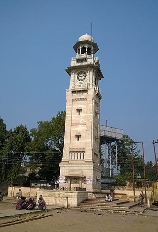
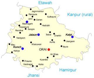
<span class="mw-page-title-main">Tikamgarh district</span> District of Madhya Pradesh in India

Tikamgarh district is one of the 52 districts of Madhya Pradesh state in central India. Tikamgarh town is the district headquarters. The district is part of Sagar Division.

<span class="mw-page-title-main">Lalitpur district, India</span> District in Uttar Pradesh, India

Lalitpur District is one of the districts of Uttar Pradesh state of India. Lalitpur district is a part of Jhansi Division. Lalitpur is the main town and administrative headquarters. The district occupies an area of 5,039 km².

<span class="mw-page-title-main">Orai</span> City in Uttar Pradesh, India

Orai is a city in Uttar Pradesh, India, and the administrative headquarters of Jalaun District. All administrative offices of Jalaun District, including the District Collectorate, police, telecom and various other government organizations are located in this city. In 2019, Orai received the award of 'Fastest Mover' Small City among India under Swachh Survekshan, an annual cleanliness survey carried by the Quality Council of India.

Badagaon Dhasan is a town and a Nagar Parishad in Tikamgarh district in the state of Madhya Pradesh, India.

Mandi Bamora is a census town in Bina-etawa district in the state of Madhya Pradesh, India. This place has a railway station Mandi Bamora. Mandi Bamora located as half- half way in two different district Bina-etawa and Vidisha. Tehsil is Bina. Mandi Bamora is very famous as a name "Great country" because two different districts boundaries separated two places Bamora and Sihora.
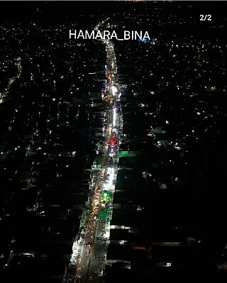
<span class="mw-page-title-main">Chakeri</span> Town in Uttar Pradesh, India

Chakeri is a census town in Kanpur metropolitan area, situated about 16 kilometres east of Kanpur city in the state of Uttar Pradesh, India. It is an industrial town with textiles and food products as its major productions. Chakeri Airforce Station, North India's second-largest air force base is situated here. Chakeri is home to reputed educational institutions and colleges. Central Leather Research Institute, the only government leather research institute in North India is situated here. The Grand Trunk Road made by emperor Sher Shah Suri passes through Chakeri. The town is enlisted as a town area of the Kanpur metropolitan area.

Parichha is a census town in Jhansi district in the Indian state of Uttar Pradesh. It is located on Jhansi-Kanpur highway on the bank of Betwa River.

Pukhrayan is a town and a Municipality in Kanpur Dehat district in the Indian state of Uttar Pradesh. Found to the south-west of Mati on National Highway 25, Pukhrayan is 2 km (1.2 mi) from Bhognipur.

Shikohabad is a city and a municipal board in the Firozabad district of the Indian state of Uttar Pradesh.

Rath is a small town with a municipal board in Hamirpur district in the Indian state of Uttar Pradesh. Rath is a Tehsil of Hamirpur District. It is situated 506 km southeast of New Delhi.

Gajner is a town located 37 kilometres from the city of Kanpur in the Kanpur Dehat district of the state of Uttar Pradesh, India. Gajner is located 11 kilometres from the district headquarters of Kanpur Dehat. Gajner is a connecting link of Kanpur, Ghatampur, Musanagar and Pukhrayan.

Ghatampur is a town and a municipal board in Kanpur Nagar district in the state of Uttar Pradesh, India. It is just 45 minutes away from the main industrial and educational hub of the state Kanpur at a distance of 40 km.

Bhimsen is a village in Kanpur district in the state of Uttar Pradesh, India.

Ait is a small town located in Jalaun district of Uttar Pradesh.

Barauli Ahir is a village in Agra district of Uttar Pradesh in India.

<span class="mw-page-title-main">Raithuwa</span> Village in India

Raithuwa is a village in Sohawal tehsil in Ayodhya district of the Indian state of Uttar Pradesh, India. The nearest town to Raithuwa is Bhadarsa which is 6 km away. Raituwa is 19 km south of district headquarters Ayodhya city.

References

  1. "Poonchh Village Population - Moth - Jhansi, Uttar Pradesh".
  2. "Poonchh Village Population - Moth - Jhansi, Uttar Pradesh". www.census2011.co.in. Retrieved 3 September 2023.
  3. "जिला पंचायत सीटों पर रोचक हुआ चुनावी घमासान". Amar Ujala (in Hindi). Retrieved 3 September 2023.
  4. Bhaskar, Dainik (May 2021). "झांसी में पंचायत चुनाव". Dainik Bhaskar. p. 1.