
Kadłubówka is a village in the administrative district of Gmina Nowe Miasto, within Płońsk County, Masovian Voivodeship, in east-central Poland. It lies approximately 3 kilometres (2 mi) north-west of Nowe Miasto, 16 km (10 mi) east of Płońsk, and 57 km (35 mi) north-west of Warsaw.
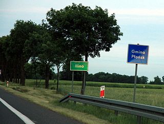
Ilino is a village in the administrative district of Gmina Płońsk, within Płońsk County, Masovian Voivodeship, in east-central Poland. It lies approximately 6 kilometres (4 mi) south-west of Płońsk and 63 km (39 mi) north-west of Warsaw.
Kadłubowo is a village in the administrative district of Gmina Dzierzążnia, within Płońsk County, Masovian Voivodeship, in east-central Poland. It lies approximately 6 kilometres (4 mi) south-west of Dzierzążnia, 16 km (10 mi) west of Płońsk, and 71 km (44 mi) north-west of Warsaw.
Korytowo is a village in the administrative district of Gmina Dzierzążnia, within Płońsk County, Masovian Voivodeship, in east-central Poland. It lies approximately 5 kilometres (3 mi) south-west of Dzierzążnia, 13 km (8 mi) west of Płońsk, and 69 km (43 mi) north-west of Warsaw.
Wilamowice is a village in the administrative district of Gmina Dzierzążnia, within Płońsk County, Masovian Voivodeship, in east-central Poland. It lies approximately 6 kilometres (4 mi) south-east of Dzierzążnia, 8 km (5 mi) south-west of Płońsk, and 65 km (40 mi) north-west of Warsaw.
Joniec is a village in Płońsk County, Masovian Voivodeship, in east-central Poland. It is the seat of the gmina called Gmina Joniec. It lies approximately 15 kilometres (9 mi) east of Płońsk and 52 km (32 mi) north-west of Warsaw.
Potyry is a village in the administrative district of Gmina Naruszewo, within Płońsk County, Masovian Voivodeship, in east-central Poland. It lies approximately 14 kilometres (9 mi) south of Płońsk and 58 km (36 mi) north-west of Warsaw.
Radzymin is a village in the administrative district of Gmina Naruszewo, within Płońsk County, Masovian Voivodeship, in east-central Poland. It lies approximately 4 kilometres (2 mi) north of Naruszewo, 8 km (5 mi) south of Płońsk, and 58 km (36 mi) north-west of Warsaw.
Sobanice is a village in the administrative district of Gmina Naruszewo, within Płońsk County, Masovian Voivodeship, in east-central Poland. It lies approximately 18 kilometres (11 mi) south of Płońsk and 58 km (36 mi) north-west of Warsaw.
Czarnoty is a village in the administrative district of Gmina Nowe Miasto, within Płońsk County, Masovian Voivodeship, in east-central Poland. It lies approximately 4 kilometres (2 mi) north of Nowe Miasto, 18 km (11 mi) east of Płońsk, and 58 km (36 mi) north-west of Warsaw.
Popielżyn Dolny is a village in the administrative district of Gmina Nowe Miasto, within Płońsk County, Masovian Voivodeship, in east-central Poland. It lies approximately 17 kilometres (11 mi) east of Płońsk and 50 km (31 mi) north-west of Warsaw.
Zasonie is a village in the administrative district of Gmina Nowe Miasto, within Płońsk County, Masovian Voivodeship, in east-central Poland. It lies approximately 18 kilometres (11 mi) east of Płońsk and 58 km (36 mi) north-west of Warsaw.

Cempkowo is a village in the administrative district of Gmina Płońsk, within Płońsk County, Masovian Voivodeship, in east-central Poland. It lies approximately 6 kilometres (4 mi) south-east of Płońsk and 58 km (36 mi) north-west of Warsaw.
Lisewo is a village in the administrative district of Gmina Płońsk, within Płońsk County, Masovian Voivodeship, in east-central Poland. It lies approximately 7 kilometres (4 mi) south-east of Płońsk and 56 km (35 mi) north-west of Warsaw.
Michalinek is a village in the administrative district of Gmina Płońsk, within Płońsk County, Masovian Voivodeship, in east-central Poland. It lies approximately 7 kilometres (4 mi) south-east of Płońsk and 56 km (35 mi) north-west of Warsaw.

Siedlin is a village in the administrative district of Gmina Płońsk, within Płońsk County, Masovian Voivodeship, in east-central Poland. It lies approximately 5 kilometres (3 mi) south-east of Płońsk and 59 km (37 mi) north-west of Warsaw.
Strubiny is a village in the administrative district of Gmina Płońsk, within Płońsk County, Masovian Voivodeship, in east-central Poland. It lies approximately 6 kilometres (4 mi) east of Płońsk and 58 km (36 mi) north-west of Warsaw.
Bogucin is a village in the administrative district of Gmina Raciąż, within Płońsk County, Masovian Voivodeship, in east-central Poland. It lies approximately 5 kilometres (3 mi) south-west of Raciąż, 24 km (15 mi) north-west of Płońsk, and 86 km (53 mi) north-west of Warsaw.
Gutarzewo is a village in the administrative district of Gmina Sochocin, within Płońsk County, Masovian Voivodeship, in east-central Poland. It lies approximately 4 kilometres (2 mi) north of Sochocin, 10 km (6 mi) north-east of Płońsk, and 67 km (42 mi) north-west of Warsaw.
Idzikowice is a village in the administrative district of Gmina Sochocin, within Płońsk County, Masovian Voivodeship, in east-central Poland. It lies approximately 6 kilometres (4 mi) south-east of Sochocin, 11 km (7 mi) east of Płońsk, and 58 km (36 mi) north-west of Warsaw.


