Małecz is a village in the administrative district of Gmina Lubochnia, within Tomaszów Mazowiecki County, Łódź Voivodeship, in central Poland. It lies approximately 4 kilometres (2 mi) west of Lubochnia, 12 km (7 mi) north of Tomaszów Mazowiecki, and 42 km (26 mi) south-east of the regional capital Łódź.
Roszkowa Wola is a village in the administrative district of Gmina Rzeczyca, within Tomaszów Mazowiecki County, Łódź Voivodeship, in central Poland. It lies approximately 10 kilometres (6 mi) east of Rzeczyca, 30 km (19 mi) east of Tomaszów Mazowiecki, and 69 km (43 mi) east of the regional capital Łódź.
Ewcin is a village in the administrative district of Gmina Będków, within Tomaszów Mazowiecki County, Łódź Voivodeship, in central Poland. It lies approximately 6 kilometres (4 mi) south-east of Będków, 15 km (9 mi) west of Tomaszów Mazowiecki, and 35 km (22 mi) south-east of the regional capital Łódź.
Prażki is a village in the administrative district of Gmina Będków, within Tomaszów Mazowiecki County, Łódź Voivodeship, in central Poland. It lies approximately 4 kilometres (2 mi) north of Będków, 23 km (14 mi) north-west of Tomaszów Mazowiecki, and 27 km (17 mi) south-east of the regional capital Łódź.
Pogorzałe Ługi is a village in the administrative district of Gmina Rokiciny, within Tomaszów Mazowiecki County, Łódź Voivodeship, in central Poland. It lies approximately 25 kilometres (16 mi) north-west of Tomaszów Mazowiecki and 26 km (16 mi) east of the regional capital Łódź.
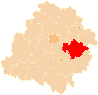
Cekanów is a village in the administrative district of Gmina Tomaszów Mazowiecki, within Tomaszów Mazowiecki County, Łódź Voivodeship, in central Poland. It lies approximately 7 kilometres (4 mi) north-west of Tomaszów Mazowiecki and 44 km (27 mi) south-east of the regional capital Łódź.
Chorzęcin is a village in the administrative district of Gmina Tomaszów Mazowiecki, within Tomaszów Mazowiecki County, Łódź Voivodeship, in central Poland. It lies approximately 10 kilometres (6 mi) west of Tomaszów Mazowiecki and 40 km (25 mi) south-east of the regional capital Łódź.
Dąbrowa is a village in the administrative district of Gmina Tomaszów Mazowiecki, within Tomaszów Mazowiecki County, Łódź Voivodeship, in central Poland. It lies approximately 4 kilometres (2 mi) west of Tomaszów Mazowiecki and 46 km (29 mi) south-east of the regional capital Łódź.
Godaszewice is a village in the administrative district of Gmina Tomaszów Mazowiecki, within Tomaszów Mazowiecki County, Łódź Voivodeship, in central Poland. It lies approximately 9 kilometres (6 mi) west of Tomaszów Mazowiecki and 42 km (26 mi) south-east of the regional capital Łódź.
Jadwigów is a village in the administrative district of Gmina Tomaszów Mazowiecki, within Tomaszów Mazowiecki County, Łódź Voivodeship, in central Poland. It lies approximately 7 kilometres (4 mi) west of Tomaszów Mazowiecki and 44 km (27 mi) south-east of the regional capital Łódź.
Karolinów is a village in the administrative district of Gmina Tomaszów Mazowiecki, within Tomaszów Mazowiecki County, Łódź Voivodeship, in central Poland. It lies approximately 9 kilometres (6 mi) south of Tomaszów Mazowiecki and 53 km (33 mi) south-east of the regional capital Łódź.
Kwiatkówka is a village in the administrative district of Gmina Tomaszów Mazowiecki, within Tomaszów Mazowiecki County, Łódź Voivodeship, in central Poland. It lies approximately 9 kilometres (6 mi) west of Tomaszów Mazowiecki and 41 km (25 mi) south-east of the regional capital Łódź.
Niebrów is a village in the administrative district of Gmina Tomaszów Mazowiecki, within Tomaszów Mazowiecki County, Łódź Voivodeship, in central Poland. It lies approximately 5 kilometres (3 mi) north-west of Tomaszów Mazowiecki and 45 km (28 mi) south-east of the regional capital Łódź.
Swolszewice Małe is a village in the administrative district of Gmina Tomaszów Mazowiecki, within Tomaszów Mazowiecki County, Łódź Voivodeship, in central Poland. It lies approximately 6 kilometres (4 mi) south-west of Tomaszów Mazowiecki and 48 km (30 mi) south-east of the regional capital Łódź.
Wiaderno is a village in the administrative district of Gmina Tomaszów Mazowiecki, within Tomaszów Mazowiecki County, Łódź Voivodeship, in central Poland. It lies approximately 5 kilometres (3 mi) west of Tomaszów Mazowiecki and 46 km (29 mi) south-east of the regional capital Łódź.
Zaborów Pierwszy is a village in the administrative district of Gmina Tomaszów Mazowiecki, within Tomaszów Mazowiecki County, Łódź Voivodeship, in central Poland. It lies approximately 6 kilometres (4 mi) north-west of Tomaszów Mazowiecki and 44 km (27 mi) south-east of the regional capital Łódź.
Kolonia Zawada is a village in the administrative district of Gmina Tomaszów Mazowiecki, within Tomaszów Mazowiecki County, Łódź Voivodeship, in central Poland. It lies approximately 5 kilometres (3 mi) west of Tomaszów Mazowiecki and 45 km (28 mi) south-east of the regional capital Łódź.
Buków is a village in the administrative district of Gmina Ujazd, within Tomaszów Mazowiecki County, Łódź Voivodeship, in central Poland. It lies approximately 6 kilometres (4 mi) north-west of Ujazd, 16 km (10 mi) north-west of Tomaszów Mazowiecki, and 34 km (21 mi) south-east of the regional capital Łódź.
Ciosny is a village in the administrative district of Gmina Ujazd, within Tomaszów Mazowiecki County, Łódź Voivodeship, in central Poland. It lies approximately 7 kilometres (4 mi) north-west of Ujazd, 18 km (11 mi) north-west of Tomaszów Mazowiecki, and 32 km (20 mi) south-east of the regional capital Łódź.
Modrzewek is a village in the administrative district of Gmina Żelechlinek, within Tomaszów Mazowiecki County, Łódź Voivodeship, in central Poland. It lies approximately 4 kilometres (2 mi) west of Żelechlinek, 23 km (14 mi) north of Tomaszów Mazowiecki, and 37 km (23 mi) east of the regional capital Łódź.