Tumor protein p53, also known as p53, cellular tumor antigen p53, phosphoprotein p53, tumor suppressor p53, antigen NY-CO-13, or transformation-related protein 53 (TRP53), is any isoform of a protein encoded by homologous genes in various organisms, such as TP53 (humans) and Trp53 (mice). This homolog is crucial in multicellular organisms, where it prevents cancer formation, thus, functions as a tumor suppressor. As such, p53 has been described as "the guardian of the genome" because of its role in conserving stability by preventing genome mutation. Hence TP53 is classified as a tumor suppressor gene.

After the Battle of Heiligerlee, the Dutch rebel leader Louis of Nassau failed to capture the city Groningen. Louis was driven away by Fernando Álvarez de Toledo, Duke of Alba and defeated at the Battle of Jemmingen on 21 July 1568.

Beryllium (4Be) has 12 known isotopes, but only one of these isotopes is stable and a primordial nuclide. As such, beryllium is considered a monoisotopic element. It is also a mononuclidic element, because its other isotopes have such short half-lives that none are primordial and their abundance is very low. Beryllium is unique as being the only monoisotopic element with both an even number of protons and an odd number of neutrons. There are 25 other monoisotopic elements but all have odd atomic numbers, and even numbers of neutrons.

The European route E 22 is one of the longest European routes. It has a length of about 5,320 km (3,310 mi). Many of the E-roads have been extended into Asia since the year 2000; the E 22 was extended on 24 June 2002.

Sényő is a village in Szabolcs-Szatmár-Bereg county, in the Northern Great Plain region of eastern Hungary.

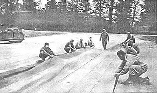
Advanced Landing Grounds (ALGs) were temporary advance airfields constructed by the Allies during World War II during the liberation of Europe. They were built in the UK prior to the invasion and thereafter in northwest Europe from 6 June 1944 to V-E Day, 7 May 1945.

Stara Rozedranka is a village in the administrative district of Gmina Sokółka, within Sokółka County, Podlaskie Voivodeship, in north-eastern Poland, close to the border with Belarus. It lies approximately 11 kilometres (7 mi) west of Sokółka and 33 km (21 mi) north of the regional capital Białystok.
Gronostaje-Puszcza is a village in the administrative district of Gmina Rutki, within Zambrów County, Podlaskie Voivodeship, in north-eastern Poland.

Langanki is a village in the administrative district of Gmina Kętrzyn, within Kętrzyn County, Warmian-Masurian Voivodeship, in northern Poland. It lies approximately 12 kilometres (7 mi) south of Kętrzyn and 65 km (40 mi) east of the regional capital Olsztyn.

Łazdoje is a village in the administrative district of Gmina Kętrzyn, within Kętrzyn County, Warmian-Masurian Voivodeship, in northern Poland. It lies approximately 12 kilometres (7 mi) south-west of Kętrzyn and 58 km (36 mi) north-east of the regional capital Olsztyn.

Przeczniak is a settlement in the administrative district of Gmina Kętrzyn, within Kętrzyn County, Warmian-Masurian Voivodeship, in northern Poland. It lies approximately 11 kilometres (7 mi) south-east of Kętrzyn and 68 km (42 mi) east of the regional capital Olsztyn.

Boże is a village in the administrative district of Gmina Mrągowo, within Mrągowo County, Warmian-Masurian Voivodeship, in northern Poland. It lies approximately 11 kilometres (7 mi) north-east of Mrągowo and 60 km (37 mi) east of the regional capital Olsztyn.

Lembruk is a village in the administrative district of Gmina Mrągowo, within Mrągowo County, Warmian-Masurian Voivodeship, in northern Poland. It lies approximately 11 kilometres (7 mi) north of Mrągowo and 53 km (33 mi) east of the regional capital Olsztyn.

Szczechy Małe is a village in the administrative district of Gmina Pisz, within Pisz County, Warmian-Masurian Voivodeship, in northern Poland. It lies approximately 11 kilometres (7 mi) north-east of Pisz and 91 km (57 mi) east of the regional capital Olsztyn.

Turowo Duże is a village in the administrative district of Gmina Pisz, within Pisz County, Warmian-Masurian Voivodeship, in northern Poland. It lies approximately 11 kilometres (7 mi) south-east of Pisz and 96 km (60 mi) east of the regional capital Olsztyn.

Orłowo is a village in the administrative district of Gmina Biała Piska, within Pisz County, Warmian-Masurian Voivodeship, in northern Poland. It lies approximately 7 kilometres (4 mi) west of Biała Piska, 12 km (7 mi) east of Pisz, and 99 km (62 mi) east of the regional capital Olsztyn.
The city of Leeuwarden, Friesland, the Netherlands has had at least 130 windmills over the centuries. Only one, the Froskepôlemolen survives today within Leeuwarden. Six other mills which have stood in Leeuwarden survive elsewhere in the Netherlands. The mills had a wide range of industrial and agricultural uses. The industrial uses include the processing of bark for tanning leather, the fulling of cloth, the production of cement, the production of dyes, the extraction of oil, the grinding of tobacco to produce snuff, the production of gunpowder, and the sawing of timber. Agricultural uses include the milling of buckwheat, oats, rye and wheat, the processing of chicory, the production of pearl barley, and the pumping of water.

The R344 road is a regional road in Ireland, located in west County Galway. It cuts off the loop made by the N59 through Clifden and Letterfrack. .
Bang Krathum railway station is a railway station located in Bang Krathum Subdistrict, Bang Krathum District, Phitsanulok. It is located 362.225 km from Bangkok Railway Station and is a class 2 railway station. It is on the Northern Line of the State Railway of Thailand. The station opened on 24 January 1908 as part of the Northern Line extension from Pak Nam Pho to Phitsanulok.


