Port Barnett, Pennsylvania

Last updated

Port Barnett is an unincorporated community in Jefferson County, in the U.S. state of Pennsylvania. [1]

Jefferson County, Pennsylvania County in the United States

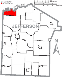
Jefferson County is a county located in the U.S. state of Pennsylvania. As of the 2010 census, the population was 45,200. Its county seat is Brookville. The county was established on March 26, 1804, from part of Lycoming County and later organized in 1830. It is named for President Thomas Jefferson. It is home to Punxsutawney Phil, the groundhog that predicts when spring will come every February 2.

U.S. state constituent political entity of the United States

In the United States, a state is a constituent political entity, of which there are currently 50. Bound together in a political union, each state holds governmental jurisdiction over a separate and defined geographic territory and shares its sovereignty with the federal government. Due to this shared sovereignty, Americans are citizens both of the federal republic and of the state in which they reside. State citizenship and residency are flexible, and no government approval is required to move between states, except for persons restricted by certain types of court orders. Four states use the term commonwealth rather than state in their full official names.

Pennsylvania State of the United States of America

Pennsylvania, officially the Commonwealth of Pennsylvania, is a state located in the northeastern, Great Lakes and Mid-Atlantic regions of the United States. The Appalachian Mountains run through its middle. The Commonwealth is bordered by Delaware to the southeast, Maryland to the south, West Virginia to the southwest, Ohio to the west, Lake Erie and the Canadian province of Ontario to the northwest, New York to the north, and New Jersey to the east.

History

The community was named for Joseph Barnett, the original owner of the town site. [2]

Related Research Articles

Barnett Township, Forest County, Pennsylvania Township in Pennsylvania, United States

Barnett Township is a township in Forest County, Pennsylvania, United States. The population was 361 at the 2010 census.

Barnett Township, Jefferson County, Pennsylvania Township in Pennsylvania, United States

Barnett Township is a township in Jefferson County, Pennsylvania, United States. The population was 254 at the 2010 census. It was named for Jefferson County pioneer Joseph Barnett.

Nordland is an unincorporated community in Jefferson County, in the U.S. state of Washington.

Roseann is an unincorporated community in Buchanan County, Virginia, in the United States.

Millerstown is an unincorporated community in Grayson County, Kentucky, in the United States.

Roseville is an unincorporated community in Jefferson County, in the U.S. state of Pennsylvania.

Heathville is an unincorporated community in Jefferson County, in the U.S. state of Pennsylvania.

Ohl is an unincorporated community in Jefferson County, in the U.S. state of Pennsylvania.

Conifer is an unincorporated community in Jefferson County, in the U.S. state of Pennsylvania.

Ramsaytown is an unincorporated community in Jefferson County, in the U.S. state of Pennsylvania.

Baxter is an unincorporated community in Jefferson County, in the U.S. state of Pennsylvania.

Kahletown is an unincorporated community in Jefferson County, in the U.S. state of Pennsylvania.

Markton is an unincorporated community in Jefferson County, in the U.S. state of Pennsylvania.

North Freedom is an unincorporated community in Jefferson County, in the U.S. state of Pennsylvania.

Rockdale is an unincorporated community in Jefferson County, in the U.S. state of Pennsylvania.

Pawnee is an unincorporated community in Harrison County, in the U.S. state of Missouri.

Brussells is an unincorporated community in Lincoln County, in the U.S. state of Missouri.

Ten Mile is an unincorporated community in Washington County, Pennsylvania.

Bonus is an unincorporated community in Butler County, Pennsylvania.

Jennie is an unincorporated community in Evans County, in the U.S. state of Georgia.

References

Coordinates: 41°09′23″N79°03′03″W / 41.15639°N 79.05083°W / 41.15639; -79.05083

Geographic coordinate system Coordinate system

A geographic coordinate system is a coordinate system that enables every location on Earth to be specified by a set of numbers, letters or symbols. The coordinates are often chosen such that one of the numbers represents a vertical position and two or three of the numbers represent a horizontal position; alternatively, a geographic position may be expressed in a combined three-dimensional Cartesian vector. A common choice of coordinates is latitude, longitude and elevation. To specify a location on a plane requires a map projection.