The Strait of Canso is a strait located in the province of Nova Scotia, Canada. It divides the Nova Scotia peninsula from Cape Breton Island.
Country Harbour is a rural community in Guysborough County, Nova Scotia, Canada. The community is situated on a large deep natural harbour of the same name and is located along the province's Eastern Shore close to Canso, Nova Scotia.
Indian Harbour Lake is a rural community and lake of the same name located in Guysborough County Nova Scotia, Canada. It is nestled ten minutes outside of Sherbrooke, and 2.5 hours from the capital of Nova Scotia, Halifax. Seven lakes are located around Indian Harbour Lake, which are named Mitchell Lake, First Lake, Second Lake, Third Lake, Indian Harbour Lake, Monument Lake, and Archibald's Lake. Indian Harbour Lake is also located 5 minutes from the community of Port Hilfordd, which has a sand beach.
Mushaboom is a rural community on the Eastern Shore of Nova Scotia, Canada. It is a part of the Halifax Regional Municipality and lies along the Marine Drive on Trunk 7. The community is located about 13 km (8.1 mi) southwest of Sheet Harbour. and east of Taylor Head Provincial Park.

Route 211 is a collector road in the Canadian province of Nova Scotia. It is located in Guysborough County and connects Stillwater on Trunk 7 to Isaac's Harbour North on Route 316.
Lake Charles is a small lake in Nova Scotia’s Halifax Regional Municipality between the communities of Dartmouth and Waverley. It is situated between Port Wallace in the south and Nova Scotia Highway 107 in the North, Nova Scotia Highway 118 in the west and Nova Scotia Route 318 to the east. It is the summit of the Shubenacadie Canal, where the level of the surface is 31 m above sea level. Located in the Shubenacadie watershed, it ultimately feeds into the Bay of Fundy. However, it also feeds into Halifax Harbour through the canal locks at Shubie Park.
Port Bickerton is a small community in the Canadian province of Nova Scotia, located in the Municipality of the District of Saint Mary's in Guysborough County.
New Harbour, is a small community in the Canadian province of Nova Scotia, located in the Municipality of the District of Guysborough in Guysborough County.
Seal Harbour is a community in the Canadian province of Nova Scotia, located in Guysborough County. Located on the east side of Isaac's Harbour, it was named for the abundance of seals once found there. Founded as a fishing settlement, it became a gold mining community with the initial discovery in the area in 1867, with further discoveries in 1892. Gold mining near Seal Harbour peaked in 1904–1907. The mines briefly reopened from 1939 to 1942 and then closed, leaving fishing and lumbering as the main industries. Some gold exploration is still carried out in the area by the Orex Exploration company.
Port Felix is a small community in the Canadian province of Nova Scotia, located in the Municipality of the District of Guysborough in Guysborough County.
Country Harbour Mines is a community in the Canadian province of Nova Scotia, located in the Municipality of the District of Guysborough in Guysborough County.
Isaac's Harbour North is a community in the Canadian province of Nova Scotia, located in the Municipality of the District of Guysborough in Guysborough County.
Pirate Harbour is a small community in the Canadian province of Nova Scotia, located in the Municipality of the District of Guysborough in Guysborough County. It is located just south of Mulgrave, Nova Scotia, on the west side of the Strait of Canso. The Mi'kmaq name for the place was Tesogwode, "the place where goods were sorted." The name Pirate Harbour was allegedly given because the space between the small island and the cove provided safe anchorage and a hiding place for pirates such as Captain Kidd and Paul Jones. A settlement was established in 1785, and early settlers included John Wilson and John Peeples, who each received a thousand-acre grant there in 1785.
St. Francis Harbour, is a small community in the Canadian province of Nova Scotia, located in the Municipality of the District of Guysborough in Guysborough County.
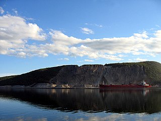
Steep Creek is a small community in the Canadian province of Nova Scotia, located in the Municipality of the District of Guysborough in Guysborough County. Located along the Strait of Canso which is the body of water separating mainland Nova Scotia from Cape Breton Island. The Canso Strait is the deepest ice free port in North America. Steep Creek borders on the communities of Pitate Harbour on one side and Melford on the other.
Linwood is a community in the Canadian province of Nova Scotia, located in Antigonish County. Linwood, Nova Scotia is a small coastal community located halfway between the town of Antigonish and the Canso Causeway. Located around Linwood Harbour, Linwood has two campgrounds, both with a view of the Harbour, along with a short hiking trail, picnic park, ice rink and a community centre.

Antigonish Harbour is a community and harbour in the Canadian province of Nova Scotia, located in Antigonish County, first settled in 1784 by disbanded soldiers loyal to the British side in the American Revolution.
Indian Harbour may refer to the following places:
St. Georges Bay is a bay with shore on the Nova Scotia peninsula and Cape Breton Island, Canada, thus comprising a sub-basin of the Gulf of St. Lawrence.

