Summit County is an urban county in the U.S. state of Ohio. As of the 2020 census, the population was 540,428, making it the fourth-most populous county in Ohio. Its county seat and largest city is Akron. The county was formed on March 3, 1840, from portions of Medina, Portage and Stark Counties. It was named Summit County because the highest elevation on the Ohio and Erie Canal is located in the county.

Cuyahoga Falls is a city in Summit County, Ohio, United States. As of the 2020 census, the city population was 51,114. The second-largest city in Summit County, it is located directly north of Akron and is a suburb of the Akron metropolitan area. The city was founded in 1812 by William Wetmore and was originally named Manchester, but renamed for the Cuyahoga River and the series of waterfalls that run along the southern boundary of the city.

Stow is a city in Summit County, Ohio, United States. The population was 34,483 at the 2020 census. It is a suburban community within the Akron metropolitan area.
William Wetmore founded Cuyahoga Falls, Ohio in 1812.

Bath Township is one of the nine townships of Summit County, Ohio, United States. A suburb of Akron, the 2020 census found 10,024 people in the township.

State Route 59 is an east–west state highway in the U.S. state of Ohio, serving the Akron metropolitan area. The western terminus of State Route 59 is in downtown Akron at a partial interchange with the Interstate 76/Interstate 77 concurrency, and the eastern terminus is at State Route 5, 0.5 miles (0.80 km) east of Ravenna. The route is approximately 23 miles (37 km) long and was certified in 1969 over what had previously been part of SR 5. It serves as a major or as the primary east–west roadway for the cities of Cuyahoga Falls, Kent, Ravenna, and Stow, the village of Silver Lake, and Franklin and Ravenna Townships.

Northampton was one of the 16 original townships in Summit County, Ohio. It was in the middle of Summit County, bordering Akron and Cuyahoga Falls. No incorporated areas were formed within the township but Akron and Cuyahoga Falls expanded into Northampton via annexation. In 1986, Northampton Township merged with Cuyahoga Falls, the first time a township and city merged in Ohio. When created it occupied survey Town 3, Range 11 in the Western Reserve and was about 25 square miles (65 km2) in area. Its first settler, Simeon Prior named the township for the Hampshire County, Massachusetts village of Northampton.
Botzum was a hamlet in Northampton Township, Summit County, Ohio around what is now the intersection of Bath and Riverview Roads in Akron and Cuyahoga Falls.

Boston Township is one of the nine townships of Summit County, Ohio, United States, about 15 miles north of Akron and 23 miles south of Cleveland. It is part of the Akron metropolitan area. The 2020 census found 1,401 people in the township.
Richfield Township is one of the nine townships of Summit County, Ohio, United States. The 2020 census found 6,437 people in the township.
Tinker's Creek, in Cuyahoga, Summit and Portage counties of Ohio, is the largest tributary of the Cuyahoga River, providing about a third of its flow into Lake Erie.

State Route 532 is a north–south state highway in the northeastern portion of the U.S. state of Ohio. The highway runs from its southern terminus at a signalized intersection with U.S. Route 224 (US 224) on the Summit–Portage county line approximately 0.75 miles (1.21 km) south of Mogadore on the border of Springfield Township and Suffield Township to its northern terminus at a diamond interchange with Interstate 76 (I-76), at its exit 29 within the Tallmadge city limits.
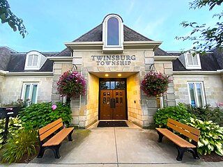
Twinsburg Township is one of the nine townships of Summit County, Ohio, United States. The 2020 census found 3,857 people in the township.

The Akron, OH Metropolitan Statistical Area, sometimes referred to as Greater Akron, is defined by the United States Office of Management and Budget as an area consisting of two counties, Summit and Portage, in Northeast Ohio and anchored by the city of Akron. As of the 2020 census, the MSA had a population of 702,219. The Akron MSA is also part of the larger Cleveland–Akron–Canton, OH Combined Statistical Area, which has a population of 3,633,962 people as of the 2020 census, the largest metropolitan area in Ohio.
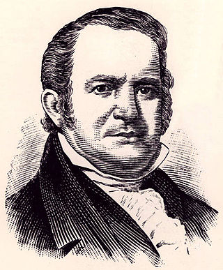
General Simon Perkins was an early settler, businessman and surveyor of the Western Reserve of Connecticut, which would later become northeast Ohio. He co-founded Akron, Ohio, with Paul Williams in 1825. He served as a brigadier-general during the War of 1812.

The Perkins Stone Mansion is a historic house museum in Akron, Ohio, United States.
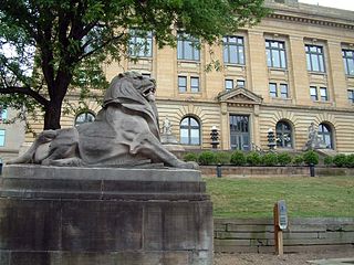
The Summit County Historical Society of Akron, Ohio, abbreviated SCHS, is a 501(c)(3) non-profit organization located in Akron, Ohio. It focuses on the history of the City of Akron and Summit County, Ohio.

David Hudson was an American businessman noted for founding Hudson Township, now Hudson, Ohio. Hudson was born in Branford, Connecticut, and lived there until the age four when his family moved to Goshen, Connecticut, where he lived for many years, owning a farm, marrying Anna Norton in 1783, and raising the oldest seven of their nine children. In 1789, Hudson joined a group to purchase a parcel of land in the Connecticut Western Reserve. The following year, he left Goshen to survey the parcel and settle it as Hudson Township. Hudson traveled through the state of New York, west along Lake Erie and south along the Cuyahoga River to reach his land.
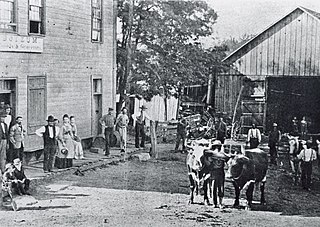
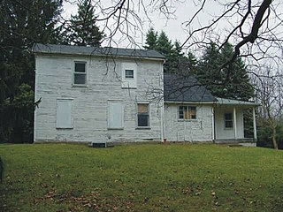
Brittain, Ohio was a small settlement, part of the township of Springfield east of Akron, which has now been completely integrated into Akron. It was settled by the John T. Brittain Family in 1832.(A house built by the family ca. 1874 still stands on Brittain Road). Brittain was located at the crossroads of roads from Tallmadge (north), Mogadore (east), North Springfield (south) and Middlebury (west). It is 1,066 feet above sea level.
Simeon Prior was a blacksmith and Revolutionary War soldier, who in 1802 along with his family founded Northampton Township, Ohio, now a part of Cuyahoga Falls, Ohio. The original family farm was located in what was called the Connecticut Western Reserve on the eastern shoulder of the Cuyahoga Valley.
