Marina Beach, or simply the Marina, is a natural urban beach in Chennai, Tamil Nadu, India, along the Bay of Bengal. The beach runs from near Fort St. George in the north to Foreshore Estate in the south, a distance of 6.0 km (3.7 mi), making it the second longest urban beach in the world, after Cox's Bazar Beach. It is a prominent landmark in Chennai.

Nagapattinam is a town in the Indian state of Tamil Nadu and the administrative headquarters of Nagapattinam district. The town came to prominence during the period of Medieval Cholas and served as their important port for commerce and east-bound naval expeditions. The Chudamani Vihara in Nagapattinam constructed by the Srivijayan king Sri Mara Vijayattungavarman of the Sailendra dynasty with the help of Rajaraja Chola I was an important Buddhist structure in those times. Nagapattinam was settled by the Portuguese and, later, the Dutch under whom it served as the capital of Dutch Coromandel from 1660 to 1781. In November 1781, the town was conquered by the British East India Company. It served as the capital of Tanjore district from 1799 to 1845 under Madras Presidency of the British. It continued to be a part of Thanjavur district in Independent India. In 1991, it was made the headquarters of the newly created Nagapattinam District. Nagapattinam is administered by a Special grade municipality covering an area of 17.92 km2 (6.92 sq mi) and had a population of 102,905 as of 2011.

Karaikal is a city of the Indian Union Territory of Puducherry. It is the administrative headquarters of the Karaikal District and the second most populated city in the Union Territory after Pondicherry. Located on the Coromandel Coast of Bay of Bengal in South India, it is a coastal enclave and is surrounded by the state of Tamil Nadu in the southern region of Indian peninsula.

The Buckingham Canal is a 796 kilometres (494.6 mi)-long fresh water navigation canal, that parallels the Coromandel Coast of South India from Kakinada City in the Kakinada district of Andhra Pradesh to Village near Chidambaram, Cuddalore District of Tamil Nadu, India. The canal connects most of the natural backwaters along the coast to Chennai (Madras) port.

Cuddalore, also spelt as Kadalur, is the city and headquarters of the Cuddalore District in the Indian state of Tamil Nadu. Situated south of Chennai, Cuddalore was an important city and port during the British Raj.

Silver Beach is a beach on the southeast coast of India. It is located 2 km (1.2 mi) from downtown Cuddalore, the headquarters of Cuddalore district in the state of Tamil Nadu. Silver Beach, however, is untouched by the busy life of the city. It is the second longest beach on the Coromandel Coast and one of the longest beaches in Asia. The 57 km-long stretch of beach faces severe seafront erosion.

Cuddalore District is one of the 38 districts in the state of Tamil Nadu in India.

Parangipettai, historically called Porto Novo, is a coastal panchayat town in Cuddalore district in the Indian state of Tamil Nadu. Parangipettai is located on the north bank of the mouth of the Vellar River at a distance of 30 km from Cuddalore. From the state capital city of Chennai, Parangipettai can be reached through the National Highway NH32 stretch between Cuddalore and Chidambaram.

East Coast Road (ECR), combination of SH-49, NH-332A, NH-32, officially known as Mutthamizh Arignar Kalaignar Road without public voting, is a two-lane highway in Tamil Nadu, India, built along the Bay of Bengal coast. It connects Tamil Nadu's state capital Chennai with Kanyakumari via Puducherry, Cuddalore, Chidambaram, Sirkali, Thirukkadaiyur, Tharangambadi, Karaikal, Nagore, Nagapattinam, Thiruthuraipoondi, Muthupet, Adirampattinam, Manora,Peravurani,Manamelkudi, Mimisal, Ramanathapuram, Rameswaram,Thoothukudi, Tiruchendur, Uvari, Kudankulam. The total length of the road is about 777 km between Chennai and Kanyakumari.

There have been at least four lighthouses named Chennai Lighthouse or Madras Lighthouse, which face the Bay of Bengal on the east coast of the Indian Subcontinent in Chennai, India.

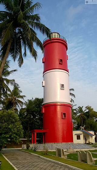
The Kannur Lighthouse is located near the Payyambalam Beach, a few kilometers from Kannur town, in Kerala state, south India. It is adjacent to the Sea View Park and the Government Guest House. The lighthouse is still active and overlooks the Arabian Sea.

Pichavaram is one of the villages of Parangipettai near Chidambaram in Cuddalore District, Tamil Nadu, India. It is located between the Vellar estuary in the north and Coleroon estuary in the south. The Vellar-Coleroon estuarine complex forms the Killai backwater and the mangroves that are permanently rooted in a few feet of water. It is located at a distance of 243 km from Chennai and 15 km from Chidambaram.
Pamban is a town in the Rameswaram taluk of Ramanathapuram district, Tamil Nadu. It is at the west edge of Pamban Island and is a popular fishing port. The town gives its name to the whole island. Pamban railway station is the first station on the island for pilgrims travelling to Rameswaram.

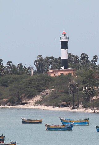
The Pamban Lighthouse is one of the two lighthouses on the Rameswaram island in Tamil Nadu. It is also known as Pamban channel northwest point lighthouse.

Mahabalipuram Lighthouse is located in Tamil Nadu, India. It has been open to tourists since 2011. It was closed in 2001 following a perceived threat from the Liberation Tigers of Tamil Eelam. The first light was commissioned here in 1887 on the roof of the Olakkannesvara Temple. The lighthouse, with a circular masonry tower made of natural stone, became fully functional in 1904. India's oldest lighthouse, built around 640 CE by Pallava king Mahendravarman I stands next to this modern structure. The Pallava era lighthouse is a protected monument, maintained by the Archaeological Survey of India.

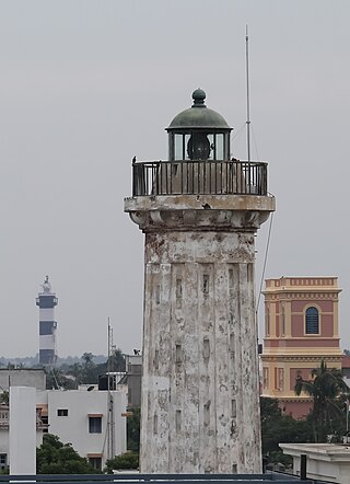
Pondicherry Lighthouse is a central government institution under ministry of ports, shipping and waterways, providing navigational aids to the mariners. The old lighthouse was constructed in Pondicherry in the nineteenth century by the French rulers. A new lighthouse was constructed in 20th century by the government of India. The old lighthouse had first beamed light on 1 September 1836. The new lighthouse started functioning in 1979.
The coastline of Tamil Nadu is located on the southeast coast of Indian Peninsula, and forms a part of Coromandel Coast of Bay of Bengal and Indian Ocean. It is 1076 km long and is the second longest coastline in the country after Gujarat. Chennai, the capital of the state and an important commercial and industrial center in the country is located in the northern part of the coast with Kanniyakumari, forming the southern tip where Indian Ocean, Bay of Bengal and Arabian Sea meet. It also shares maritime border with Sri Lanka across the Palk strait in Gulf of Mannar. The coastal corridor consists of 14 districts with 15 major ports and harbors, sandy beaches, lakes and river estuaries. Tamil Nadu is the only state in India with territory on both the eastern and western coastlines.

Thirupadiripuliyur railway station is one of the two railway stations serving the town of Cuddalore, headquarters of the Cuddalore district in Tamil Nadu, India, the other one being Cuddalore Port Junction. It is located on the main line between Chennai Egmore and Tiruchirappalli Junction. It comes under the Tiruchirappalli railway division of the Southern Railway zone.
Kasimedu is a hamlet in the neighbourhood of Royapuram, in Chennai district of Tamil Nadu state in the peninsular India. This hamlet is occupied by fishermen whose families depend on the fishing harbour and the fish market nearby. It stretches for about 2 km, near Ennore fishing harbour along the shore, north of Chennai Port. Large numbers of victims from Kasimedu fishing community were found during the tsunami observed on 26 December 2004. Kasimedu is located at about 5 km from Chennai Beach railway station. Near about 200 tons of fishes are brought to Kasimedu, daily. State Highway 114 passes through Kasimedu.


