Postaja, Tolmin

Last updated
Postaja
Most na Soci-train station-fom Podbrdo.jpg
Slovenia location map.svg
Red pog.svg
Postaja
Location in Slovenia
Coordinates: 46°8′36.62″N13°45′51.14″E / 46.1435056°N 13.7642056°E / 46.1435056; 13.7642056 Coordinates: 46°8′36.62″N13°45′51.14″E / 46.1435056°N 13.7642056°E / 46.1435056; 13.7642056
Country Flag of Slovenia.svg Slovenia
Traditional region Slovenian Littoral
Statistical region Gorizia
Municipality Tolmin
Area
  Total 2.17 km2 (0.84 sq mi)
Elevation 187.5 m (615.2 ft)
Population (2002)
  Total 122
[1]

Postaja (pronounced  [pɔˈstaːja] ) is a settlement on the left bank of the Idrijca River, southeast of Most na Soči, in the Municipality of Tolmin in the Littoral region of Slovenia. [2] It includes the hamlets of Na Lazih (Slovene : Na lazih) and Klohe. The Most na Soči train station is located in Postaja. [3]

Idrijca river in Slovenia

The Idrijca is a river flowing through the Idrija Hills and Cerkno Hills. It is 60 kilometres (37 mi) long. It rises near Vojsko, flows towards northeast and after passing through Idrija turns to the northwest. After passing through Spodnja Idrija and Cerkno it joins the Soča in Most na Soči. It has the pluvio-nival regime and belongs to the Adriatic Sea Basin.

Most na Soči Place in Slovenian Littoral, Slovenia

Most na Soči is a town in the Municipality of Tolmin in the Littoral region of Slovenia. It is located on a rocky crest above the confluence of Soča and Idrijca rivers. In the past these two riverbeds, deeply carved into the rocky slopes, provided the settlement with excellent protection from intruders. Due to the nearby Doblar hydro plant, the basins of the river were entirely inundated and below the settlement a vast reservoir was formed, which now attracts both fishermen and visitors, who can stroll along some well-kept panoramic paths.

Tolmin Town in Slovenian Littoral, Slovenia

Tolmin is a small town in northwestern Slovenia. It is the administrative centre of the Municipality of Tolmin.

Contents

Name

Until 1937, Postaja was a hamlet of Sveta Lucija ob Soči (later renamed Most na Soči) and its house numbers were continuous with that of the main town. Postaja received its own house numbering system in 1938 even though it still had no official name, and it was referred to as the "Sveta Lucija ob Soči railroad station" or simply "the station" (Slovene : postaja). The name Postaja became the official name of the settlement in 1952. [3]

House numbering system of giving a unique number to each building in a street or area

House numbering is the system of giving a unique number to each building in a street or area, with the intention of making it easier to locate a particular building. The house number is often part of a postal address. The term describes the number of any building with a mailbox, or even a vacant lot.

Slovene language language spoken in Slovenia

Slovene or Slovenian belongs to the group of South Slavic languages. It is spoken by approximately 2.5 million speakers worldwide, the majority of whom live in Slovenia. It is the first language of about 2.1 million Slovenian people and is one of the 24 official and working languages of the European Union.

History

Railroad fortification Postaja Tolmin Slovenia - fortification.JPG
Railroad fortification

The Austrian authorities built a fortification to protect the railroad bridge belonging to the Bohinj Railway on the east edge of the settlement. After the First World War, the fortification was used by the Italian army for housing and to store weapons. [4]

Bohinj Railway Slovenian-Italian cross-border railway

The Bohinj Railway is a railway in Slovenia and Italy. It connects Jesenice in Slovenia with Trieste in Italy. It was built by Austria-Hungary from 1900 to 1906 as a part of a new strategic railway, the Neue Alpenbahnen, that would connect Western Austria and Southern Germany with the then Austro-Hungarian port of Trieste. The line starts in Jesenice, at the Southern end of the Karawanks Tunnel; it then crosses the Julian Alps through the Bohinj Tunnel, and passes the border town of Nova Gorica before crossing the Italian border and reaching Trieste.

Railway bridge

Railway bridge and part of the village of Baca pri Modreju Zelezniski viadukt v Baci pri Modreju.jpg
Railway bridge and part of the village of Bača pri Modreju

There is an imposing railway bridge belonging to the Bohinj Railway over the Idrijca in the settlement and in the nearby settlement of Bača pri Modreju. It is the longest and largest such structure along the entire line [5] and has seven arches. [3] :396

Bača pri Modreju Place in Slovenian Littoral, Slovenia

Bača pri Modreju is a village in the Municipality of Tolmin in the Littoral region of Slovenia. It lies at the confluence of the Bača River with the Idrijca River, which in turn joins the Soča River at Most na Soči, northwest of the settlement. The village includes the hamlets of Grapa, Stopec, and Sopotnica.

Related Research Articles

Idrija Place in Littoral, Slovenia

Idrija is a town in western Slovenia. It is the seat of the Municipality of Idrija. It is located in the traditional region of the Slovenian Littoral and is in the Gorizia Statistical Region. It is notable for its mercury mine with stores and infrastructure, as well as miners' living quarters, and a miners' theatre. Together with the Spanish mine at Almadén, it has been a UNESCO World Heritage Site since 2012. In 2011, Idrija was given the Alpine Town of the Year award.

Kanal, Kanal Settlement in Slovenia

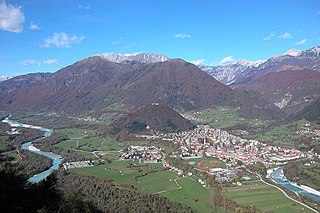
Kanal, frequently referred to as Kanal ob Soči, is a settlement mostly on the left bank of the Soča River in the Slovene Littoral, the traditional region in southwestern Slovenia. It is an important crossing point over the Soča. At its eastern border, on the left bank of the Soča, runs the Bohinj Railway, the railway track linking the Central Europe and the Mediterranean.

Podbrdo, Tolmin Place in Slovenian Littoral, Slovenia

Podbrdo is a settlement in the Municipality of Tolmin in the Littoral region of Slovenia. It lies in narrow valley of the Bača River, next to the Bohinj Railway line at the end of the longest railway tunnel in Slovenia and next to the road from Bohinjska Bistrica and Železniki across Petrovo Brdo towards Most na Soči.

Vintgar Gorge

The Vintgar Gorge or Bled Gorge is a 1.6-kilometer (0.99 mi) gorge in northwestern Slovenia in the municipalities of Gorje and Bled, four kilometers northwest of Bled. Carved by the Radovna River, it is the continuation of the Radovna Valley. The sheer canyon walls are 50 to 100 meters high, with a total slope measuring about 250 m (820 ft). The stream has created many erosive features such as pools and rapids, and terminates in the picturesque 13 m (43 ft) Šum Falls, the largest river waterfall in Slovenia. As the first mountain gorge in the area to be made accessible to tourists, the word vintgar has been generalized in Slovene to refer to other scenic, protected gorges, e.g. the Iška Gorge, the Bistrica Gorge on Pohorje and the Ribnica Gorge in Bohinj.

Bukovski Vrh Place in Slovenian Littoral, Slovenia

Bukovski Vrh is a small settlement above Bukovo in the Littoral region of Slovenia. It lies on a plateau high above the Bača Valley in the Municipality of Tolmin.

Gorenji Log Place in Slovenian Littoral, Slovenia

Gorenji Log is a small settlement on the left bank of the Soča River southwest of Most na Soči in the Municipality of Tolmin in the Littoral region of Slovenia. The Bohinj Railway line runs through the settlement.

Gorski Vrh Place in Slovenian Littoral, Slovenia

Gorski Vrh is a small dispersed settlement in the hills north of the Idrijca River in the Municipality of Tolmin in the Littoral region of Slovenia. It is accessible from the village of Slap ob Idrijci via Šentviška Gora.

Grahovo ob Bači Place in Slovenian Littoral, Slovenia

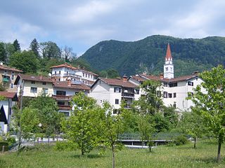
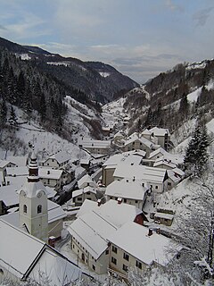
Grahovo ob Bači is a village on the Bača River in the Municipality of Tolmin in the Littoral region of Slovenia.

Hudajužna Place in Slovenian Littoral, Slovenia

Hudajužna is a village in the valley of the Bača River in the Municipality of Tolmin in the Littoral region of Slovenia. The Bohinj Railway line runs through the settlement.

Klavže Place in Slovenian Littoral, Slovenia

Klavže is a settlement in the Bača Valley in the Municipality of Tolmin in the Littoral region of Slovenia.

Pečine Place in Slovenian Littoral, Slovenia

Pečine is a village in the mountains above the right bank of the Idrijca River in the municipality of Tolmin in the Littoral region of Slovenia. It includes the hamlets of Črni Vrh, Kabiunk, Kal, Maraževec, Podkal, Travnik, and Stari Rut.

Šentviška Gora Place in Slovenian Littoral, Slovenia

Šentviška Gora is the main settlement in the hills between the valleys of the Bača and Idrijca rivers, known as the St. Vitus Plateau or Šentviška Gora Plateau, in the Municipality of Tolmin in the Littoral region of Slovenia.

Nadlesk Village in Inner Carniola, Slovenia

Nadlesk is a village south of Stari Trg in the Municipality of Loška Dolina in the Inner Carniola region of Slovenia. The settlement includes the hamlets of Hrib, Sredi Vasi, and Kot.

Ciril Kosmač Slovenian writer

Ciril Kosmač was a Slovenian novelist and screenwriter.

Rovišče, Zagorje ob Savi Place in Upper Carniola, Slovenia

Rovišče is a settlement in the Municipality of Zagorje ob Savi in central Slovenia. The area is part of the traditional region of Upper Carniola. It is now included with the rest of the municipality in the Central Sava Statistical Region. It includes the hamlet of Zasavska Gora, also known as Sveta Gora.

Podbrdo railway station railway station in Slovenia

Podbrdo railway station serves the settlement of Podbrdo, in the municipality of Tolmin, Slovenia.

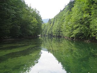
The Tolmin dialect is a Slovene dialect in the Rovte dialect group. It is spoken in the watersheds of the Bača and lower Idrijca rivers, as well as the reaches of the Soča River in that area, bounded on the west by a line west of Tolmin and Most na Soči. Other settlements in the dialect area include Grahovo ob Bači.

Sveta Lucija may refer to several places in Slovenia:

References

  1. Statistical Office of the Republic of Slovenia
  2. Tolmin municipal site
  3. 1 2 3 Savnik, Roman, ed. 1968. Krajevni leksikon Slovenije, vol. 1. Ljubljana: Državna založba Slovenije, pp. 417–418.
  4. Information sign posted at the fortification in Postaja.
  5. Information sign posted at the fortification in Postaja.