Related Research Articles

Sharp County is a county located in the U.S. state of Arkansas. As of the 2020 census, the population was 17,271. The county seat is Ash Flat. The county was formed on July 18, 1868, and named for Ephraim Sharp, a state legislator from the area.

Randolph County is located between the Ozark Mountains and Arkansas Delta in the U.S. state of Arkansas. The county is named for John Randolph, a U.S. senator from Virginia influential in obtaining congressional approval of the Louisiana Purchase, which includes today's Randolph County. Created as Arkansas's 32nd county on October 29, 1835, Randolph County has two incorporated cities, including Pocahontas, the county seat and most populous city. The county is also the site of numerous unincorporated communities and ghost towns.

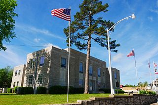
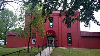
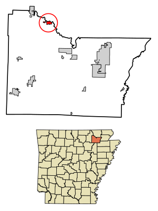
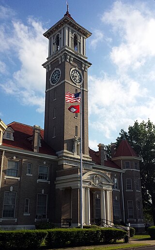
Lawrence County is a county located in the U.S. state of Arkansas. As of the 2020 census, the population was 16,216. The county seat is Walnut Ridge. Lawrence County is Arkansas's second county, formed on January 15, 1815, and named for Captain James Lawrence who fought in the War of 1812. It is an alcohol prohibition or dry county.

Jefferson County, Arkansas is a county located in the U.S. state of Arkansas in the area known as the Arkansas Delta that extends west of the Mississippi River. Jefferson County consists of five cities, two towns, and 20 townships. The county is bisected by the Arkansas River, which was critical to its development and long the chief transportation byway. In 2020, Jefferson County's population was estimated at 67,260. Its county seat and largest city is Pine Bluff. Jefferson County is included in the Pine Bluff metropolitan statistical area. The county seat and the most populous city is Pine Bluff.
Izard County is a county located in the U.S. state of Arkansas. As of the 2020 census, the population was 13,577. The county seat is Melbourne. Izard County is Arkansas's 13th county, formed on October 27, 1825, and named for War of 1812 General and Arkansas Territorial Governor George Izard. It is an alcohol prohibition or dry county.
Fulton County is a county located in the U.S. state of Arkansas. As of the 2020 census, the population was 12,075. The county seat is Salem. Fulton County was formed on December 21, 1842, and named for William Fulton, the last governor of the Arkansas Territory. It is an alcohol prohibition or dry county.
Imboden is a city in Lawrence County, Arkansas, United States. The population was 677 at the 2010 census. It is named after a family of settlers.

Lynn is a town in Lawrence County, Arkansas, United States. The population was 288 at the 2010 census.

Ravenden is a town in Lawrence County, Arkansas, United States. The population was 470 at the 2010 census. The town is in the valley of the Spring River along U.S. Highway 63 and the Burlington-Northern Railroad.

Smithville is a town in Lawrence County, Arkansas, United States. The population was 78 at the 2010 census.

Strawberry is a town in Lawrence County, Arkansas, United States. The population was 302 at the 2010 census.
Clarendon is a city in, and the county seat of, Monroe County, Arkansas, United States. Located in the Arkansas Delta, the city's position on the White River at the mouth of the Cache River has defined the community since first incorporating in 1859. Although the river has brought devastation and disaster to the city occasionally throughout history, it has also provided economic opportunities, transportation, recreation and tourism to the city.

Williford is a town in Sharp County, Arkansas, United States. The population was 70 in 2020

Wray is the home rule municipality that is the county seat of Yuma County, Colorado, United States. Located in the Colorado Plains, the city is 170 miles east of Denver, 9 miles west of the Nebraska state line, and 25 miles northwest of the Kansas state line. The population was 2,358 at the 2020 United States census.
Rosboro is an unincorporated community in Clark Township, Pike County, Arkansas, United States.

Highway 58 is an east–west state highway in north central Arkansas. The route of 53.37 miles (85.89 km) begins at Highway 14 and runs east to US Highway 67 in Donaldson. There is also an alternate route of 2.71 miles (4.36 km) designated as Highway 58E near Williford. Both routes are maintained by the Arkansas State Highway and Transportation Department (AHTD).
Saffell is an unincorporated community in Lawrence County, Arkansas, United States. Saffell is located at the junction of Arkansas highways 25 and 361, 3.5 miles (5.6 km) south-southeast of Strawberry. Saffell has a post office with ZIP code 72572.
Hillcrest School District is a school district based in Strawberry, Arkansas, United States. The district encompasses 266.08 square miles (689.1 km2) of land in Lawrence, Independence, and Sharp counties, and serves portions of Strawberry, Lynn, Smithville, Poughkeepsie, and Saffell.
River Valley School District was a school district in Lawrence County, Arkansas. It served Poughkeepsie and Strawberry.
Twin Rivers School District was a school district in Lawrence, Randolph, and Sharp counties in Arkansas. It was headquartered in the Oak Ridge Central Campus in unincorporated Randolph County, near Ravenden Springs. It served various communities, including Ravenden Springs.
References
- ↑ U.S. Geological Survey Geographic Names Information System: Poughkeepsie, Arkansas
- ↑ Arkansas Atlas & Gazetteer, DeLorme, 2nd ed., 2004, p. 27 ISBN 0899333451
- ↑ "SCHOOL DISTRICT REFERENCE MAP (2010 CENSUS): Sharp County, AR." U.S. Census Bureau. Retrieved on May 26, 2018. Note this map reflects the status before the dissolution of the Twin Rivers School District. Compare to the highway map.
- ↑ "General Highway Map Sharp County, Arkansas" (PDF). Arkansas Department of Transportation . Retrieved March 6, 2021. - See Poughkeepsie on the map.
- ↑ "ConsolidationAnnex_from_1983.xls." Arkansas Department of Education. Retrieved on October 13, 2017.
