Related Research Articles

Hocking Hills State Park is a state park in the Hocking Hills region of Hocking County, Ohio, United States. In some areas the park adjoins the Hocking State Forest. Within the park are over 25 miles (40 km) of hiking trails, rock formations, waterfalls, and recess caves. The trails are open from dawn to dusk, all year round, including holidays.
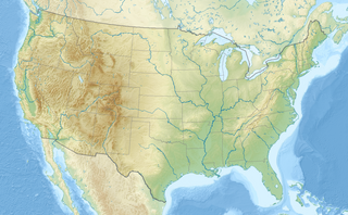
The Shawnee National Forest is a United States National Forest located in the Ozark and Shawnee Hills of Southern Illinois, United States. Administered by the U.S.D.A. Forest Service, it consists of approximately 280,000 acres (1,100 km²) of federally managed lands. In descending order of land area it is located in parts of Pope, Jackson, Union, Hardin, Alexander, Saline, Gallatin, Johnson, and Massac counties. Forest headquarters are located in Harrisburg, Illinois. There are local ranger district offices in Jonesboro and Vienna. The Shawnee National Forest is also the single largest publicly owned body of land in the state of Illinois. It is considered part of Southern Illinois, and is south of the St. Louis, Missouri, and Metro East areas, in area code 618. Portions of it are in the far south area of Illinois known as Little Egypt. Cities in or near the area are Carbondale, Illinois, Marion, Illinois, and Cairo, Illinois.

Pearl Lake State Park, at the base of Hahn's Peak, is in Routt County, Colorado near the town of Hahn's Peak, Colorado and is north of Steamboat Springs. Pearl Lake is named for M. Pearl Hartt, the wife of pioneer sheep rancher, John Kelly Hartt.

Governor Dodge State Park is a 5,270-acre (2,133 ha) Wisconsin state park outside Dodgeville in Iowa County, Wisconsin. Named after Henry Dodge, the first governor of the Wisconsin Territory, the park contains geologic features indicative of the Driftless Area. It is located 4.1 miles north of the Central business district of the City of Dodgeville.

Clinton Lake is a 4,900 acres (19.8 km2) reservoir located near Clinton, Illinois. The lake is a part of the Clinton Lake State Recreation Area, which encompasses 9,300 acres (37.6 km2). It was built in the 1970s as a cooling source for the Clinton Nuclear Generating Station. The lake opened in 1978.

North Higgins Lake State Park is a public recreation area located nine miles (14 km) west of Roscommon in Beaver Creek Township, Crawford County, Michigan. The state park occupies 449 acres (182 ha) on the north shore of Higgins Lake at the site of what was once one of the world's largest seedling nurseries.

Sleepy Hollow State Park is a public recreation area covering 2,678 acres (1,084 ha) in the townships of Ovid and Victor in Clinton County, Michigan. The state park is located off US-127 nine miles southeast of St. Johns and four miles northwest of Laingsburg and centers around man-made, 410-acre (170 ha) Lake Ovid.
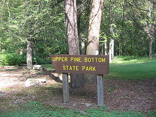
Upper Pine Bottom State Park is a 5-acre (2.0 ha) Pennsylvania state park in Lycoming County, Pennsylvania in the United States. The park is in Cummings Township on Pennsylvania Route 44 and is surrounded by the Tiadaghton State Forest. It is on Upper Pine Bottom Run, which gave the park its name and is a tributary of Pine Creek. Upper Pine Bottom State Park is in the Pine Creek Gorge, where the streams have cut through five major rock formations from the Devonian and Carboniferous periods.

Kinkaid Lake is a reservoir located in southwestern Illinois. Entirely within Jackson County, the lake is approximately 5 miles (8.0 km) northwest of Murphysboro and 100 miles (160 km) southeast of St. Louis.
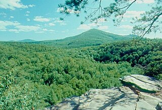
Trough Creek State Park is a 554 acres (224 ha) Pennsylvania state park in Cass, Penn and Todd Townships, Huntingdon County, Pennsylvania in the United States. The majority of the park is in Todd Township along Pennsylvania Route 994, east of the unincorporated village of Entriken. Huntingdon is the nearest borough. The park borders Rothrock State Forest and Raystown Lake National Recreation Area. There is a growing population of bald eagles at the lake. Fourteen eagles were spotted in January 2007. This is up from two that were spotted in 1990, the first year that an eagle survey was taken. These three sections of state and federal owned property combine together to provide hunting, hiking and fishing opportunities for the outdoorsman.
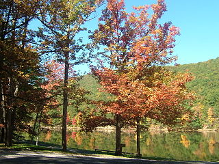
Poe Valley State Park is a 620-acre (251 ha) Pennsylvania state park in Penn Township, Centre County, Pennsylvania in the United States. The park is surrounded by Bald Eagle State Forest. Poe Paddy State Park is 4 miles (6.4 km) to the east. The forests of the park surround the 25-acre (10 ha) Poe Lake. Poe Valley State Park is in isolated Poe Valley which lies between Potters Mills on U.S. Route 322 and Millheim on Pennsylvania Route 45. The park was closed during the 2008 and 2009 season while the lake was drained for dam repairs and the park facilities were upgraded.

Douthat State Park is a state park located in the Allegheny Mountains in Virginia. It is in Bath County and Alleghany County. The park is 4,545 acres (18 km2) total with a 50-acre (20 ha) lake.

Tyler State Park is a state park north of Tyler, Texas. It is 985.5 acres (399 ha) in Smith County, north of Tyler. The park includes a 64-acre (26 ha) lake. The land was deeded by private owners in 1934 and 1935; original improvements were made by the Civilian Conservation Corps (CCC). The park opened in 1939.

Pinckney State Recreation Area is a Michigan state recreation area in Dexter, Sylvan and Lyndon Townships, Washtenaw County and Putnam and Unadilla Townships, Livingston County in the U.S. state of Michigan. The park is 11,000 acres (4,500 ha) and sits at an elevation of 922 feet (281 m). The park is connected to the nearby Waterloo State Recreation Area by the 35-mile (56 km) Waterloo–Pinckney Trail. Pinckney State Recreation Area is open for year-round recreation including hiking, fishing, swimming, hunting and a variety of winter sports.
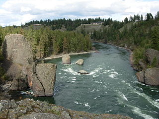
Riverside State Park is a Washington state park located 9 miles (14 km) northwest of Spokane in the community of Nine Mile Falls. The park protects 11,162 acres (4,517 ha) of Okanagan dry forest along the Spokane and Little Spokane rivers. It is the second largest state park in Washington after Mount Spokane State Park and is a popular recreation area for locals.

New Germany State Park is a public recreation area covering 483 acres (195 ha) adjacent to Savage River State Forest in Garrett County, Maryland. The state park is administered by the Maryland Department of Natural Resources.
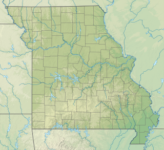
Knob Noster State Park is a public recreation area covering 3,934 acres (1,592 ha) in Johnson County, Missouri, in the United States. The state park bears the name of the nearby town of Knob Noster, which itself is named for one of two small hills or "knobs" that rise up in an otherwise flat section of Missouri. Noster is a Latin adjective meaning "our"—therefore, Knob Noster translates as "our hill." A local Indian belief stated that the hills were "raised up as monuments to slain warriors." The park offers year-round camping, hiking, and fishing and is managed by the Missouri Department of Natural Resources.

The Garden of the Gods Wilderness is a 3,318-acre (13.43 km2) parcel of land listed as a Wilderness Area of the United States. It is located within the Shawnee National Forest in Hardin, Pope, Saline, and Gallatin counties in the U.S. state of Illinois. The nearest town of any size is Equality.

Lake Sugema [Pronounced sōō•jē’•mə](+40° 41' 22.85", -91° 59' 39.01") is a man-made 574-acre (2.32 km2) lake 3 miles (4.8 km) southwest of Keosauqua, Van Buren County, in southeast Iowa, United States. It is located south of the Des Moines River, west of State Highway 1 and north of State Highway 2.
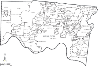
Great Parks of Hamilton County is the park district of Hamilton County, Ohio, United States. It was established in 1930 and was known as the Hamilton County Park District until 2014. The park system includes 17 parks and 4 conservation areas. It is governed by a board of park commissioners. Park headquarters are located in the second largest park in the system, Winton Woods. The county park system also coordinates with the Cincinnati Park Board.
References
- ↑ "Pounds Hollow Lake". Illinois Office of Tourism. Illinois Department of Commerce and Economic Opportunity . Retrieved March 15, 2021.
- 1 2 "Pounds Hollow Recreation Area". Shawnee National Forest. United States Department of Agriculture . Retrieved March 15, 2021.
- ↑ Illinois Atlas and Gazetteer. Freeport, Maine: DeLorme. 1991. p. 91. ISBN 0-89933-213-7.