Pratapgarh, Tripura

Last updated
Pratapgarh
town
India Tripura locator map1.svg
Red pog.svg
Pratapgarh
India location map.svg
Red pog.svg
Pratapgarh
Coordinates: 23°49′N91°18′E / 23.81°N 91.30°E / 23.81; 91.30 Coordinates: 23°49′N91°18′E / 23.81°N 91.30°E / 23.81; 91.30
CountryFlag of India.svg  India
State Tripura
District West Tripura
Population (2001)
  Total 25,890
Languages
  Official Bengali, Kokborok, English
Time zone IST (UTC+5:30)
Vehicle registration TR
Website tripura.gov.in

Pratapgarh is a census town in West Tripura district in the Indian state of Tripura.

A census town is a type of town that satisfies certain characteristics, depending on the country in which it is located.

India Country in South Asia

India, also known as the Republic of India, is a country in South Asia. It is the seventh largest country by area and with more than 1.3 billion people, it is the second most populous country as well as the most populous democracy in the world. Bounded by the Indian Ocean on the south, the Arabian Sea on the southwest, and the Bay of Bengal on the southeast, it shares land borders with Pakistan to the west; China, Nepal, and Bhutan to the northeast; and Bangladesh and Myanmar to the east. In the Indian Ocean, India is in the vicinity of Sri Lanka and the Maldives, while its Andaman and Nicobar Islands share a maritime border with Thailand and Indonesia.

Tripura State in North-east India

Tripura is a state in northeastern India. The third-smallest state in the country, it covers 10,491 km2 (4,051 sq mi) and is bordered by Bangladesh to the north, south, and west, and the Indian states of Assam and Mizoram to the east. In 2011 the state had 3,671,032 residents, constituting 0.3% of the country's population.

Contents

Geography

Pratapgarh is located at 23°49′N91°18′E / 23.81°N 91.30°E / 23.81; 91.30 . [1]

Demographics

As of 2001 India census, [2] Pratapgarh had a population of 25,890. Males constitute 51% of the population and females 49%. Pratapgarh has an average literacy rate of 72%, higher than the national average of 59.5%: male literacy is 77%, and female literacy is 67%. In Pratapgarh, 11% of the population is under 6 years of age.

Politics

Pratapgarh assembly constituency is part of Tripura West (Lok Sabha constituency). [3]

Pratapgarh is one of the 60 assembly constituencies of Tripura a Northeastern Indian state. Pratapgarh is also part of West Tripura Lok Sabha constituency.

Tripura West Lok Sabha constituency is one of two Lok Sabha constituencies in Tripura state in northeastern India. It includes the state capital Agartala.

Related Research Articles

Badharghat town in Tripura, India

Badharghat is a census town in West Tripura district in the state of Tripura, India.

Belonia, India City in Tripura, India

Belonia is a town and Municipal Council in South Tripura district, Tripura, India. It is also the headquarters of South Tripura District. It is linked with Agartala by National Highway 8 via Udaipur and also via Rajnagar, Sonamura, Melaghar, and Bishramganj. Belonia lies on a border with Bangladesh.

Chamrail Census Town in West Bengal, India

Chamrail is a census town in Bally Jagachha CD Block of Howrah Sadar subdivision in Howrah district in the Indian state of West Bengal. It is a part of Kolkata Urban Agglomeration.

Gabberia Census Town in West Bengal, India

Gabberia is a census town in Panchla CD Block of Howrah Sadar subdivision in Howrah district in the state of West Bengal, India.

Jhorhat Census Town in West Bengal, India

Jhorhat is a census town in Sankrail CD Block of Howrah Sadar subdivision in Howrah district in the Indian state of West Bengal. It is a part of Kolkata Urban Agglomeration.

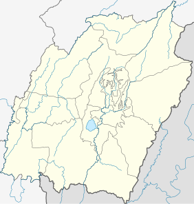
Jogendranagar is a census town in West Tripura district in the Indian state of Tripura.

Mayang Imphal Town in Manipur, India

Mayang Imphal is a town and a Municipal council in Imphal West district in the Indian state of Manipur. Pin code of Mayang Imphal is 795132.

Mrigala Village in West Bengal, India

Mrigala is a village in Chanditala II CD Block in Srirampore subdivision of Hooghly district in the Indian state of West Bengal. It was earlier recorded as a census town.

Sabroom city in Tripura, India

Sabroom is a town and a nagar panchayat in South Tripura district in the Indian state of Tripura.

Template:Infobox settlement The oldest house of Sonamura this is the House of Gopal Datta Sonamura India is a town and the headquarter of Sonamura Subdivision in Sipahijala district in the Indian state of Tripura. It lies on the border with Bangladesh, to the east of Comilla. It contains a hospital, police station, jail, and a town hall.

Teliamura town in Tripura, India

Teliamura is a town and a nagar panchayat in Khowai district in the Indian state of Tripura. It is on the National Highway No.08 of India. It is also the headquarters of the recently included sub-division of Teliamura. It is 45 km from Agartala, Capital of Tripura, 35 km from Khowai and 42 km from Ambassa.

Tentulkuli Census Town in West Bengal, India

Tentulkuli is a census town in Domjur CD Block of Howrah Sadar subdivision in Howrah district in the Indian state of West Bengal. It is a part of Kolkata Urban Agglomeration.

Uttar Pirpur Census Town in West Bengal, India

Uttar Pirpur is a census town in Uluberia II CD Block of Uluberia subdivision in Howrah district in the Indian state of West Bengal. It is a part of Kolkata Urban Agglomeration.

Uttar Raypur Census Town in West Bengal, India

Uttar Raypur is a census town under Budge Budge police station of Budge Budge I CD Block in Alipore Sadar subdivision of South 24 Parganas district in the Indian State of West Bengal. It is a part of Kolkata Urban Agglomeration.

Vasudevanallur panchayat town in Tamil Nadu, India

Vasudevanallur is a panchayat town in Tirunelveli district in the Indian state of Tamil Nadu.

Vedasandur is a panchayat town in Dindigul district Located at Madurai Region Indian state of Tamil Nadu. Vedasandur town is 21 km from Dindigul city, and 82 km From Madurai Metropolitan City.

Antu, India Town in Uttar Pradesh, India

Antu is a town and a nagar panchayat in the Community Development Block Sandwa Chandrika, Pratapgarh Teshil, Pratapgarh district in the state of Uttar Pradesh, India, located 20.6 km northwest of the district administrative headquarter Bela Pratapgarh and 4.7 km northeast of Sandwa Chandrika. The territory of the town has 2 square kilometers. It is divided into 10 wards. The postal Zip Code is 230501.

Kunda, India Town in Uttar Pradesh, India

Kunda is a town and a Tahsil in Pratapgarh district in the Indian state of Uttar Pradesh.

Gandhigram, Tripura Town in Tripura, India

Gandhigram is a town in Tripura, India. located around 10 km from city centre Agartala. It comes under Sadar district. It has an old age home called Sandhyoneer.

Santirbazar City in Tripura, India

Santirbazar is a town and Municipal Council in South Tripura district, Tripura, India. It is linked with Agartala by National Highway 8 via Udaipur and Bishramganj.

References

  1. "Yahoo maps location of Pratapgarh". Yahoo maps. Retrieved 2008-12-31.
  2. "Census of India 2001: Data from the 2001 Census, including cities, villages and towns (Provisional)". Census Commission of India. Archived from the original on 2004-06-16. Retrieved 2008-11-01.
  3. "Assembly Constituencies - Corresponding Districts and Parliamentary Constituencies" (PDF). Tripura. Election Commission of India. Archived from the original (PDF) on 2005-11-08. Retrieved 2008-10-08.