Gwinnett County is a county in the north central portion of the U.S. state of Georgia. As of 2017, the population is estimated to be 920,260, making it the second-most populous county in Georgia. Its county seat is Lawrenceville. The county is named for Button Gwinnett, one of the signatories of the Declaration of Independence.

Suwanee is a city in Gwinnett County in the U.S. state of Georgia. As of the 2010 census, the population was 15,355; this had grown to an estimated 18,694 as of 2015. Suwanee was the practicing home of the Atlanta Falcons football team from 1979 to 2001 and was voted among the Top 10 Best Places to Live by Money in 2007. In 2012, Suwanee was rated by Kiplinger as the third best place in America for raising families. In 2013, Suwanee was identified as one of the nation's 10 Best Towns for Families by Family Circle magazine and in 2018, Suwanee was rated #1 for places with the best public schools in Georgia by Niche.
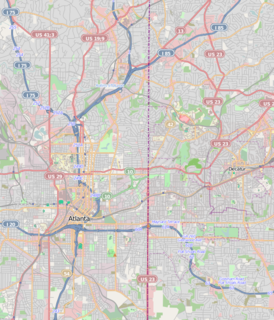
The BeltLine is a former railway corridor around the core of Atlanta, Georgia, under development in stages as a multi-use trail. Some portions are already complete, while others are still in a rough state but hikeable. Using existing rail track easements, the BeltLine is designed to improve transportation, add green space, and promote redevelopment. There are longer-term visions for streetcar or light-rail lines along all or part of the corridor.
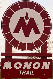
The Monon Trail is a rail trail located entirely within the state of Indiana. The Monon Railroad was a popular railroad line connecting the cities of Chicago and Indianapolis, with stops at major settlements along its route. After the decline of railroad travel and the sale of the company in 1987, the portion of the line between Indianapolis and Delphi, Indiana, was abandoned.

Grove Park is a northwest Atlanta, inside-the-perimeter neighborhood bounded by:

The Ohlone Greenway is a 4.5-mile (7.2 km) pedestrian and bicycle path in the East Bay region of the San Francisco Bay Area.
City of Parks is a municipal project to create a continuous paved pedestrian and biking trail around the city of Louisville, Kentucky while also adding a large amount of park land. The project was announced on February 22, 2005. Current plans call for making approximately 4,000 acres (1,600 ha) of the Floyds Fork floodplain in eastern Jefferson County into park space, expanding area in the Jefferson Memorial Forest, and adding riverfront land and wharfs along the Riverwalk Trail and Levee Trail. There are also plans to connect the 100-mile (160 km) Louisville trail to a planned seven mile (11 km) trail connecting the Southern Indiana cities of New Albany, Clarksville and Jeffersonville.
Johns Creek is a city in north Fulton County in the U.S. state of Georgia. According to the 2010 U.S. Census, the population was 76,728. The city is a northeastern suburb of Atlanta. In 2017, Johns Creek ranked third on the USA TODAY list of "50 best cities to live in."
The Trust for Public Land is a U.S. nonprofit organization with a mission to "create parks and protect land for people, ensuring healthy, livable communities for generations to come." Since its founding in 1972, The Trust for Public Land has completed 5,000 park-creation and land conservation projects across the United States, protected over 3 million acres, and helped pass more than 500 ballot measures--creating $70 billion in voter-approved public funding for parks and open spaces. The Trust for Public Land also researches and publishes authoritative data about parks, open space, conservation finance, and urban climate change adaptation. Headquartered in San Francisco, the organization is among the largest U.S. conservation nonprofits, with approximately 30 field offices across the U.S., including a federal affairs function in Washington, D.C.

Clear Creek is a stream in northeast Atlanta that is a tributary to Peachtree Creek and part of the Chattahoochee River watershed. It has two main branches, one originating east of the high ground along which Boulevard runs and another to the west originating on the northeast side of downtown Atlanta. The easterly branch of Clear Creek begins in several springs and branches in what are now Inman Park and the Old Fourth Ward. Flowing north, the creek was joined by other branches and springs, including Angier Springs near the end of Belgrade Avenue and the so-called Ponce de Leon Springs, which were “discovered” during railroad construction in the 1860s and gave rise to the eponymous park and avenue.

Chastain Memorial Park is the largest city park in Atlanta, Georgia. It is a 268-acre (1.08 km2) park near the northern edge of the city. Included in the park are jogging paths, playgrounds, tennis courts, a golf course, swimming pool, horse park and amphitheater.

The Detroit International Riverfront is a tourist attraction and landmark of Detroit, Michigan extending from the Ambassador Bridge in the west to Belle Isle in the east, for a total of 5.5 miles. The International Riverfront encompasses a cruise ship passenger terminal and dock, a marina, a multitude of parks, restaurants, retail shops, skyscrapers, and high rise residential areas along with Cobo Center. The Marriott at the Renaissance Center and the Robert's Riverwalk Hotel are also situated along the International Riverfront. Private companies and foundations together with the city, state, and federal government have contributed several hundred million dollars toward the riverfront development. Key public spaces in the International Riverfront, such as the RiverWalk, Dequindre Cut Greenway and Trail, William G. Milliken State Park and Harbor, and a cruise ship passenger terminal and dock at Hart Plaza complement the architecture of the area. The area provides a venue for a variety of annual events and festivals including the Detroit Electronic Music Festival, Detroit Free Press International Marathon, the Detroit International Jazz Festival, Motor City Pride, the North American International Auto Show, and River Days.

The Cleveland/Bradley County Greenway is a 4-mile-long public greenway walking path in Cleveland, Tennessee maintained by the local Greenway Advisory Board. The path is the longest path in the Greenway Network, a network of public walking trails located in Bradley County, Tennessee.
The PATH400 Greenway Trail is a multi-use trail under construction along the Georgia 400 freeway in Buckhead, Atlanta. Once complete, the trail will be 10 feet to 14 feet wide and traverse the cities of Atlanta, Sandy Springs and Dunwoody.

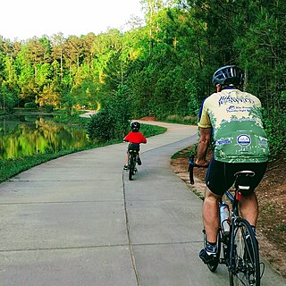
The Western Gwinnett Bikeway is a multi-use trail under construction along Peachtree Industrial Boulevard in Gwinnett County. The trail will be 10 feet to 14 feet wide and traverse the cities of Norcross, Peachtree Corners, Berkeley Lake, Duluth, Suwanee, Sugar Hill and Buford. It is intended to be the spine of West Gwinnett’s trails and greenways, connecting parks, trails, businesses, schools and neighborhoods to the urban core.
The Peachtree Creek Greenway trail is a multi-use trail under construction along the Peachtree Creek in and near Atlanta, Georgia, United States, which will traverse the cities of Atlanta, Brookhaven, Chamblee and Doraville once complete.
The Big Creek Greenway is a multi-use trail with two completed sections along Big Creek in the state of Georgia, United States. The first section begins at Big Creek Park in Roswell, GA and currently runs 8 miles (13 km) to Marconi Drive in Alpharetta. A second completed section of the trail begins in Forsyth County at McFarland Parkway and runs 9.6 miles (15.4 km). Once complete, the trail will be 12 feet wide and traverse the cities of Roswell, Alpharetta and Cumming.

The Sugar Hill Greenway is a 16.5-mile (26.6 km) multi-use trail under construction in and around the city of Sugar Hill, Georgia, in the United States. Once complete, the trail will be 12 feet (3.7 m) wide and will connect Sugar Hill to the Western Gwinnett Bikeway.