Gallery
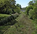 Interim trail adjacent to Piedmont Park
 Ponce City Market seen from Beltline
 Ponce City Market and Kroger seen from Beltline in 2025
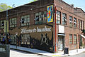
 Ford Factory Lofts seen from Beltline, 2012
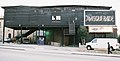


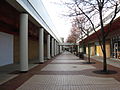
 Inman Park former industrial buildings
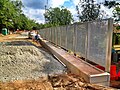 Beltline Eastside Trail under construction at Irwin Street in the Old Fourth Ward, May 2012.


