Related Research Articles

Karamea is a town on the West Coast of the South Island of New Zealand. It is the northernmost settlement of any real size on the West Coast, and is located 96 kilometres (60 mi) northeast by road from Westport. Apart from a narrow coastal strip, the town of Karamea and its local area are completely surrounded to the south, east and north by Kahurangi National Park.

Kahurangi National Park in the northwest of the South Island of New Zealand is the second largest of the thirteen national parks of New Zealand. It was gazetted in 1996 and covers 5,193 km2 (2,005 sq mi), ranging from the Buller River near Murchison in the south, to the base of Farewell Spit in Golden Bay in the north. The park has no single dominant landform, but includes an unusually wide variety of landscapes, including mountain ranges, rivers, gorges, raised peneplains and karst features such as caves and arches. Many of the landforms within the park are considered to be nationally or internationally significant.

The Aorere River is in the Tasman District of the South Island of New Zealand that flows from headwaters in the alpine regions of the Kahurangi National Park. It has a catchment area of 573 km2 (221 sq mi), representing around 11% of the total area of Kahurangi National Park. The river flows generally northwards for 40 km (25 mi) before draining into Golden Bay at the town of Collingwood. The Heaphy Track's northeastern end is in the upper valley of the Aorere.

The Heaphy Track is a popular tramping and mountain biking track in the north west of the South Island of New Zealand. It is located within the Kahurangi National Park and classified as one of New Zealand's ten Great Walks by the Department of Conservation. Named after Charles Heaphy, the track is 78.4 kilometres (48.7 mi) long and is usually walked in four or five days. The track is open for shared use with mountain bikers in the winter season from 1 May to 30 September each year. The southern end of the track is at Kōhaihai, north of Karamea on the northern West Coast, and the northern end is in the upper valley of the Aorere River, Golden Bay.

Lewis Pass is the northernmost of the three main mountain passes through the Southern Alps in the South Island of New Zealand. With an elevation of 907 metres, it is slightly lower than Arthur's Pass and higher than Haast Pass.

Cape Foulwind is a headland on the West Coast of the South Island of New Zealand, overlooking the Tasman Sea. It is located 11 kilometres (6.8 mi) west of the town of Westport. There is a lighthouse located on a prominent site on the headland. A walkway beginning at the lighthouse carpark traverses the rocky headland to Tauranga Bay and passes close by a colony of New Zealand fur seals. There is limestone quarry in the area, and a cement works operated nearby from 1958 to 2016.

Tapawera is a small town in the Tasman District of New Zealand's South Island. It is located 76 km southwest of Nelson and 48 km southeast of Motueka. It is situated on the Motueka Valley Highway by the banks of the Motueka River.
Golden Bay Air Limited is a small airline based at Tākaka Aerodrome in Tākaka, New Zealand. The airline currently operates three light aircraft from Tākaka to Wellington and Karamea, and also from Nelson to Tākaka and Karamea with connecting road shuttle services to the Abel Tasman National Park, the Heaphy Track in the Kahurangi National Park and to and from Tākaka township. Other services provided by the airline include charter flights around New Zealand flown on demand and preset scenic routes around the national parks as well as Farewell Spit.
The Heaphy River is a river of the northwestern South Island of New Zealand. It flows through Kahurangi National Park, rising on the northern slopes of Amohia Peak and initially flowing northwest before turning southwest to reach the Tasman Sea 30 kilometres north of Karamea. Stages of the Heaphy Track follow the lower course of this river, with the track reaching the coast at the river's mouth. The Heaphy River is located in the Buller District.

The Karamea River is located in the West Coast Region of the South Island of New Zealand. The river rises within Kahurangi National Park in the Matiri Range of the Southern Alps. The river rises to the east of Mount Allen, meandering west briefly before turning north. After some 25 km (16 mi) it again turns west, to enter a series of small lakes where its waters are joined by those of the Roaring Lion River. From here the river continues west through steep-sided valleys before leaving the national park and reaching its floodplain 10 km (6.2 mi) from the coast of the Tasman Sea. The river passes the small settlements of Umere and Arapito before reaching the Ōtūmahana Estuary and the Tasman Sea close to the township of Karamea.

The Kōhaihai River is a river of the northwest of New Zealand's South Island. Flowing southwest and then west from the Dommett Range, the river's entire length is within the Kahurangi National Park. The river's mouth marks the south western end of the Heaphy Track and the northern terminus of the West Coast's road system. The nearest town is Karamea.
Golden Bay is a large shallow bay in New Zealand's Tasman District, near the northern tip of the South Island. An arm of the Tasman Sea, the bay lies northwest of Tasman Bay and Cook Strait. It is protected in the north by Farewell Spit, a 26 km long arm of fine golden sand that is the country's longest sandspit. The Aorere and Tākaka rivers are the major waterways to flow into the bay from the south and the west.

Little Wanganui is a dairy-farming village on the West Coast of the South Island of New Zealand, on the Little Wanganui River. It is 77 kilometres (48 mi) north of Westport and 21 kilometres (13 mi) south of Karamea, at the opposite end of the Karamea Beach. The settlement has a pub, community hall, and volunteer fire brigade, and in 2013 the population was 207. There is a surfing beach, and the Little Wanganui River is popular for whitebaiting and fishing for brown trout.
The Ōpārara Basin is a basin drained by the Ōpārara River at 20 kilometres (12 mi) north of Karamea, at the West Coast Region of the South Island of New Zealand. With its large natural rock arches, a network of caves rich in fossils, and a beautiful, unspoiled natural environment typical of temperate rainforests, it is one of the most striking places of the Kahurangi National Park.

The Karamea Aerodrome serves the town of Karamea, in the South Island of New Zealand. It is a non certificated aerodrome located around 1.4 kilometres (0.87 mi) northwest of the town.

The Old Ghost Road is a mountain bike and tramping trail part-funded as one of the projects of the New Zealand Cycle Trail (NZCT) system in the Buller District of New Zealand. Of all NZCT projects, it is the technically most difficult one to ride and is rated "advanced". The highest point of the trail is at 1,280 metres (4,200 ft).

The Wangapeka Track is a tramping track in the north-west of the South Island of New Zealand. It is one of the main tramping tracks in the Kahurangi National Park, a protected area managed by the Department of Conservation. The route traverses the southern end of the park, from the historic Wangapeka goldfields area west of Tapawera, to the coastal plains of the West Coast at Little Wanganui. The route is 59 km (37 mi) long, and crosses the Wangapeka and Little Wanganui saddles, each over 1,000 m (3,300 ft) in elevation. The track passes through the valleys of the Wangapeka River, Karamea River, Taipō River and Little Wanganui River. The majority of the track is in river valleys and under forest cover, with small sections in tussock land at Stag Flat and the Little Wanganui Saddle. It typically takes walkers 4–6 days to complete the route.

The Big Rimu Walk is a nature trail near Karamea, located in Kahurangi National Park on the West Coast of the South Island of New Zealand. A short walk of 1.1 kilometres (0.68 mi) through regenerating bush leads to a large rimu tree that is 36 metres (118 ft) tall with a trunk over two metres in diameter and estimated to be over 1,000 years old. Other smaller rimu in the area were logged during the 1940s but this large tree was left.
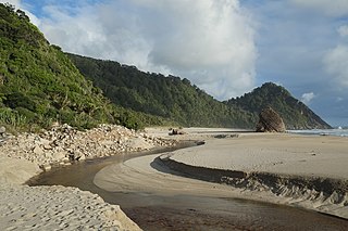
Scotts Beach is a beach on the West Coast of the South Island of New Zealand. It is on the route of the Heaphy Track within Kahurangi National Park, and is around 3 km (1.9 mi) from the road end at Kohaihai. The beach is sandy, and is surrounded by steep cliffs covered in rainforest vegetation. The route to the beach is along an inland track over the Kohaihai bluff to a saddle at around 100 m (330 ft) elevation. The track passes through stands of nikau palms.
References
- ↑ "Correspondence". The Colonist . 28 July 1882. p. 3 – via Papers Past.
- ↑ "Karamea roads and their cost". The Colonist . 26 May 1868. Archived from the original on 2 September 2022. Retrieved 2 September 2022– via Papers Past.
- ↑ "Nelson deputations". The Colonist . 27 March 1915. Archived from the original on 2 September 2022. Retrieved 2 September 2022– via Papers Past.
- ↑ "Karamea – Wangapeka track". Nelson Evening Mail . 11 April 1924. Archived from the original on 2 September 2022. Retrieved 2 September 2022– via Papers Past.
- ↑ "Karamea and Nelson – Need for cattle track to benefit both districts". Nelson Evening Mail . 11 March 1920. Archived from the original on 2 September 2022. Retrieved 2 September 2022– via Papers Past.
- ↑ "Wangapeka Track – Extension to Karamea urged". Nelson Evening Mail . 7 August 1924. Archived from the original on 2 September 2022. Retrieved 2 September 2022– via Papers Past.
- ↑ "Collingwood to Karamea". Nelson Evening Mail. 26 October 1931. p. 4 – via Papers Past.
- ↑ "Would cost ₤46,000". Star (Christchurch). 17 August 1934. p. 2 – via Papers Past.
- ↑ "Completion of Heaphy Track". The Press . 1 October 1936. p. 12. Retrieved 26 January 2024– via Papers Past.
- ↑ "Link with Karamea". The Press . 20 March 1968. Archived from the original on 2 September 2022. Retrieved 2 September 2022– via Papers Past.
- ↑ "S.I. Link Road: Track "in jeopardy"". The Press . 8 March 1973. p. 16 – via Papers Past.
- ↑ "Heaphy Track group formed". 18 April 1973. pp. The Press – via Papers Past.
- ↑ "Road extension opposed". The Press . 5 July 1976. p. 11 – via Papers Past.
- ↑ "Inland Collingwood road route rejected". The Press . 27 September 1973. p. 3 – via Papers Past.
- ↑ "Wangapeka route would save Heaphy – O.P H." The Press . 30 March 1973. Archived from the original on 2 September 2022. Retrieved 2 September 2022– via Papers Past.
- 1 2 Hindmarsh, Gerard (12 August 2016). "Karamea-Collingwood road an idea whose time has gone". Stuff . Retrieved 26 January 2024.
- ↑ "Heaphy issue "clouded"". The Press . 12 July 1975. p. 16 – via Papers Past.
- ↑ "Heaphy track road work stopped, but issue not dead yet". The Press . 13 March 1976. p. 1 – via Papers Past.
- ↑ "Transfer of Unformed Legal Road in Buller and Tasman Districts... - 1995-ln8303 - New Zealand Gazette". gazette.govt.nz. Retrieved 26 January 2024.
- ↑ "New Heaphy Track designation: Road status lost". Otago Daily Times . 16 December 1995.
- ↑ Williams, Dave (30 March 2005). "In the loop; Kahurangi one of six sites proposed". The Nelson Mail. ProQuest 274420113.
- ↑ Carroll, Joanne; Mitchell, Charlie (14 December 2015). "New road linking West Coast to Nelson would bring 'life after coal'". Stuff. Archived from the original on 2 September 2022. Retrieved 1 September 2022.
- ↑ Carson, Jonathan (10 June 2017). "Paving paradise: The case against building a road through Kahurangi National Park". Stuff. Archived from the original on 2 September 2022. Retrieved 2 September 2022.