Goor is a town about 20 km North west of Enschede in the Dutch province of Overijssel. It received town rights in 1263. The population is about 13,000.
Chiaiano is a north-western quarter of Naples, with a population of about 23,000.

Mochle is a village in the administrative district of Gmina Sicienko, within Bydgoszcz County, Kuyavian-Pomeranian Voivodeship, in north-central Poland. It lies 5 kilometres (3 mi) east of Sicienko and 14 km (9 mi) north-west of Bydgoszcz.
Bystre is a village in the administrative district of Gmina Boćki, within Bielsk County, Podlaskie Voivodeship, in north-eastern Poland. It lies approximately 10 kilometres (6 mi) south-east of Boćki, 21 km (13 mi) south of Bielsk Podlaski, and 60 km (37 mi) south of the regional capital Białystok.
Danowo is a village in the administrative district of Gmina Szczuczyn, within Grajewo County, Podlaskie Voivodeship, in north-eastern Poland.
Kamieniec is a village in the administrative district of Gmina Żarnów, within Opoczno County, Łódź Voivodeship, in central Poland.
Brzeziny is a village in the administrative district of Gmina Skomlin, within Wieluń County, Łódź Voivodeship, in central Poland. It lies approximately 5 kilometres (3 mi) north-east of Skomlin, 12 km (7 mi) west of Wieluń, and 97 km (60 mi) south-west of the regional capital Łódź.
Łabuzówka is a settlement in the administrative district of Gmina Szczucin, within Dąbrowa County, Lesser Poland Voivodeship, in southern Poland. It lies approximately 11 kilometres (7 mi) east of Szczucin, 25 km (16 mi) north-east of Dąbrowa Tarnowska, and 96 km (60 mi) east of the regional capital Kraków.
Zadnoga is a village in the administrative district of Gmina Krynice, within Tomaszów Lubelski County, Lublin Voivodeship, in eastern Poland. It lies approximately 2 kilometres (1 mi) west of Krynice, 16 km (10 mi) north of Tomaszów Lubelski, and 93 km (58 mi) south-east of the regional capital Lublin.
Falki is a village in the administrative district of Gmina Gnojno, within Busko County, Świętokrzyskie Voivodeship, in south-central Poland. It lies approximately 3 kilometres (2 mi) south-west of Gnojno, 15 km (9 mi) north-east of Busko-Zdrój, and 36 km (22 mi) south-east of the regional capital Kielce.
Marianowo is a village in the administrative district of Gmina Wieczfnia Kościelna, within Mława County, Masovian Voivodeship, in east-central Poland.
Przemkowo is a village in the administrative district of Gmina Dzierzążnia, within Płońsk County, Masovian Voivodeship, in east-central Poland. It lies approximately 7 kilometres (4 mi) south-east of Dzierzążnia, 9 km (6 mi) south-west of Płońsk, and 64 km (40 mi) north-west of Warsaw.
Kuznocin is a village in the administrative district of Gmina Sochaczew, within Sochaczew County, Masovian Voivodeship, in east-central Poland.
Kamionek is a village in the administrative district of Gmina Kiszkowo, within Gniezno County, Greater Poland Voivodeship, in west-central Poland.
Kolonia Lipiny is a village in the administrative district of Gmina Sompolno, within Konin County, Greater Poland Voivodeship, in west-central Poland.
Góra is a village in the administrative district of Gmina Pobiedziska, within Poznań County, Greater Poland Voivodeship, in west-central Poland.
Jeknica is a village in the administrative district of Gmina Somonino, within Kartuzy County, Pomeranian Voivodeship, in northern Poland. It lies approximately 8 kilometres (5 mi) south of Somonino, 14 km (9 mi) south of Kartuzy, and 33 km (21 mi) south-west of the regional capital Gdańsk.

Jemníky is a village and municipality in Kladno District in the Central Bohemian Region of the Czech Republic.
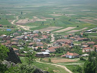
Malo Konjari is a village in Municipality of Prilep, Republic of Macedonia. The village has a sports airfield build whilst the village was part of Yugoslavia.
Mazhuchishte is a village in Municipality of Prilep, Republic of North Macedonia.


