Gmina Łęczna is an urban-rural gmina in Łęczna County, Lublin Voivodeship, in eastern Poland. Its seat is the town of Łęczna, which lies approximately 23 kilometres (14 mi) east of the regional capital Lublin.
Gmina Ludwin is a rural gmina in Łęczna County, Lublin Voivodeship, in eastern Poland. Its seat is the village of Ludwin, which lies approximately 4 kilometres (2 mi) north of Łęczna and 25 km (16 mi) east of the regional capital Lublin.
Gmina Milejów is a rural gmina in Łęczna County, Lublin Voivodeship, in eastern Poland. Its seat is the village of Milejów-Osada, which lies approximately 10 kilometres (6 mi) south of Łęczna and 26 km (16 mi) east of the regional capital Lublin.
Gmina Puchaczów is a rural gmina in Łęczna County, Lublin Voivodeship, in eastern Poland. Its seat is the village of Puchaczów, which lies approximately 6 kilometres (4 mi) east of Łęczna and 29 km (18 mi) east of the regional capital Lublin.
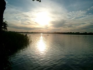
Łęczna Lake District Landscape Park or Łęczna Lakeland Scenic Park is a protected area in eastern Poland, established in 1990, covering an area of 118.16 square kilometres (45.62 sq mi) in the geographic region called the Łęczna-Włodawa Lakeland or the Łęczna-Włodawa Plain.

Bekiesza is a village in the administrative district of Gmina Cyców, within Łęczna County, Lublin Voivodeship, in eastern Poland. It lies approximately 5 kilometres (3 mi) east of Cyców, 24 km (15 mi) east of Łęczna, and 46 km (29 mi) east of the regional capital Lublin.
Cyców is a village in Łęczna County, Lublin Voivodeship, in eastern Poland. It is the seat of the gmina called Gmina Cyców. It lies approximately 19 kilometres (12 mi) east of Łęczna and 41 km (25 mi) east of the regional capital Lublin.
Podgłębokie is a village in the administrative district of Gmina Cyców, within Łęczna County, Lublin Voivodeship, in eastern Poland. It lies approximately 4 kilometres (2 mi) west of Cyców, 16 km (10 mi) east of Łęczna, and 38 km (24 mi) east of the regional capital Lublin.
Albertów is a village in the administrative district of Gmina Puchaczów, within Łęczna County, Lublin Voivodeship, in eastern Poland. It lies approximately 6 kilometres (4 mi) east of Puchaczów, 12 km (7 mi) east of Łęczna, and 34 km (21 mi) east of the regional capital Lublin.
Bogdanka is a village in the administrative district of Gmina Puchaczów, within Łęczna County, Lublin Voivodeship, in eastern Poland. It lies approximately 6 kilometres (4 mi) north-east of Puchaczów, 10 km (6 mi) east of Łęczna, and 33 km (21 mi) east of the regional capital Lublin.
Brzeziny is a village in the administrative district of Gmina Puchaczów, within Łęczna County, Lublin Voivodeship, in eastern Poland. It lies approximately 3 kilometres (2 mi) east of Puchaczów, 9 km (6 mi) east of Łęczna, and 31 km (19 mi) east of the regional capital Lublin.
Ciechanki is a village in the administrative district of Gmina Puchaczów, within Łęczna County, Lublin Voivodeship, in eastern Poland. It lies approximately 3 kilometres (2 mi) south-west of Puchaczów, 5 km (3 mi) east of Łęczna, and 27 km (17 mi) east of the regional capital Lublin.
Ciechanki-Kolonia is a village in the administrative district of Gmina Puchaczów, within Łęczna County, Lublin Voivodeship, in eastern Poland. It lies approximately 3 kilometres (2 mi) south of Puchaczów, 7 km (4 mi) east of Łęczna, and 28 km (17 mi) east of the regional capital Lublin.
Jasieniec is a village in the administrative district of Gmina Puchaczów, within Łęczna County, Lublin Voivodeship, in eastern Poland. It lies approximately 8 kilometres (5 mi) south-east of Puchaczów, 14 km (9 mi) east of Łęczna, and 35 km (22 mi) east of the regional capital Lublin.
Stara Wieś is a village in the administrative district of Gmina Puchaczów, within Łęczna County, Lublin Voivodeship, in eastern Poland.
Szpica is a village in the administrative district of Gmina Puchaczów, within Łęczna County, Lublin Voivodeship, in eastern Poland. It lies approximately 5 kilometres (3 mi) south-east of Puchaczów, 9 km (6 mi) south-east of Łęczna, and 31 km (19 mi) east of the regional capital Lublin.
Turowola is a village in the administrative district of Gmina Puchaczów, within Łęczna County, Lublin Voivodeship, in eastern Poland. It lies approximately 3 kilometres (2 mi) north-west of Puchaczów, 5 km (3 mi) east of Łęczna, and 28 km (17 mi) east of the regional capital Lublin.
Turowola-Kolonia is a village in the administrative district of Gmina Puchaczów, within Łęczna County, Lublin Voivodeship, in eastern Poland. It lies approximately 2 kilometres (1 mi) west of Puchaczów, 5 km (3 mi) east of Łęczna, and 27 km (17 mi) east of the regional capital Lublin.
Zawadów is a village in the administrative district of Gmina Puchaczów, within Łęczna County, Lublin Voivodeship, in eastern Poland. It lies approximately 10 kilometres (6 mi) south-east of Puchaczów, 14 km (9 mi) south-east of Łęczna, and 34 km (21 mi) east of the regional capital Lublin.
Ziółków is a village in the administrative district of Gmina Spiczyn, within Łęczna County, Lublin Voivodeship, in eastern Poland. It lies approximately 7 kilometres (4 mi) south-east of Spiczyn, 6 km (4 mi) west of Łęczna, and 18 km (11 mi) east of the regional capital Lublin.


