The Aysén del General Carlos Ibáñez del Campo Region, often shortened to Aysén Region or Aisén, is one of Chile's 16 first order administrative divisions. Although the third largest in area, the region is Chile's most sparsely populated region with a population of 102,317 as of 2017. The capital of the region is Coihaique, the region's former namesake.
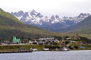
Puerto Williams is a city, port and naval base on Navarino Island in Chile, and is also the southernmost populated settlement in the world. It faces the Beagle Channel. It is the capital of the Chilean Antarctic Province, one of four provinces in the Magellan and Chilean Antarctica Region, and administers the communes of Chilean Antarctic Territory and Cabo de Hornos. It has a population of 2,874, including both naval personnel and civilians. Puerto Williams claims the title of world's southernmost city. The settlement was founded in 1953, and was first named Puerto Luisa. The town was later named after John Williams Wilson, a British man who founded Fuerte Bulnes, the first settlement in the Strait of Magellan. It has served primarily as a naval base for Chile. The Chilean Navy runs the Guardiamarina Zañartu Airport and hospital, as well as nearby meteorological stations. Since the late 20th century, the number of navy personnel has decreased in Puerto Williams and the civilian population has increased. In that period, tourism and support of scientific research have contributed to an increase in economic activity.

Navarino Island is a Chilean island located between Isla Grande de Tierra del Fuego, to the north, and Cape Horn, to the south. The island forms part of the Commune of Cabo de Hornos, the southernmost commune in Chile and in the world, belonging to Antártica Chilena Province in the XII Region of Magallanes and Chilean Antarctica. Its population is concentrated primarily in the communal capital, Puerto Williams, and in small settlements like Puerto Navarino, Río Guanaco and Puerto Toro. The highest point of the island is Pico Navarino at 1,195 m (3,921 ft). The island is a popular destination for fly-fishers.

Moraleda Channel is a body of water separating the Chonos Archipelago from the mainland of Chile. It is located at 44.4147222°S 73.4205556°W, leading to Gulf of Corcovado. Southward from the mouth of the Aisén Fjord, Moraleda Channel divides into two arms. The east arm, called Canal Costa, is the main one. Farther south the name changes to Estero Elefantes, which terminates in the gulf of the same name. The channel runs along the Liquiñe-Ofqui Fault.
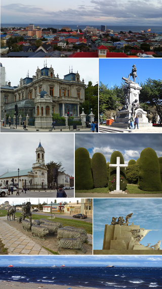
Punta Arenas is the capital city of Chile's southernmost region, Magallanes and Antarctica Chilena. Although officially renamed as Magallanes in 1927, the name was changed back to Punta Arenas in 1938. The city is the largest south of the 46th parallel south and the most populous southernmost city in Chile and the Americas. Due to its location, it is also the coldest coastal city with more than 100,000 inhabitants in Latin America. Punta Arenas is one of the world's most southerly ports and serves as an Antarctic gateway city.

Melinka is a Chilean town in Aysén Province, Aysén Region. It is located on Ascención Island and is the administrative center of the commune of Guaitecas since 1979.
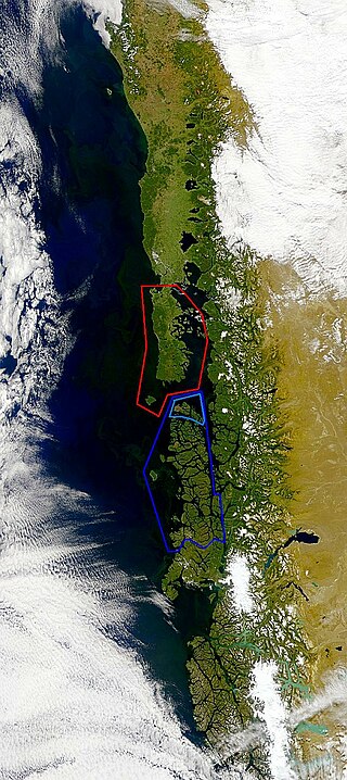
Guaitecas Archipelago is a sparsely populated archipelago in the Aisén region of Chile. The archipelago is made up of eight main islands and numerous smaller ones. The eight largest islands are from northwest to southeast: Gran Guaiteca, Ascención, Betecoy, Clotilde, Leucayec, Elvira, Sánchez and Mulchey. The islands have subdued topography compared to the Andes, with Gran Guaiteca containing the archipelago's high point at 369 m (1,211 ft).
Puerto Cisnes is a town and seaport in Cisnes commune, Aysén Province, Aysén del General Carlos Ibáñez del Campo Region in the Chilean Patagonia. The town is on the Puyuhuapi Channel at the outflow of Cisnes River. The town is located in the northwestern portion of the Aysén Region, an area that includes numerous islands, fjords and channels. The major island is Magdalena Island, which contains the national park that bears its name. Queulat National Park straddles the border between this commune and Lago Verde. Much of the commune area is covered with a lush vegetation and is divided by the Moraleda Channel. The main mountain of the area is Melimoyu volcano.
Guaitecas is Chilean commune located in Guaitecas Archipelago which are part of Aysén Province and Region. The administrative centre is Melinka, the only port and town in the wider Chonos Archipelago.

Edmundo Pérez Zujovic was a Chilean businessman and politician, militant of the Christian Democratic Party (PDC). He served as Minister of State during the government of president Eduardo Frei Montalva, in the administration he led the Public Works and Interior portfolios.
The Hornitos Formation is a Campanian geologic formation of the Algarrobal Basin in the Atacama Region of northern Chile. The formation comprises limestones, sandstones, conglomerates, marls and tuff. Dinosaur remains are among the fossils that have been recovered from the formation, including the sauropod Arackar licanantay.
The southern coast of Chile presents a large number of fjords and fjord-like channels from the latitudes of Cape Horn to Reloncaví Estuary. Some fjords and channels are important navigable channels providing access to ports like Punta Arenas, Puerto Chacabuco and Puerto Natales.
From 1850 to 1875, some 30,000 German immigrants settled in the region around Valdivia, Osorno and Llanquihue in Southern Chile as part of a state-led colonization scheme. Some of these immigrants had left Europe in the aftermath of the German revolutions of 1848–49. They brought skills and assets as artisans, farmers and merchants to Chile, contributing to the nascent country's economic and industrial development.
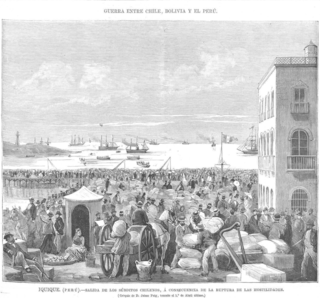
The Expulsion of Chileans from Bolivia and Peru in 1879 was an ethnic cleansing ordered by of the governments of Bolivia and Peru. The expulsion took place at the beginning of the War of the Pacific (1879-1883) between Chile and Peruvian-Bolivian alliance. Chilean citizens in both nations were ordered to leave within eight days or face internment and confiscation of their property. They were expelled on poorly-built rafts and pontoons at Peruvian ports, or forced to wander through the desert to reach the northernmost positions occupied by the Chilean Army in Antofagasta. The edict was widely popular in Peru and met with little resistance, allowing it to occur quickly.
Estratos de Pupunahue is the name given to the sedimentary strata of Oligocene-Miocene age that crop out in Pupunahue and Mulpún near Valdivia, Chile. Outside this locality Estratos de Pupunahue extends below the surface over a larger area. The thickness of the strata varies from a few meters to 530 meters. The strata were initially described by Henning Illies. The strata are made up of conglomerate, sandstone and mudstone. The clast of the conglomerates are made up of metamorphic rock and the disposition of the conglomerates varies from clast-supported to matrix-supported. The sandstone and mudstone contain layers of lignite coal that exceed 30 cm in thickness.
Caldera Basin is a sedimentary basin located in the coast of northern Chile west of Copiapó. The basin has a fill of marine sediments of Late Cenozoic age. With a north-south extension of 43 kilometres (27 mi) and an east-west width of 20 kilometres (12 mi) the basin occupies an area between the coast and the Chilean Coast Range and between the port of Caldera and the mouth of Copiapó River. The sedimentary fill rests on metamorphic rocks of Paleozoic age and on plutonic rocks of Mesozoic age.

Puerto Gaviota is a village and fishing community in the Magdalena Island, southern Chile. It is located in the southwestern part of the island at the meeting point of Puyuhuapi Channel with Moraleda Channel. The village emerged as consequence of the codfish boom of the 1980s.
Pedro María Ñancúpel Alarcón was a pirate and outlaw of Huilliche descent active in the archipelagoes of Chiloé, Guaitecas and other places in the fjords and channels of Patagonia in the 1880s, forming part of the pirate crew led by José Domingo Nahuelhuén. Ñancúpel was captured in Melinka in 1886 and bought into justice in Ancud the same year, being accused of several murders that the pirate crew had taken part in. He was later acquitted, successfully proving that he was not with the crew at the time of the murders. After being freed detainment in Ancud, he was captured once again a few years later and again accused of piracy and multiple murders and was subsequently executed by firing squad on 6 November 1888. He was said at the time to have killed 99 persons, but he was only ever tried for the deaths of just over 20 people.

Squatting in Chile is the occupation of unused land or derelict buildings without the permission of the owner. From the 1960s onwards, informal settlements known as callampas were permitted although there were also evictions such as the massacre of Puerto Montt in 1969. In the 1970s, the government of Salvador Allende encouraged occupations, then following the coup d'état, the military junta repressed squatting. Callampas then became known as campamentos.
Chilean colonization of the Strait of Magellan began in 1843 when an expedition founded Fuerte Bulnes. In 1848 the settlement of Punta Arenas was established further north in the strait and grew eventually to become the main settlement in the strait, a position it holds to this day. The Chilean settlement of the strait was crucial to establish its sovereignty claims in the area. Argentina formally recognised Chilean sovereignty in 1881. The Magallanes territory was made a regular Chilean province in 1928.