Ruta 146 | ||||
Route information | ||||
Maintained by Puerto Rico DTPW | ||||
Length | 28.3 km [1] (17.6 mi) | |||
Major junctions | ||||
West end | ![]() | |||
| ||||
East end | ![]() ![]() | |||
Location | ||||
Country | United States | |||
Territory | Puerto Rico | |||
Municipalities | Arecibo, Utuado, Ciales | |||
Highway system | ||||
|
Puerto Rico Highway 146
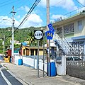
 (PR-146) is a road that travels from Arecibo, Puerto Rico to Ciales. [2] This highway begins at PR-123 near Dos Bocas Lake and ends at its junction with PR-145 and PR-149 in downtown Ciales. [3]
Municipality | Location | km [1] | mi | Destinations | Notes | |||
---|---|---|---|---|---|---|---|---|
Arecibo | Río Arriba | 0.0 | 0.0 | ![]() | Western terminus of PR-146 | |||
Utuado | No major junctions | |||||||
Ciales | Frontón | 11.0 | 6.8 | ![]() ![]() | Western terminus of PR-140 concurrency | |||
11.3 | 7.0 | ![]() ![]() | Eastern terminus of PR-140 concurrency | |||||
17.5 | 10.9 | ![]() | ||||||
Cordillera | 26.8 | 16.7 | ![]() ![]() | |||||
Hato Viejo–Cordillera line | 28.0 | 17.4 | ![]() | |||||
Jaguas | 28.3 | 17.6 | ![]() ![]() ![]() | Eastern terminus of PR-146 | ||||
1.000 mi = 1.609 km; 1.000 km = 0.621 mi
|
Puerto Rico Highway 3(PR-3) at nearly 100 miles long, is the second-longest highway on Puerto Rico. It connects the San Juan neighborhood of Río Piedras to downtown Salinas indirectly around the eastern coast of the island. Highway 3 ranges from a three lane urban avenue in San Juan to a one lane rural road past Fajardo. While other roads connect San Juan, it runs the coastline of Puerto Rico east of San Juan, beginning in Río Piedras near Santurce and goes to Fajardo where it goes south paralleling the coastline to Humacao and Maunabo. It goes up to a mountain-scenic route and goes west to Salinas, where it meets PR-1.
Puerto Rico Highway 1 (PR-1) is a highway in Puerto Rico that connects the city of Ponce to San Juan. Leaving Ponce, the road heads east and follows a somewhat parallel route along the southern coast of the island heading towards Salinas. At Salinas, the road turns north to cut through the Cordillera Central in its approach to San Juan. Before reaching San Juan, it climbs to make its way to the mountain town of Cayey and then it winds down into the city of Caguas on its final approach to San Juan.
Puerto Rico Highway 6 (PR‑6) is a 1.7-kilometer (1.1-mile) long north‑south urban primary highway within the barrio of Juan Sánchez in the municipality of Bayamón, Puerto Rico, that serves as a by-pass route from Puerto Rico Highway 5 (PR‑5) to Puerto Rico Highway 2 (PR‑2). The entire route is also known as Expresito de Villa España or Calle San José.
Puerto Rico Highway 177 (PR-177) is a main highway connecting the area of Cupey, San Juan, Puerto Rico to Bayamón, Puerto Rico. It passes through Guaynabo in the area known as Torrimar. It is divided in all of its length. In Bayamón, it ends in the intersection to Puerto Rico Highway 174 and Main Road, which connects to Puerto Rico Highway 2. In Cupey, it ends at Puerto Rico Highway 176.
Puerto Rico Highway 149 (PR-149) is a secondary highway in Puerto Rico that connects the towns of Manatí in the north coast of Puerto Rico, from PR-22 to Juana Díaz in the south coast, ending at PR-1.
Puerto Rico Highway 119 (PR-119) is a long north-to-south highway in Puerto Rico that goes from Puerto Rico Highway 2 in Hatillo, close to its border with Camuy to the same highway in San Germán. It goes through the municipalities of Camuy, San Sebastián, Las Marías and Maricao before ending in the freeway segment of PR-2. Between Camuy and San Sebastián it passes near Guajataca Lake, the largest artificial lake in western Puerto Rico.
Puerto Rico Highway 165 (PR-165) is the road that goes from Naranjito to Guaynabo. The highway passes by Toa Alta, Toa Baja, Dorado, Levittown, Cataño and Guaynabo.
Puerto Rico Highway 29 (PR-29) is an avenue in the city of Bayamón, Puerto Rico. It connects from the PR-2 to the PR-5, intersects the PR-167 at Plaza del Sol. This road is called Avenida Main Oeste.
Puerto Rico Highway 164 (PR-164) is the main road from Naranjito to Corozal in Puerto Rico. It begins at the intersection of PR-167 and PR-148 in eastern Naranjito, passing through downtown. Then it goes to Corozal from its junction with PR-5 and PR-152 until reaching PR-159 near downtown Corozal. This road is 16.4 km (10.2 mi) in length.
Puerto Rico Highway 139 (PR-139) is a two-way secondary highway in the municipality of Ponce in Puerto Rico. With a length of 25.2 km (15.7 mi), it extends from the interchange of PR-10 and PR-14 located in Barrio Machuelo Arriba to the junction with PR-143 on the Ponce–Jayuya municipal limit.
Puerto Rico Highway 157 (PR-157) is a rural road in Puerto Rico that travels from Ciales to Orocovis. It begins at its intersection with PR-149 in Toro Negro and ends at its junction with PR-155 near downtown Orocovis.
Puerto Rico Highway 144 (PR-144) is a rural road that travels from Jayuya, Puerto Rico to Ciales. This road extends from PR-140 in Collores and ends at PR-149 in Toro Negro.
Puerto Rico Highway 145 (PR-145) is a rural road that travels from Ciales, Puerto Rico to Morovis. This road extends from its junction with PR-146 and PR-149 in downtown Ciales and ends at PR-155 between Morovis Norte, Torrecillas and Fránquez barrios.
Puerto Rico Highway 153 (PR-153) is a rural road that goes from Santa Isabel, Puerto Rico to Coamo. This road extends from PR-1 in downtown Santa Isabel and ends at its junction with PR-14 and PR-138 near downtown Coamo.
Puerto Rico Highway 140 (PR-140) is a road that travels from Jayuya, Puerto Rico to Barceloneta, passing through Utuado, Ciales and Florida. This highway begins at PR-143 in Pica barrio and ends at PR-2 in Florida Afuera barrio.
Puerto Rico Highway 173 (PR-173) is a road that travels from Aibonito, Puerto Rico to Guaynabo, passing through Cidra and Aguas Buenas. This highway begins at PR-14 junction in Plata and ends at its intersection with PR-1 and PR-8834 in Río.
Puerto Rico Highway 6685 (PR-6685) is a rural highway in Puerto Rico that runs south to north, connecting the towns of Ciales and Manatí on Puerto Rico's north coast. It runs slightly parallel to Puerto Rico Highway 149 until it ends at Puerto Rico Highway 2 in Manatí. It has a junction with PR-149 in Ciales and with Puerto Rico Highway 642 in Río Arriba Saliente barrio, in Manatí.
Puerto Rico Highway 803 (PR-803) is a north–south road that travels from eastern Corozal to southwestern Naranjito in Puerto Rico. With a length of 10.2 km (6.3 mi), it begins at PR-164 in Palmarejo barrio and ends at its junction with PR-152 and PR-802 in Cedro Arriba barrio.
Puerto Rico Highway 805 (PR-805) is an east–west road located in the municipality of Corozal in Puerto Rico. With a length of 7.3 km (4.5 mi), it extends from its intersection with PR-568 near the Cuchillas boundary, passing through Negros barrio until its junction with PR-803 in Palos Blancos area.
Puerto Rico Highway 633 (PR-633) is an east–west rural road located between the municipalities of Ciales and Morovis in Puerto Rico. With a length of 4.3 km (2.7 mi), it begins at its intersection with PR-149 in Hato Viejo barrio and ends at its junction with PR-155 in Barahona.