  Highway 140 | ||||
|---|---|---|---|---|
| Ruta 140 | ||||
| Route information | ||||
| Maintained by Puerto Rico DTPW | ||||
| Length | 69.9 km [1] (43.4 mi) | |||
| Existed | 1953 [2] –present | |||
| Major junctions | ||||
| South end | ||||
| ||||
| North end | ||||
| Location | ||||
| Country | United States | |||
| Territory | Puerto Rico | |||
| Municipalities | Ponce, Jayuya, Utuado, Ciales, Florida, Barceloneta | |||
| Highway system | ||||
| ||||
Puerto Rico Highway 140 (PR-140) is a road that travels from Jayuya, Puerto Rico to Barceloneta, passing through Utuado, Ciales and Florida. [3] This highway begins at PR-143 in Pica barrio and ends at PR-2 in Florida Afuera barrio. [4]
Contents
- Puerto Rico Highway 140 by municipality
 Heading north in Frontón, Ciales
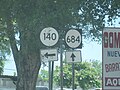
 Northbound sign in Florida Afuera, Barceloneta