Puig de la Talaia | |
---|---|
Highest point | |
Coordinates | 41°20′13″N1°28′17″E / 41.33694°N 1.47139°E Coordinates: 41°20′13″N1°28′17″E / 41.33694°N 1.47139°E |
Geography | |
Location | Baix Penedès, Catalonia |
Parent range | Catalan Pre-Coastal Range |
Climbing | |
First ascent | Unknown |
Easiest route | From El Montmell |
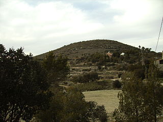
Puig de la Talaia is a mountain located in the El Montmell municipal term, in the Baix Penedès comarca, Catalonia, Spain. It has an elevation of 801 metres above sea level [1] and is part of the Catalan Pre-Coastal Range.
El Montmell is a village in the province of Tarragona and autonomous community of Catalonia, Spain.
Baix Penedès is a comarca in Catalonia, Spain. The area has been settled since the times of the Iberians, with ancient ruins remaining in Banyeres at Can Canyís, in the capital El Vendrell at the village of Guàrdies and in Calafell at the villages of Toixoneres and la Ciutadella.
Catalonia is an autonomous community in Spain on the northeastern corner of the Iberian Peninsula, designated as a nationality by its Statute of Autonomy. Catalonia consists of four provinces: Barcelona, Girona, Lleida, and Tarragona. The capital and largest city is Barcelona, the second-most populated municipality in Spain and the core of the sixth most populous urban area in the European Union. It comprises most of the territory of the former Principality of Catalonia. It is bordered by France (Occitanie) and Andorra to the north, the Mediterranean Sea to the east, and the Spanish autonomous communities of Aragon to the west and Valencia to the south. The official languages are Catalan, Spanish, and the Aranese dialect of Occitan.
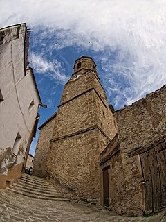
Talaia, the name of the mountain, means "watchtower" in the Catalan language.
A watchtower is a type of fortification used in many parts of the world. It differs from a regular tower in that its primary use is military and from a turret in that it is usually a freestanding structure. Its main purpose is to provide a high, safe place from which a sentinel or guard may observe the surrounding area. In some cases, non-military towers, such as religious towers, may also be used as watchtowers.
Catalan is a Western Romance language derived from Vulgar Latin and named after the medieval Principality of Catalonia, in northeastern modern Spain. It is the only official language of Andorra, and a co-official language of the Spanish autonomous communities of Catalonia, the Balearic Islands and Valencia. It also has semi-official status in the Italian commune of Alghero. It is also spoken in the eastern strip of Aragon, in some villages of Region of Murcia called Carche and in the Pyrénées-Orientales department of France. These territories are often called Països Catalans or "Catalan Countries".
The Volta a Catalunya is a road bicycle race held annually in Catalonia, Spain.
Cornudella de Montsant is a municipality in the comarca of the Priorat in Catalonia, Spain. It is situated in the north-west of the comarca below the Montsant range and the Prades Mountains. The Siurana reservoir is on the territory of the municipality and supplies its drinking water.
Santa Maragarida de Montbui is a municipality in the comarca of the Anoia in Catalonia, Spain. It is situated in the Òdena Basin, immediately to the west of Igualada of which it effectively forms a suburb. The ajuntament is in Sant Maure. Other neighbourhoods in Montbui are the Old Town, el Saió-Coll del Guix and La Mallola.
Calonge is a municipality in the comarca of the Baix Empordà in Catalonia, Spain, on the coastline of the Costa Brava.
La Guingueta d'Àneu is a municipality in the comarca of the Pallars Sobirà in Catalonia, Spain. It is situated in the valley of the Noguera Pallaresa river below the reservoir of La Torrassa. It is linked to Sort by the C-147 road.
Fígols is a municipality in the comarca of the Berguedà in Catalonia, Spain. It is situated to the north of Cercs, in the mountains above the Llobregat valley. Deposits of lignite are extracted commercially.
Saldes is a municipality in the comarca of the Berguedà in Catalonia, Spain. It is situated at the foot of the Pedraforca mountain (2497 m) in the north of the comarca. Deposits of lignite are extracted commercially. The village is linked to Guardiola de Berguedà by a local road. The monastery Sant Sebastià del Sull is located in Saldes.
Arbolí is a municipality in the comarca of the Baix Camp in Catalonia, Spain. It is situated in the west of the comarca in the Prades mountains. A local road links the village with the C-242 road.
Bonastre is a municipality in the comarca of the Baix Penedès in Catalonia, Spain. It is situated in the west of the comarca in the Quadrell range. Bonastre became part of the Baix Penedès in the comarcal revision of 1990: previously it formed part of the Tarragonès.
Estat Català is a pro-independence nationalist historical political party of Catalonia (Spain).
Borredà is a municipality in the comarca of the Berguedà in Catalonia, Spain. It is situated in the upper valley of the Margençol river in the east of the comarca. There are several notable houses from the 17th and 18th centuries. The Romanesque church of Sant Sadurní de Rotgers, a protected historico-artistic monument, can be reached by a mountain track. The village is served by the C-149 road between Berga and Sant Quirze de Besora. The municipality surrounds an exclave of Les Llosses.
Porqueres is a municipality located in the county of Pla de l'Estany, in the province of Girona, in the autonomous region of Catalunya of Spain. The municipality is made up of several villages. Mata, Les Pedreres and Miànigues, have the largest part of the population. At the top of the mountain range of Serra de Sant Patllari is the village of Pujarnol. In the west is Porqueres, and on the northern part of the Lake of Banyoles is Usall. Amid the green forests of the Ginestar mountains is the village of Merlant.
The following outline is provided as an overview of and topical guide to Catalonia:
Mont Caro or Caro is the highest mountain of the Ports de Tortosa-Beseit, Catalonia, Spain.
The Castelltallat range is located in central Catalonia (Spain) between the counties of Bages and Solsonès, extending over the provinces of Barcelona and Lleida, and occupying an area of about 65 square kilometres. It is one of the isolated hills of the Catalan Central Depression and is located at its southwestern end.
Vilaverd is a municipality in the comarca of the Conca de Barberà in Catalonia, Spain.
The Catalan Transversal Range is a system of minor mountain ranges at the eastern end of the Pre-Pyrenees, between the Osona and Garrotxa comarques. The existence of the Catalan Transversal Range has made communications in the northern areas of Catalonia difficult in the past, especially between Northeastern Catalonia and Western Catalonia, a problem that has been partly solved with the development of the Eix Transversal.
Castell de l'Airosa is a rocky mountain in the eastern side of the Ports de Tortosa-Beseit, Catalonia, Spain. Its summit has an altitude of 953.8 metres above sea level.
Republican Left of Catalonia–Catalonia Yes is a Catalan pro-independence electoral coalition. The alliance is formed by Republican Left of Catalonia, Catalonia Yes and independents, and in the 2015 and 2016 Spanish general elections it was led by Gabriel Rufián.
![]() | This Spain location article is a stub. You can help Wikipedia by expanding it. |