Te Awamutu is a town in the Waikato region in the North Island of New Zealand. It is the council seat of the Waipa District and serves as a service town for the farming communities which surround it. Te Awamutu is located some 30 kilometres (19 mi) south of Hamilton on State Highway 3, one of the two main routes south from Auckland and Hamilton.

Waipa District is a municipality in the Waikato region of New Zealand that is administered by the Waipa District Council. Its most populous town is Cambridge. The seat of the council is at the second most populous town, Te Awamutu. The district is south and south-east of the city of Hamilton. It has five wards: Te Awamutu, Cambridge, Pirongia, Maungatautari and Kakepuku.
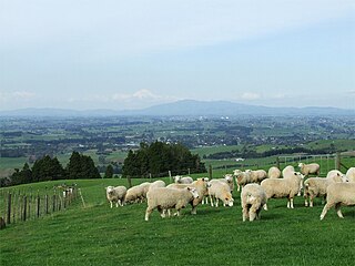
Pirongia is a small town in the Waipa District of the Waikato region of New Zealand's North Island. It is 12 kilometres to the west of Te Awamutu, on the banks of the Waipa River, close to the foot of the 962 metre Mount Pirongia, which lies in Pirongia Forest Park to the west of the town.

Te Poi is a small village in rural Waikato, New Zealand, established in 1912 at the base of the Kaimai Range. Te Poi is part of a thriving farming area, particularly for dairying, thoroughbred horse breeding and cropping.

Te Rapa is a mixed light industrial, large-scale retail and semi-rural suburb to the northwest of central Hamilton, New Zealand that is built on a flat area that was previously the bed of an ancient river, the forerunner to the present Waikato River.
Paterangi is a settlement in the Waikato region of New Zealand's North Island. It is located 10 km northwest of Te Awamutu. It is close to the site of one of the most strongly fortified pa built during the New Zealand wars of the late 19th century.

Te Pahu is a rural community in the Waipa District and Waikato region of New Zealand's North Island, located just north of Cambridge across State Highway 1.

Ōhaupō is a rural community in the Waipa District and Waikato region of New Zealand's North Island. It is located on State Highway 3, about halfway between Hamilton and Te Awamutu.
Waerenga is the name of a hamlet, 11 km (6.8 mi) east of Te Kauwhata, which is part of a statistical area unit in the Waikato District.

Mangatangi is a locality about 7 km east of Mangatawhiri and 10.5 km west of Miranda in the Waikato District in the North Island of New Zealand.
Pokuru is a rural community in the Waipa District and Waikato region of New Zealand's North Island.

Waikeria is a rural community in the Otorohanga District and Waikato region of New Zealand's North Island.
Aria is a rural community in the Waitomo District and Waikato region of New Zealand's North Island.
Ngāhinapōuri is a rural community in the Waipa District and Waikato region of New Zealand's North Island. It is located on State Highway 39, between Whatawhata and Pirongia.
Rukuhia is a rural community in the Waipa District and Waikato region of New Zealand's North Island.
Roto-o-Rangi or Rotoorangi is a rural community in the Waipa District and Waikato region of New Zealand's North Island, located south of Cambridge and north-east of Te Awamutu.
Karapiro or Karāpiro is a settlement and rural area in the Waipa District and Waikato region of New Zealand's North Island. It includes both the artificially created Lake Karapiro and the accompanying Karapiro Power Station. Karapiro is located just off State Highway 1, south-west of Cambridge.
Manawaru or Manawarū is a rural community in the Matamata-Piako District and Waikato region of New Zealand's North Island.
Eureka is a rural settlement in the Waikato District and Waikato region of New Zealand's North Island. It is located on State Highway 26, and is surrounded by dairy farmland on a flat plain.

Motumaoho is a small village in the Waikato region of New Zealand's North Island, just to the west of the Pakaroa Range. It is on SH26, 25 km (16 mi) east of Hamilton and 7 km (4.3 mi) west of Morrinsville. The village is bordered by the Waitakaruru Stream to the east. Motumaoho can be translated as an intruding clump of trees.

