Sataua is a village on the island of Savai'i in Samoa. It is situated at the northwestern end of the island in the district of Vaisigano.
Moata'a is a village on the island of Upolu in Samoa. It is situated on the central north coast of the island, to the east of the capital Apia. The village is in the political district of Tuamasaga.
Sala'ilua is a village on the island of Savai'i in Samoa. It is situated on the south coast of the island in Palauli district.
Apai is one of four small villages on Manono Island in Samoa. The village population is 111.
Salua is one of four small villages on Manono Island in Samoa. The village population is 201.
Foailuga is a village on the south-west coast of Savai'i island in Samoa. It is situated in Palauli district.
Gataivai is a village on the island of Savai'i in Samoa. It is situated on the south east coast of the island in Palauli district.
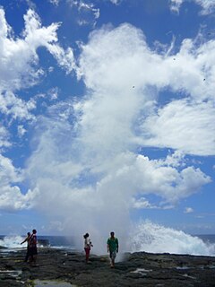
Satuiatua is a village on the island of Savai'i in Samoa. It is situated on the central south coast of the island in Palauli district.
Tufutafoe is a village on the island of Savai'i in Samoa. It is situated on the west coast of the island in Vaisigano district.
Vaega is a village on the island of Savai'i in Samoa. It is situated on the south coast of the island in the political district of Satupa'itea.
Siutu is a village on the island of Savai'i in Samoa. It is situated on the southeast coast of the island in Palauli district.
Manono Uta is a village on the island of Upolu in Samoa. It is situated on the north west coast of the island in the political district of Aiga-i-le-Tai.
Apolima Uta is a village on the island of Upolu in Samoa. It is situated on the north west coast of the island in the political district of Aiga-i-le-Tai.
Samatau is a village on the island of Upolu in Samoa. It is situated on the west side of the island in the political district of A'ana.
Pata is a village on the island of Upolu in Samoa. It is in the political district of A'ana.
Vaimoso is a village on the island of Upolu in Samoa. It is situated on the north central side of the island near the country's capital Apia. The village is in the political district of Tuamasaga.
Fogasavai'i is a village on the island of Savai'i in Samoa. It is situated on the south east coast of the island in the traditional district of Salega which falls within the larger political district (Itumalo) of Satupa'itea.
Vaipua is a village on the island of Savai'i in Samoa. It is situated on the south east coast of the island in the traditional district of Salega which falls within the larger political district (Itumalo) of Satupa'itea.
Fai'a'ai is a village on the island of Savai'i in Samoa. It is situated on the south east coast of the island in the traditional district of Salega which falls within the larger political district (Itumalo) of Satupa'itea.
Lano is a village on the north east coast of Savai'i island in Samoa. The village is part of the electoral constituency Fa'asaleleaga IV which is within the larger political district (Itumalo) of Fa'asaleleaga.