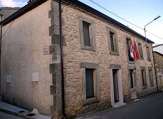
Pulvayal | |
|---|---|
village | |
| Country | |
| State | Tamil Nadu |
| District | Pudukkottai |
| Population (2001) | |
| • Total | 2,102 |
| Languages | |
| • Official | Tamil |
| Time zone | UTC+5:30 (IST) |
Pulvayal is a village in the Annavasal revenue block of Pudukkottai district, [1] Tamil Nadu, India.
As per the 2001 census, Pulvayal had a total population of 2102 [2] with 1050 males and 1052 females. Out of the total population 1211 people were literate.

The Arctic Archipelago, also known as the Canadian Arctic Archipelago, is an archipelago lying to the north of the Canadian continental mainland, excluding Greenland.

Bever is a municipality located in the Belgian province of Flemish Brabant. The municipality only comprises the town of Bever proper. It is located in the Pajottenland. It is located at 50°43′N3°56′E. On January 1, 2018, Bever had a total population of 2,204. The total area is 19.78 km² which gives a population density of 111 inhabitants per km². It is a Dutch-speaking village with language facilities for French-speakers.

The Bishopric of Dorpat was a medieval prince-bishopric, i.e. both a diocese of the Roman Catholic Church and a temporal principality ruled by the bishop of the diocese. It existed from 1224 to 1558, generally encompassing the area that now comprises Tartu County, Põlva County, Võru County, and Jõgeva County in Estonia. The prince-bishopric was a sovereign member of the Holy Roman Empire and part of the Livonian Confederation until its dissolution in 1561.

Masasi is one of the six districts of the Mtwara Region of Tanzania. It is bordered to the north by the Lindi Region, to the east by the Newala District, to the south by the Ruvuma River and Mozambique and to the west by Nanyumbu District.

The Pacific Remote Islands Marine National Monument is a group of unorganized, mostly unincorporated United States Pacific Island territories managed by the United States Fish and Wildlife Service of the United States Department of the Interior and the National Oceanic and Atmospheric Administration (NOAA) of the United States Department of Commerce. These remote refuges are "the most widespread collection of marine- and terrestrial-life protected areas on the planet under a single country's jurisdiction". They protect many endemic species including corals, fish, shellfish, marine mammals, seabirds, water birds, land birds, insects, and vegetation not found elsewhere.

Kampong Tralach is a district (srok) in the south east of Kampong Chhnang province, in central Cambodia. The district capital is Kampong Tralach town located 37 kilometres south of the provincial capital of Kampong Chhnang by road. The district shares a border with Kandal province to the south and Kampong Cham province to the east. The Tonle Sap river runs through the district crossing roughly from north to south.

Navares de Enmedio is a municipality located in the province of Segovia, Castile and León, Spain. According to the 2004 census (INE), the municipality has a population of 136 inhabitants.

Gmina Turośl is a rural gmina in Kolno County, Podlaskie Voivodeship, in north-eastern Poland. Its seat is the village of Turośl, which lies approximately 15 kilometres (9 mi) west of Kolno and 102 km (63 mi) west of the regional capital Białystok.
Turośl is a village in Kolno County, Podlaskie Voivodeship, in north-eastern Poland. It is the seat of the gmina called Gmina Turośl. It lies approximately 15 kilometres (9 mi) west of Kolno and 102 km (63 mi) west of the regional capital Białystok.
Bożówka is a village in the administrative district of Gmina Magnuszew, within Kozienice County, Masovian Voivodeship, in east-central Poland. It lies approximately 5 kilometres (3 mi) south of Magnuszew, 20 km (12 mi) north-west of Kozienice, and 62 km (39 mi) south-east of Warsaw.

Sukhtagalagyshlag - is a village and municipality in the Khachmaz District of Azerbaijan. It has a population of 230.

Staw is a village in the administrative district of Gmina Szczytniki, within Kalisz County, Greater Poland Voivodeship, in west-central Poland. It lies approximately 22 kilometres (14 mi) east of Kalisz and 126 km (78 mi) south-east of the regional capital Poznań.
Mješaji is a village in the municipality of Foča, Republika Srpska, Bosnia and Herzegovina.
Konnapere is a village in Märjamaa Parish, Rapla County in western Estonia.
Eiste is a village in Saaremaa Parish, Saare County in western Estonia.
Bagawad is a village in Dharwad district of Karnataka, India.
Annavasal block is a revenue block in Pudukkottai district, Tamil Nadu, India. It has a total of 43 panchayat villages.
Perumanadu (Tamil: Perumanadu) is a village in the Annavasalrevenue block of Pudukkottai district, Tamil Nadu, India.

Monforte del Cid is a village in the province of Alicante and autonomous community of Valencia, Spain. The municipality covers an area of 79.5 square kilometres (30.7 sq mi) and as of 2011 had a population of 7,771 people.

Cervellati Glacier is the 5 nmi long glacier situated southeast of Patton Glacier and northwest of Ramorino Glacier on the east slope of Sentinel Range in the Ellsworth Mountains, Antarctica. It flows northeastwards between Tyree Ridge and Epperly Ridge, and enters Crosswell Glacier southeast of Mount Bearskin. The feature was named by US-ACAN in 2006 after Roberto Cervellati, Italian representative to the SCAR Expert Group on Geographic Information, 1992–2006, and director of the SCAR Composite Gazetteer of Antarctica in the same period.
{{cite web}}: CS1 maint: archived copy as title (link)Coordinates: 10°23′N78°43′E / 10.383°N 78.717°E