
Ben Lomond, 974 metres (3,196 ft), is a mountain in the Scottish Highlands. Situated on the eastern shore of Loch Lomond, it is the most southerly of the Munros. Ben Lomond lies within the Ben Lomond National Memorial Park and the Loch Lomond and The Trossachs National Park, property of the National Trust for Scotland.

The Cambrian Mountains are a series of mountain ranges in Wales. The term Cambrian Mountains used to apply to most of the upland of Wales, and comes from the country's Latin name Cambria. Since the 1950s, its application has become increasingly localised to the geographically homogeneous Mid Wales uplands, known in Welsh as Elenydd, which extend from Plynlimon (Pumlumon) to Radnor Forest in the east and Mynydd Mallaen to the south. This barren and sparsely populated 'wilderness' has been referred to as the Desert of Wales. The area includes the sources of the River Severn and River Wye and was unsuccessfully proposed as a national park in the 1960s and 1970s. The highest point of the range is Plynlimon, at 2,467 feet (752 m).

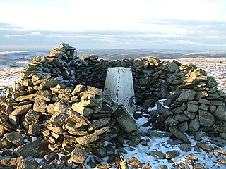
Plynlimon, or Pumlumon in Welsh, is the highest point of the Cambrian Mountains in Wales, and the highest point in Mid Wales. It is a massif that dominates the surrounding countryside and is the highest point of Ceredigion.

Radnor Forest is a rock dome composed of Silurian shales, mudstones and limestone in the historic county of Radnorshire, Powys, Mid Wales. It is a forest in the medieval sense of the word. It lies within the Welsh Marches region since Offa's Dyke lies nearby to the east.

The mountains and hills of the British Isles are categorised into various lists based on different combinations of elevation, prominence, and other criteria such as isolation. These lists are used for peak bagging, whereby hillwalkers attempt to reach all the summits on a given list, the oldest being the 282 Munros in Scotland, created in 1891.
Pen Pumlumon Llygad-bychan is a subsidiary summit of Pen Pumlumon Fawr and the third highest summit on the Plynlimon massif, a part of the Cambrian Mountains in the county of Ceredigion, Wales. It is not named on Ordnance Survey walking maps.

Pumlumon Fach is a top of Pen Pumlumon Fawr on the Plynlimon massif, a part of the Cambrian Mountains in the county of Ceredigion, Wales. It lies on small ridge heading north-west from the summit of Pen Pumlumon Fawr.
Y Garn is a subsidiary summit of Pen Pumlumon Fawr and the fourth highest peak on the Plynlimon massif, a part of the Cambrian Mountains in the county of Ceredigion, Wales.
Pen Pumlumon Arwystli is the second highest summit on the Plynlimon massif, a part of the Cambrian Mountains in the county of Ceredigion, Wales.
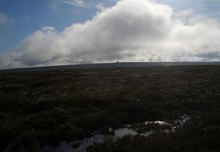
Black Mixen is a subsidiary summit of Rhos Fawr or Great Rhos in the Radnor Forest. The summit is large peat bog plateau. The summit is marked with a cairn, and is next to a radio transmitter and its building.

Top o'Selside is a hill in the Lake District in Cumbria, England. At 335 metres (1,099 ft), it is the highest point of the group of hills situated between Coniston Water and Windermere. This group also includes the Wainwright of Black Fell and the summits of Black Brows and Rusland Heights. Top o'Selside lies not in the centre of this region, but in the south-western corner, just outside the forestry plantations of Grizedale Forest and only two-thirds of a mile from the eastern shore of Coniston Water. This large separation from any higher ground gives it enough relative height to make it a Marilyn.

This article comprises three sortable tables of major mountain peaks of Canada.

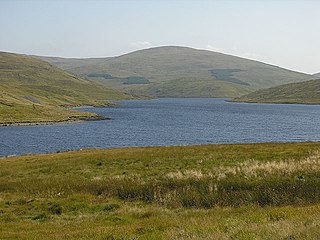
Llyn Eiddwen is a lake and site of special scientific interest near Trefenter in Ceredigion, Wales. It is the source of the River Aeron.
Pen y Garn is a mountain in the Cambrian Mountains, Mid Wales standing at 611 metres above sea level.
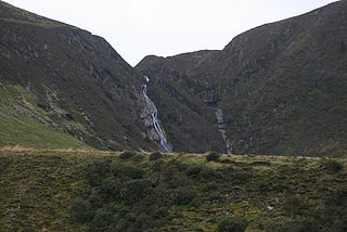
Pistyll y Llyn is one of the tallest waterfalls in Wales and the United Kingdom. It is a horsetail style set of falls which are located in the Cambrian Mountains about 2+1⁄2 miles from Glaspwll in Powys, Wales.
Llan Ddu Fawr or Waun Claerddu is a hill located in Ceredigion, Wales, at 594 metres (1,949 ft) above sea level. It is located about 10 miles south of Pumlumon. The surrounding land can be very boggy. There is a trig point at the summit, but this is not the highest point. There is also a cairn of about 15 meters in diameter. The peak is located within the region known as the Desert of Wales.
Banc Bugeilyn is a hill found in Plynlimon between Aberystwyth and Welshpool in the United Kingdom; grid reference SN826925.
Clipyn Du is a mountain in northern Powys in Wales. Also known as Tarren Bwlch-Gwyn or Siambwr Trawsfynydd, it is one of the higher summits of the area and is located a few miles north of Plynlimon (Pumlumon). It has an elevation of 582 m (1,909 ft) and a topographic prominence of 124 m (407 ft), so is classed as a HuMP, having over 100 metres of prominence. Tarren Bwlch-Gwyn is the name of a steep-sided escarpment nearby. Nearby is a lake, Glaslyn.
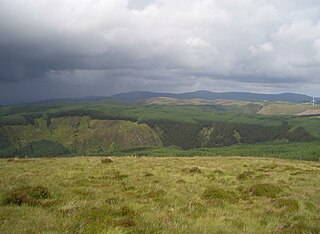
Y Glog or Draws Drum is a mountain situated in Ceredigion, Wales. It stands at an elevation of 574 metres above sea level and is located a few miles south of Plynlimon (Pumlumon), north of Pen y Garn, and just south of the A44 road. The mountain is classified as a HuMP, denoting its prominence. It is situated in a region characterized by desolate moorland, which is home to the Cefn Croes Wind Farm and the nearby small lakes known as Llynoedd Ieuan.

The South Summit is a subsidiary peak to the primary peak of Mount Everest in the Himalayas. Although the South Summit's elevation above sea level of 8,749 metres (28,704 ft) is higher than the second-highest mountain on Earth, K2, it is not considered a separate mountain as its prominence is only 11 meters. The primary peak of Mount Everest is 8,849 metres (29,032 ft) elevation above sea level.

