
The Graian Alps are a mountain range in the western part of the Alps.

Cogne is a town and comune (municipality) in Aosta Valley, northern Italy, with 1369 inhabitants, as of 2017.

Castor is a mountain in the Pennine Alps on the border between Valais, Switzerland and the Aosta Valley in Italy. It is the higher of a pair of twin peaks, the other being Pollux, named after the Gemini twins of Roman mythology. Castor's peak is at an elevation of 4,223 m (13,855 ft), and it lies between Breithorn and the Monte Rosa. It is separated from Pollux by a pass at 3,847 m (12,621 ft), named Passo di Verra in Italian and Zwillingsjoch in German.

The Grand Golliat is a mountain of the Pennine Alps, located between the Petit Col Ferret and the Great St. Bernard Pass. At 3,238 metres above sea level, its summit straddles the border between Switzerland and Italy, separating the Swiss canton of Valais from the Italian region of Aosta Valley. The name Golliat comes from "gouilles" or small lakes located on the Italian side of the mountain.

Mont Gelé (3,518 m) is a mountain of the Pennine Alps, located on the border between Switzerland and Italy. It lies between the valleys of Bagnes and Valpelline, on the main Alpine watershed. It overlooks the Fenêtre de Durand from the east side.
Mont Avic is a mountain in the Graian Alps, in the Aosta Valley, north-western Italy. It has an elevation of 3,006 m. It is included in the Gran Paradiso massif.
The Aiguille des Glaciers is a mountain in the Mont Blanc massif of the Graian Alps. It lies on the borders of Savoie and Haute-Savoie in France and Aosta Valley in Italy.

Aiguille de Leschaux is a mountain in the Mont Blanc massif on the border of Haute-Savoie, France and Aosta Valley, Italy.

The Orco Valley is a valley in the Piedmont region of northern Italy located in the Graian Alps, in the territory of the Metropolitan City of Turin. The valley takes its name from the Orco river, which flows through the valley.
The Grande Rochère is a mountain of the Italian Pennine Alps, located north of Morgex in the Aosta Valley. Reaching a height of 3,326 metres above sea level, it is the culminating point of the group lying between the Col Ferret and the Great St. Bernard Pass.
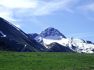
Punta Tersiva (3,512m) is a mountain of the Graian Alps in Aosta Valley, north-western Italy. It is described as an "elegant, pyramid shaped mountain".

Ciarforon or Charforon (3,642m), is a mountain in the Gran Paradiso Massif of the Graian Alps on the border of Aosta Valley and Piedmont, Italy.

The Grande Rousse (3,607m) is a mountain of the Graian Alps in Aosta Valley, Italy. It is the culminating point of a ridge separating the Rhêmes and the Valgrisenche valleys. It was first climbed in 1864.

Testa del Rutor or Tête du Ruitor (3,486m) is a mountain of the Graian Alps in Aosta Valley, north-western Italy. It is the highest summit of the Rutor-Léchaud Group, lying roughly between the Mont Blanc Massif and the Vanoise Massif. The huge Glacier del Rutor lies on its slopes. The mountain is rarely climbed except by Italy's mountain troops, the Alpini, who use it for training.

Tsanteleina (3,601m) is a mountain of the Graian Alps located on the border between Savoie, France and Aosta Valley, Italy. It lies at the head of the Val di Rhèmes, although the summit itself is hidden from view in the valley. The eastern side of the mountain lies within the Gran Paradiso National Park.

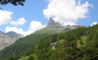
Punta Garin or Pic Garin or Pointe Garin (3,448 m) is a mountain of the Graian Alps, just south of Monte Emilius in Aosta Valley, Italy. It boasts a pyramidal summit.

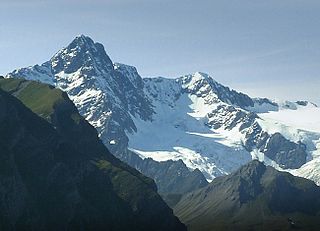
Becca di Luseney (3,502m) is a mountain of the Pennine Alps in Aosta Valley, northwest Italy. It has a pyramidal look on all four sides, and its north face is covered with a glacier. A huge rockfall from its southwest face came down in 1952, completely destroying the village of Chamen and other settlements in the Valpelline valley. The mountain was first climbed in 1866.

Testa Grigia (3,315m) is a mountain on the Italian side of the Monte Rosa Massif in the Pennine Alps. It is the highest mountain of the ridge that separates the Lys valley (Gressoney-La-Trinité) from the Ayas Valley, in Aosta Valley.

The Mont Tout Blanc is a 3,438.2 metres high mountain belonging to the Italian side of Graian Alps.
Punta Grober is a mountain that is part of the Monte Rosa Alps in the Pennine Alps. It is located in Piedmont between the Valsesia and the Anzasca Valley.

