Pureza, Rio Grande do Norte

Last updated
Pureza, Rio Grande do Norte
Municipality
Pureza - State of Rio Grande do Norte, Brazil - panoramio (1).jpg
City center of Pureza
Bandeira de Pureza, Rio Grande do Norte, Brasil.png
Brasao de Pureza, Rio Grande do Norte, Brasil.png
RioGrandedoNorte Municip Pureza.svg
CountryFlag of Brazil.svg  Brazil
Region Nordeste
State Rio Grande do Norte
MesoregionLeste Potiguar
Population
 (2020 [1] )
  Total9,724
Time zone UTC−3 (BRT)

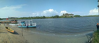
Pureza is a municipality in the state of Rio Grande do Norte in the Northeast region of Brazil. [2] [3] [4] [5] The place means "pure" in Portuguese hence its pure lake located in the area, and it is depicted in the municipal seal.

The municipality was founded in April 5, 1963 [6] from a portion of the municipality of Touros.

Six municipalities borders Pureza, three of them are Touros to the north, Rio do Fogo to the east and João Câmara to the west.

See also

Related Research Articles

Boa Saúde is a municipality in the state of Rio Grande do Norte in the Northeast region of Brazil.

Campo Redondo is a municipality in the state of Rio Grande do Norte in the Northeast region of Brazil.

Coronel Ezequiel is a municipality in the state of Rio Grande do Norte in the Northeast region of Brazil.

São José do Campestre is a municipality in the state of Rio Grande do Norte in the Northeast region of Brazil.

Serra de São Bento Municipality in Nordeste, Brazil

Serra de São Bento is a municipality in the state of Rio Grande do Norte in the Northeast region of Brazil.

Caiçara do Rio do Vento is a municipality in the state of Rio Grande do Norte in the Northeast region of Brazil.

Ouro Branco is a municipality in the state of Rio Grande do Norte in the Northeast region of Brazil.
Bodó is a municipality in the state of Rio Grande do Norte in the Northeast region of Brazil.
Florânia Municipality in Nordeste, Brazil

Florânia is a municipality in the state of Rio Grande do Norte in the Northeast region of Brazil.

Santana do Matos Municipality in Nordeste, Brazil

Santana do Matos is a municipality in the state of Rio Grande do Norte in the Northeast region of Brazil.

Canguaretama is a municipality in the state of Rio Grande do Norte in the Northeast region of Brazil.

Tibau do Sul The Municipality of Tibau do Sul in Nordeste, Brazil

Tibau do Sul is a municipality in the state of Rio Grande do Norte in the Northeast region of Brazil.

São José de Mipibu Municipality in Nordeste, Brazil

São José de Mipibu is a municipality in the state of Rio Grande do Norte in the Northeast region of Brazil.

Extremoz Municipality in Nordeste, Brazil

Extremoz is a municipality in the state of Rio Grande do Norte in the Northeast region of Brazil.

Governador Dix-Sept Rosado is a municipality in the state of Rio Grande do Norte in the Northeast region of Brazil.

Riacho da Cruz is a municipality in the state of Rio Grande do Norte in the Northeast region of Brazil.

São Miguel, Rio Grande do Norte Municipality in Nordeste, Brazil

São Miguel is a municipality in the state of Rio Grande do Norte in the Northeast region of Brazil.

Frutuoso Gomes Municipality in Nordeste, Brazil

Frutuoso Gomes is a municipality in the state of Rio Grande do Norte in the Northeast region of Brazil.

Serrinha dos Pintos Municipality in Nordeste, Brazil

Serrinha dos Pintos is a municipality in the state of Rio Grande do Norte in the Northeast region of Brazil.

Pendências Municipality in Nordeste, Brazil

Pendências is a municipality in the state of Rio Grande do Norte in the Northeast region of Brazil.

References

  1. IBGE 2020
  2. "Divisão Territorial do Brasil" (in Portuguese). Divisão Territorial do Brasil e Limites Territoriais, Instituto Brasileiro de Geografia e Estatística (IBGE). July 1, 2008. Retrieved December 17, 2009.
  3. "Estimativas da população para 1º de julho de 2009" (PDF) (in Portuguese). Estimativas de População, Instituto Brasileiro de Geografia e Estatística (IBGE). August 14, 2009. Retrieved December 17, 2009.
  4. "Ranking decrescente do IDH-M dos municípios do Brasil" (in Portuguese). Atlas do Desenvolvimento Humano, Programa das Nações Unidas para o Desenvolvimento (PNUD). 2000. Archived from the original on October 3, 2009. Retrieved December 17, 2009.
  5. "Produto Interno Bruto dos Municípios 2002-2005" (PDF) (in Portuguese). Instituto Brasileiro de Geografia e Estatística (IBGE). December 19, 2007. Retrieved December 17, 2009.

Coordinates: 5°28′01″S35°33′21″W / 5.46694°S 35.55583°W / -5.46694; -35.55583