Purog Kangri

Last updated
Purugangri
China Tibet Autonomous Region rel location map.svg
Red pog.svg
China edcp relief location map.jpg
Red pog.svg
Coordinates 33°55′28.92″N89°14′58.20″E / 33.9247000°N 89.2495000°E / 33.9247000; 89.2495000
Area423 square kilometres (163 sq mi)
Highest elevation6,072 metres (19,921 ft)
Lowest elevation5,620 metres (18,440 ft)
Purog Kangri

Purog Kangri (Tibetan : བུ་རོགས་གངས་རི, Wylie : bu rogs gangs ri) is an ice sheet in the Tibetan Plateau, in Nagqu, China. It is shrinking rapidly.

Contents

Location

Purog Kangri was discovered by Chinese and American scientists around 1999. It has been confirmed to be the third largest ice field in the world. The other two are in the Arctic and the Antarctic. [1] Purog Kangri is in the Nagqu prefecture-level city of Tibet, China. It is in a harsh mountain environment that is not accessible to tourists. [2] It is about 150 kilometres (93 mi) from the double lake. [3]

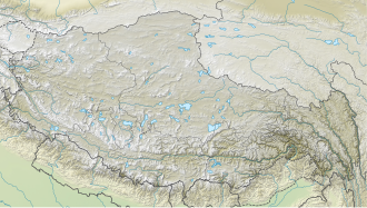
The Purog Kangri ice field is at 33°51′18″N89°48′18″E / 33.8550°N 89.8050°E / 33.8550; 89.8050 at an elevation of 6,072 metres (19,921 ft) above sea level. [4] The ice field is the largest in the North of the Tibetan Plateau. It is made up of several ice caps with a total area of 422.58 square kilometres (163.16 sq mi) as of 2002, and a volume of about 52 cubic kilometres (12 cu mi). The glacier snow line is 5,620 to 6,860 metres (18,440 to 22,510 ft) above sea level. [5] The ice sheet is radial, with over 50 tongues of ice of different lengths that extend from the ice sheet through wide and shallow valleys. In the areas with lower tongues there are many ice pyramids. [5]

Climate

Purog Kangri is near the boundary between the southern part of the Tibetan Plateau, where the weather is driven by the monsoon cycle, and the northern part where it is driven by continental westerly storms coming from the Arctic and the North Atlantic. The latter process has the greatest effect on the ice field. [6] The Tibetan Plateau and Himalaya hold the largest amount of ice outside the Arctic and Antarctic. Meltwater from the glaciers feeds the Yangtze, Yellow, Indus, Brahmaputra and Ganges rivers. [4] The glaciers have been shrinking since the Little Ice Age. [5]

Shrinkage

Ice cores were recovered from the Purog Kangri ice field in 2000, filling a gap in knowledge of climate change in the Central Tibetan Plateau. [7] The longest core was 213 metres (699 ft). The upper 102 metres (335 ft) covered the last 1,000 years, and was analyzed along its length for the δ18O oxygen isotope ratio. [8] The results, correlated and checked against ice cores from other locations, showed a sharp increase in temperature starting in the late 19th century. [9] Between 1960 and 2004 the glaciers in the region have shrunk in volume by 389 cubic kilometres (93 cu mi), or 7%, and in area by 3,248 square kilometres (1,254 sq mi), or 5.5%. The rate of shrinkage is expected to accelerate, with 2/3 of China's glaciers gone by 2060. [1]

Measurements using interferometric synthetic-aperture radar showed that the ice field became slightly thicker in 2011–2012, by about 0.44 metres (1 ft 5 in), then in 2012–2016 thinned each year by 0.13 to 0.52 metres (5.1 in to 1 ft 8.5 in). This was mainly due to a steep drop in annual precipitation, from 405.13 to 207.19 millimetres (15.950 to 8.157 in). [10] Another study using TanDEM-X SAR data sets from 2012 and 2016 indicated annual surface thinning of 0.317 metres (1 ft 0.5 in) with a 0.027 metres (1.1 in) margin of error. [11]

Notes

    1. 1 2 Glacier study reveals chilling prediction.
    2. Nagqu City, Exploring Tourism.
    3. Purugangri Glaciers ... China Tour.
    4. 1 2 Thompson et al. 2006, p. 62.
    5. 1 2 3 Pu et al. 2002, p. 87.
    6. Thompson et al. 2006, p. 66.
    7. Yao et al. 2007, p. 362.
    8. Yao et al. 2007, p. 363.
    9. Yao et al. 2007, p. 364.
    10. Liu et al. 2019.
    11. Liu et al. 2016.

    Sources

    Related Research Articles

    <span class="mw-page-title-main">Salween River</span> Major river in Southeast Asia

    The Salween is a Southeast Asian river, about 3,289 kilometres (2,044 mi) long, flowing from the Tibetan Plateau south into the Andaman Sea. The Salween flows primarily within southwest China and eastern Myanmar (Burma), with a short section forming the border of Burma and Thailand. Throughout most of its course, it runs swiftly through rugged mountain canyons. Despite the river's great length, only the last 90 km (56 mi) are navigable, where it forms a modest estuary and delta at Mawlamyine. The river is known by various names along its course, including the Thanlwin in Burma and the Nu Jiang in China. The commonly used spelling "Salween" is an anglicisation of the Burmese name dating from 19th-century British maps.

    <span class="mw-page-title-main">Karakoram</span> Major mountain range spanning the borders between Pakistan, India and China

    The Karakoram is a mountain range in the Kashmir region spanning the border of Pakistan, China, and India, with the northwestern extremity of the range extending to Afghanistan and Tajikistan. Most of the Karakoram mountain range falls under the jurisdiction of Gilgit-Baltistan, which is controlled by Pakistan. Its highest peak, K2, is located in Gilgit-Baltistan, Pakistan. It begins in the Wakhan Corridor (Afghanistan) in the west, encompasses the majority of Gilgit-Baltistan, Pakistan and extends into Ladakh and Aksai Chin.

    <span class="mw-page-title-main">Tibetan Plateau</span> Plateau in Central, South and East Asia

    The Tibetan Plateau, also known as Qinghai–Tibet Plateau and Qing–Zang Plateau, is a vast elevated plateau located at the intersection of Central, South, and East Asia covering most of the Tibet Autonomous Region, most of Qinghai, western half of Sichuan, Southern Gansu provinces in Western China, southern Xinjiang, Bhutan, the Indian regions of Ladakh and Lahaul and Spiti as well as Gilgit-Baltistan in Pakistan, northwestern Nepal, eastern Tajikistan and southern Kyrgyzstan. It stretches approximately 1,000 kilometres (620 mi) north to south and 2,500 kilometres (1,600 mi) east to west. It is the world's highest and largest plateau above sea level, with an area of 2,500,000 square kilometres (970,000 sq mi). With an average elevation exceeding 4,500 metres (14,800 ft) and being surrounded by imposing mountain ranges that harbor the world's two highest summits, Mount Everest and K2, the Tibetan Plateau is often referred to as "the Roof of the World".

    <span class="mw-page-title-main">Nagqu</span> Prefecture-level city in Tibet, China

    Nagqu is a prefecture-level city in the north of the Chinese autonomous region of Tibet. On May 7, 2018, the former Nagqu Prefecture was officially declared the sixth prefecture-level city in Tibet after Lhasa, Shigatse, Chamdo, Nyingchi and Shannan. The regional area, covering an area of 450,537 km2 (173,953 sq mi), is bordered by Bayingolin and Hotan Prefectures of Xinjiang to the north, Haixi, Yushu Prefectures of Qinghai and Chamdo to the east, Nyingchi, Lhasa and Shigatse to the south, Ngari Prefecture to the west. As of the 2010 census, it had a population of 462,381. Since its official establishment in 2018, it is the largest prefecture-level city by area in the world, being slightly larger than Sweden.

    <span class="mw-page-title-main">Svartisen</span> Glaciers in Nordland, Norway

    Svartisen is a collective term for two glaciers located in Nordland county in northern Norway. It is part of Saltfjellet-Svartisen National Park, located in the Saltfjell mountain range. The glaciers are located in the municipalities of Beiarn, Meløy, Rana, and Rødøy. Svartisen consists of two separate glaciers that are separated by the 1-kilometre (0.62 mi) long Vesterdalen valley. The two glaciers are:

    <span class="mw-page-title-main">Geladaindong Peak</span> Mountain in Qinghai, China

    Geladaindong Peak is a snow-covered mountain located in Southwestern Qinghai Province of China near the border of Tibet Autonomous Region. It is the tallest mountain in the Tanggula Mountain Range of the Tibetan Plateau with an elevation of 6,621 metres (21,722 ft) above sea level. The traditional source of the Yangtze River, begins with glaciers on its surface. The Yangtze's true source, however, lies 325 km (202 mi) away at the head of the Dam Qu.

    <span class="mw-page-title-main">Nyenchen Tanglha Mountains</span> Mountain range in China

    The Nyenchen Tanglha Mountains are a 700-kilometre (430 mi) long mountain range, and subrange of the Transhimalaya System, located in Tibet and the Tibet Autonomous Region of China.

    <span class="mw-page-title-main">Xainza County</span> County in Tibet, China

    Xainza County, also Shantsa, Shentsa, is a county within Nagqu of the Tibet Autonomous Region of China. In 1999 the county had a population of 16,190.

    <span class="mw-page-title-main">Shuanghu County</span> County in Tibet, China

    Shuanghu County, also transliterated from Tibetan as Tsonyi County or Co Nyi County, is a county under the jurisdiction of the prefecture-level city of Nagqu, in the northernmost part of the Tibet Autonomous Region, China. It was formed in 2012, combining the territory of the former Shuanghu Special District with the eastern half of Nyima County. Much of the county is within the Changtang area.

    <span class="mw-page-title-main">Tanggula Mountains</span> Mountain range in Tibet

    The Tanggula, Tangla, Tanglha, or Dangla Mountains is a mountain range in the central part of the Qinghai-Tibet Plateau in Tibet. Administratively, the range is in the Nagqu Prefecture of the Tibet Autonomous Region, with the central section extending into the Tanggula Town and the eastern section entering the Yushu Tibetan Autonomous Prefecture of Qinghai province.

    <span class="mw-page-title-main">Siling Lake</span> Lake in Tibet

    Siling Lake, is a salt lake in the Tibet Autonomous Region, China to the north of Xainza. Doijiang is located near the lake. Administratively it belongs to Xainza County and Baingoin County of the Nagqu.

    <span class="mw-page-title-main">Matthias Kuhle</span>

    Matthias Kuhle was a German geographer and professor at the University of Göttingen. He edited the book series Geography International published by Shaker Verlag.

    The Third Pole, also known as the Hindu Kush-Karakoram-Himalayan system (HKKH), is a mountainous region located in the west and south of the Tibetan Plateau. Part of High-Mountain Asia, it spreads over an area of more than 4.2 million square kilometres across nine countries, i.e. Afghanistan, Bangladesh, Bhutan, China, India, Myanmar, Nepal, Pakistan and Tajikistan, bordering ten countries. The area is nicknamed "Third Pole" because its mountain glaciers and snowfields store more frozen water than anywhere else in the world after the Arctic and Antarctic polar caps. With the world's loftiest mountains, comprising all 14 peaks above 8,000 metres (26,000 ft), it is the source of 10 major rivers, and forms a global ecological buffer.

    Sjögren Glacier is a glacier 15 nautical miles long in the south part of Trinity Peninsula, Antarctica. It flows southeast from Detroit Plateau to the south side of Mount Wild, where it enters Prince Gustav Channel.

    <span class="mw-page-title-main">Duilong River</span> River in Lhasa, Tibet

    The Duilong River, or Duilong Qu, is a right tributary of the Lhasa River, which it enters just below the city of Lhasa, Tibet, China. The river is about 137 kilometres (85 mi) in length. Water quality may be compromised by dissolved substances including arsenic from geothermal springs.

    Kunlun Volcanic Group, also known as Ashikule Volcanic Field, is a volcanic field in northwestern Tibet. Eight other volcanic fields are also in the area. The field is within a basin that also contains three lakes.

    <span class="mw-page-title-main">Quelccaya Ice Cap</span> Glacier in Peru

    The Quelccaya Ice Cap is the second largest glaciated area in the tropics, after Coropuna. Located in the Cordillera Oriental section of the Andes mountains in Peru, the cap covers an area of 42.8 square kilometres (16.5 sq mi) with ice up to 200 metres (660 ft) thick. It is surrounded by tall ice cliffs and a number of outlet glaciers, the largest of which is known as Qori Kalis Glacier; lakes, moraines, peat bogs and wetlands are also present. There is a rich flora and fauna, including birds that nest on the ice cap. Quelccaya is an important source of water, eventually melting and flowing into the Inambari and Vilcanota Rivers.

    <span class="mw-page-title-main">Sepu Kangri</span> Mountain in Tibet

    The Sepu Kangri is a mountain in Biru County, Nagqu prefecture, Tibet Autonomous Region. The mountain is 285 kilometres (177 mi) east-northeast of Lhasa and 178 kilometres (111 mi) east-southeast of Nagqu Town. With a height of 6,956 metres (22,822 ft), it forms the highest point in the eastern part of the Nyenchen Tanglha Mountains. The full name of the mountain is Sepu Kunglha Karpo, meaning "white snow god".

    Heishibeihu is a volcanic field in the Kunlun Mountains of China.

    <span class="mw-page-title-main">Dazecuo</span> Meromictic lake in Tibet, China

    Dazecuo is one of many inland lakes in Tibet. It is a salt lake on the Tibetan Plateau in Xainza County within Nagqu in the Tibet Autonomous Region of China. It was reported in 2021 that the lake receives "good environmental protection".