
Indira Gandhi International Airport is the primary international airport serving Delhi, India. The airport, spread over an area of 5,106 acres (2,066 ha), is situated in Palam, Delhi, 15 km (9.3 mi) south-west of the New Delhi Railway Station and 16 km (9.9 mi) from New Delhi city centre. Named after Indira Gandhi, the former Prime Minister of India, it is the busiest airport of India in terms of passenger traffic since 2009. It is also the busiest airport in the country in terms of cargo traffic, overtaking Mumbai during late 2015. As of now, it is the 17th busiest airport in the world and 6th busiest airport in Asia by passenger traffic handling nearly 70 million passengers. It is the world's busiest airport for Airbus A320 flights. The under construction expansion program will increase the airport's capacity to handle 100 million passengers by 2030.

The Airbus A300-600ST, or Beluga, is a version of the standard A300-600 wide-body airliner modified to carry aircraft parts and outsize cargo. It received the official name of Super Transporter early on; however, the name Beluga, a whale it resembles, gained popularity and has since been officially adopted. Its replacement, the Beluga XL, made its first flight in January 2020.

Munich Airport is an international airport serving Upper Bavaria. It is the second-busiest airport in Germany in terms of passenger traffic after Frankfurt Airport, and the ninth-busiest airport in Europe, handling 47.9 million passengers in 2019. It is the world's 15th-busiest airport in terms of international passenger traffic, and was the 38th-busiest airport worldwide in 2018. It serves as hub for Lufthansa including its subsidiaries Lufthansa CityLine, Air Dolomiti and Eurowings as well as a base for Condor and TUI fly Deutschland.

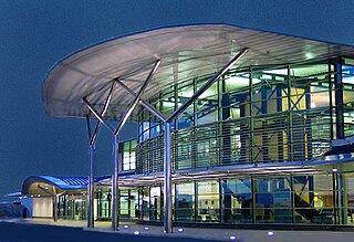
Aberdeen International Airport is an international airport, located in the Dyce suburb of Aberdeen, Scotland, approximately 5 nautical miles northwest of Aberdeen city centre. A total of just under 3.1 million passengers used the airport in 2017, an increase of 4.6% compared with 2016.

Abu Dhabi International Airport is an international airport in the Emirate of Abu Dhabi, the capital of the United Arab Emirates.

DigitalGlobe is an American commercial vendor of space imagery and geospatial content, and operator of civilian remote sensing spacecraft. The company went public on the New York Stock Exchange on 14 May 2009, selling 14.7 million shares at US$19.00 each to raise US$279 million in capital. On 5 October 2017, Maxar Technologies completed its acquisition of DigitalGlobe.
Guernsey Airport is an international airport on the island of Guernsey and the largest airport in the Bailiwick of Guernsey. It is located in the Forest, a parish in Guernsey, 2.5 nautical miles southwest of St. Peter Port and features mostly flights to Great Britain and some other European destinations.
PT Lion Mentari Airlines, operating as Lion Air, is an Indonesian low-cost airline. Based in Jakarta, Lion Air is the country's largest privately run airline, the second largest low-cost airline in Southeast Asia and the largest airline of Indonesia. With Wings Air and Batik Air, Lion Group is the country's largest airline's group. The airline operates domestic as well as international routes, which connects different destinations of Indonesia to Singapore, the Philippines, Malaysia, Thailand, Australia, India, Japan and Saudi Arabia, as well as charter routes to Mainland China, Hong Kong, South Korea and Macau, with more than 630 flights per day.

Air Greenland A/S, also known as Greenlandair, is the flag carrier airline of Greenland, owned by the Greenlandic Government. It operates a fleet of 32 aircraft, including 1 airliner used for transatlantic and charter flights, 8 fixed-wing aircraft primarily serving the domestic network, and 18 helicopters feeding passengers from the smaller communities into the domestic airport network. Flights to heliports in the remote settlements are operated on contract with the government of Greenland.

Google Earth is a computer program, formerly known as Keyhole EarthViewer, that renders a 3D representation of Earth based primarily on satellite imagery. The program maps the Earth by superimposing satellite images, aerial photography, and GIS data onto a 3D globe, allowing users to see cities and landscapes from various angles. Users can explore the globe by entering addresses and coordinates, or by using a keyboard or mouse. The program can also be downloaded on a smartphone or tablet, using a touch screen or stylus to navigate. Users may use the program to add their own data using Keyhole Markup Language and upload them through various sources, such as forums or blogs. Google Earth is able to show various kinds of images overlaid on the surface of the earth and is also a Web Map Service client. In 2019, Google has revealed that Google Earth now covers more than 98 percent of the world, and has captured 10 million miles of Street View imagery.
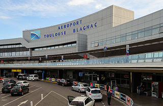
Toulouse–Blagnac Airport is an international airport located 3.6 nautical miles west northwest of Toulouse, partially in Blagnac, both communes of the Haute-Garonne department in the Occitanie region of France. In 2017, the airport served 9,264,611 passengers. As of April 2017, the airport features flights to 74 destinations, mostly in Europe and Northern Africa with a few additional seasonal long-haul connections.

Kota Kinabalu International Airport (KKIA) is an international airport in Kota Kinabalu, the state capital of Sabah, Malaysia. It is located approximately 8 km (5.0 mi) southwest of the city centre. In 2017, 8 million passengers passed through the airport, making it the second busiest airport in Malaysia after Kuala Lumpur International Airport. A medium-sized airport with good connections to most major aviation hubs across the Asia-Pacific region, the airport serves the city of Kota Kinabalu as well as the entire west coast of Sabah.

Puerto Princesa International Airport is an airport serving the general area of Puerto Princesa, located in the province of Palawan in the Philippines. It is classified as an international airport by the Civil Aviation Authority of the Philippines.

Elizovo Airport, also known as Yelizovo Airport or Petropavlovsk-Kamchatsky Airport, is located in the Russian Far East city of Petropavlovsk-Kamchatsky, Kamchatka Krai. Its main runway is 3,400 m (11,155 ft) long.
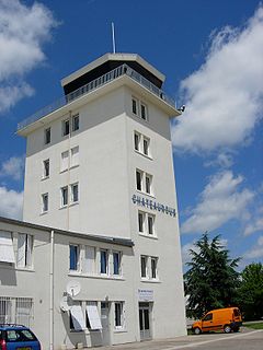
Châteauroux-Centre "Marcel Dassault" Airport, formerly known as Châteauroux-Déols "Marcel Dassault" Airport, is an airport serving the French city of Châteauroux. The airport is located 5.5 km (3.0 NM) north-northeast of Châteauroux in Déols, a commune of the Indre department in the Centre-Val de Loire region in France. The airport is named after Marcel Dassault and is located on the site of the former Châteauroux-Déols Air Base. It is dedicated to air freight, aeronautical maintenance, pilot training and training of airport firefighters.

GeoEye Inc. was an American commercial satellite imagery company based in Herndon, Virginia. GeoEye was merged into the DigitalGlobe corporation January 29, 2013.

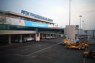
Lhasa Gonggar Airport is the airport serving Lhasa, the capital city of the Tibet Autonomous Region, China. It is about 62 kilometres (39 mi) southwest of the city in Gyazhugling, Gonggar County of Shannan. The airport is close to the road to Tsetang, the seat of Nêdong District and the capital of Shannan.

Cathay Pacific Flight 780 was a flight from Juanda International Airport in Surabaya, Indonesia to Hong Kong International Airport on 13 April 2010. On board were 309 passengers and a crew of 13. As Flight 780 neared Hong Kong, the crew were unable to change the thrust output of the engines. The aircraft, an Airbus A330-342, landed at almost twice the speed of a normal landing, suffering minor damage. The 57 passengers who sustained injuries were hurt in the ensuing slide evacuation; one of them received serious injuries.
Bacolod–Silay Airport, also referred to as Bacolod-Silay International Airport, is the main airport serving the general area of Metro Bacolod, in the Western Visayas region of the Philippines.
Airbus Defence and Space is a division of Airbus responsible for defence and aerospace products and services. The division was formed in January 2014 during the corporate restructuring of European Aeronautic Defence and Space (EADS), and comprises the former Airbus Military, Astrium, and Cassidian divisions. It is the world's second largest space company after Boeing and one of the top ten defence companies in the world.

