Qatraneh

Last updated
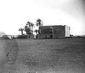
Al Qatraneh or Al Qatrana
اﻟﻘﻄﺮاﻧﺔ
Town
Jordan location map.svg
Red pog.svg
Al Qatraneh or Al Qatrana
Location in Jordan
Coordinates: 31°15′13″N36°02′50″E / 31.25361°N 36.04722°E / 31.25361; 36.04722
CountryFlag of Jordan.svg Jordan
Governorate Karak Governorate
Government
  TypeMunicipality
   Mayor Faisal Alasfar
Population
 (2015) [1]
  Total
7,070
Time zone UTC+2 (UTC+2)
  Summer (DST) UTC+3 (UTC+3)
Area code +(962)3

Al Qatraneh or Al Qatrana is a small town in Jordan. [2] It is located 90 miles south of Amman. [2] [3] It belongs administratively to Karak Governorate.

Contents

History

The town is famous for its historic Qasr Al-Qatraneh, which was built in the Ottoman era as a waystation for pilgrims on their way to Hajj.

The modern Qatraneh kaza was created in 1996.

Geography

Location of Qatraneh Department of the Karak Governorate Karak-Gotraneh.png
Location of Qatraneh Department of the Karak Governorate

The town lies on the Desert Highway, in the desert plain east of the Mountains of Moab, on the borders between Karak and Amman Governorates. The town is located on one of the tributaries of the Mujib River.

Demographics

In the census of 2004, the town had a population of 6,949. The male to female ratio was 51% to 49%. Jordanian citizens made up 95% of the population. The estimated population in 2010 is about 8,300.

See also

References

  1. "The General Census - 2015" (PDF). Department of Population Statistics.
  2. 1 2 King Abdullah II of Jordan, Our Last Best Chance , New York, New York: Viking Press, 2011, p. 56
  3. Matthew Teller, Rough guide to Jordan, London: Rough Guides, 2002, pp. 334335