Al-Ukhaydir, Tabuk Province

Last updated
Al-Ukhaydir
Tabuk Province, Saudi Arabia
Al-Ukhaydir Tabuk 1907-2.jpg
The fort in 1907
Saudi Arabia location map.svg
Red pog.svg
Al-Ukhaydir
Coordinates 28°05′30″N37°07′33″E / 28.091633°N 37.125917°E / 28.091633; 37.125917
Length20 by 20 meters (66 ft × 66 ft)
Site information
Controlled by Saudi Arabia
ConditionWell-preserved
Site history
Built1531
Built by Turabay ibn Qaraja

Al-Ukhaydir (also spelled al-Akhthar, al-Akhdar, al-Akhider, Akhizer), also known as Haydar or Aqabat, is a site in the Tabuk Province in Saudi Arabia, located southeast of Tabuk. During early Ottoman rule, a fort, Qal'at al-Akhdar, was built at the site, part of the larger network of fortifications along the Hajj caravan route to Medina and Mecca.

Contents

Etymology

The fort's name al-Ukhaydir is Arabic for "the small green place". [1] According to archaeologist Andrew Petersen, the exact origin of the name is unclear. [1] A likely possibility is that it was linked to the tradition of Elijah, who is commonly identified by Levantine Muslims as al-Khadr. [1] Al-Khadr is also the subject of local Arabian legend. [2] The association with al-Khadr was mentioned by travelers and visiting historians throughout the Ottoman era (1517–1917) and a shrine dedicated to al-Khadr was situated within the fort's walls. [1]

Petersen suggests that "the name may reflect the greenness of this site, in an area of overwhelming aridity". [1] Historian Richard Blackburn also relates that the "sparse greenery thereabouts is said to account" for its name, "little green place or Wadi al-Ukhaydir (slightly green valley)". [2]

Location

Al-Ukhaydir is located south of Tabuk in the Tabuk Province of Saudi Arabia. It was a midway point in the Syria–Hejaz route, being 760 kilometers (470 mi) south of Damascus and 560 kilometers (350 mi) north of Medina. [3] It is situated on sandy grounds in a deep gorge surrounded by rocky slopes, partly covered by lava. [4]

History

Al-Ukhaydir is first clearly mentioned in the early 13th century, during Ayyubid rule, by Syrian geographer Yaqut al-Hamawi, who noted that the Islamic prophet Muhammad prayed at the site on his way to Tabuk in 630. [4] A mosque was built at the place where he prayed, which was located in the center of a wadi (dry riverbed) called "Wadi al-Ukhaydir". [4] The 14th-century traveler Ibn Batuta remarked that Wadi al-Ukhaydir was isolated in the wilderness and referred to it as a "valley of hell" where many Hajj pilgrims had died one year because of a water shortage at the site. [5] Moreover, he recorded that the story of the deadly episode had been inscribed on a rock at the site by one of the pilgrims. [5]

A view of the fort from the southeast, with the Hejaz mountains in the background and Bedouin encampments immediately to the west of the fort, 1907 Al-Ukhaydir Tabuk 1907-1.jpg
A view of the fort from the southeast, with the Hejaz mountains in the background and Bedouin encampments immediately to the west of the fort, 1907

The Ottoman Empire conquered Hejaz, including al-Ukhaydir, from the Mamluks by 1517. Not long before then, a reservoir had been built at al-Ukhaydir, because in 1517 an anonymous source described intertribal fighting at the pool, which rendered it unusable by the Hajj pilgrims that year. [5] As an unprotected rest stop and watering place on the Hajj route from Damascus to Medina, the Ottomans sought to fortify the site, along with numerous others throughout the 16th century. A particularly urgent reason to fortify al-Ukhaydir was due to the poisoning of its reservoir with colocynth by a certain Mulhim, the chieftain of the Bedouin tribe of Banu Lam al-Mafarija, in 1530. [5] [6] Mulhim continued to sabotage the Hajj caravan's rest stops until being defeated by the pilgrim caravan at al-Mu'azzam at significant loss of life to the pilgrims. [6]

To prevent recurrent sabotage by the Bedouin, including al-Mafarija [6] and Banu Uqbah, [2] Sultan Sulayman the Magnificent decreed the construction of a fort at al-Ukhaydir in 1531/32. [6] Accordingly, the governor of Damascus, Mustafa Ablaq Pasha, commanded the Lajjun-based Arab strongman, Turabay ibn Qaraja, to build a fort at the site, which was completed in forty days. [2] Twenty local Janissaries from Damascus were regularly posted at al-Ukhaydir, and a tax on pilgrims' goods was collected at the fort to contribute to the troops' wages. [6]

In 1672, the Turkish traveler Evliya Celebi visited al-Ukhaydir and described it as a strongly-built, square building with a mosque, enough rooms to house forty soldiers, a separate room for the Janissary commander, twelve long cannons and a reservoir was supplied by three channels. [5] Celebi also noted that the site and its vicinity was inhabited by Bedouin from the Haydari Sufi order who claimed their ancestor, Ali Haydar al-Qarrar, built a fort at the site in 667 CE. [5] Based on 20th-century excavations at the site, archaeologist Andrew Petersen concludes that a fort pre-dating the Ottomans likely existed at the site. [1] Celebi further noted that the fort had been previously restored by a Damascene official named Haydar Pasha. [5] The Sufi traveler Abd al-Ghani al-Nabulsi also noted the fort's strength and claimed it was named "al-Ukhaydir" after the Muslim holy figure of al-Khadr (identified with Elijah), who according to legend, dug the fort's well, which contained high-quality water. [5] In the early 18th century, al-Ukhaydir was controlled by the Bani Manjak tribe. [5] Further religious association to the site was reported by the Turkish traveler Mehmed Edib in the late 18th century, including that Ali Haydar's tomb was located there and was a pilgrimage site for Bedouin tribesmen and that it was the place where Job was covered with insects which were turned into stones. [5]

The viceroy of Egypt, Muhammad Ali Pasha, had al-Ukhaydir inspected in 1825 and according to his engineers' report, the fort was in good condition and contained three functioning cisterns and one cistern in need of repair. [7] In Charles Doughty's description of the site in 1875, he noted that there was a shrine within the fort dedicated to Elijah (i.e. al-Khader to Muslims) and a large cistern outside the fort's wall which was supplied by a well within the walls. [7] He also mentioned that there were huts around the fort inhabited by local cultivators of "camel knot-grass" under the Ottoman garrison's protection. [7]

Modern era

The Hejaz Railway station at al-Ukhaydir, 1916 or 1917 T E Lawrence and the Arab Revolt 1916 - 1918 Q59667.jpg
The Hejaz Railway station at al-Ukhaydir, 1916 or 1917

In 1906, the Hejaz Railway, which was established partly to replace the traditional Hajj caravan route, was extended to al-Ukhaydir. [3] Al-Ukhaydir was the southernmost point in the Hejaz where Christians were permitted by the Ottoman Empire to travel. [8] Thus, construction of the remainder of the line south of al-Ukhaydir was overseen by Egyptian engineers, rather than many of the Europeans who were used for the northern line of the railway. [8]

By 1907, the fort was being used as a telegraph station with three operators. [7] That year, French archaeologists A. Jaussen and R. Savignac carried out the first major excavation at al-Ukhaydir, producing photos, site plans and Arabic inscription squeezes. [7] They also identified an old mosque 400–500 meters north of the fort, which they claimed was the mosque Yaqut al-Hamawi associated with Muhammad centuries earlier. [7] At the time, local Arabs continued to inhabit the area, cultivating camel fodder and serving the garrison. [7]

Architecture

The fort at al-Ukhaydir, built from dressed stone, was one of the smallest on the Hajj route. [7] The square structure measured roughly 20 meters (66 ft) on each side and consisted of three stories, topped by crenelated battlements. [7] Its arched gateway was on the northern end, [7] and on top of it was a projecting, cube-shaped machicolation laying on four, two-tier corbels. [7] At the ground floor there were at least eight gun slits, two of them on either side of the machicolation, a projecting turret on the northeastern corner of the fort, one immediately east of the gateway, two on the west wall and two on the southern wall. The upper floor had a few gun slits as well. Towers are situated at the southwest and northeast corners of the fort. There were six cisterns inside the fort, all but the westernmost one of which were connected to each other. [9] The largest cistern was 19 by 10 meters (62 ft × 33 ft) and the smallest was 3 by 3 meters (9.8 ft × 9.8 ft). [10] Northwest of the fort was a smaller, ruined, square structure with a gate at its southern side, overlooking the fort's largest cistern. [10]

See also

Related Research Articles

<span class="mw-page-title-main">Mecca</span> Holiest city in Islam, Saudi Arabian provincial capital

Mecca is the capital of Mecca Province in the Hejaz region of western Saudi Arabia and the holiest city in Islam. It is 70 km (43 mi) inland from Jeddah on the Red Sea, in a narrow valley 277 m (909 ft) above sea level. Its last recorded population was 2,385,509 in 2022. Its metropolitan population in 2022 is 2.4 million, making it the third-most populated city in Saudi Arabia after Riyadh and Jeddah. Around 44.5% of the population are Saudi citizens and around 55.5% are foreigners from other Muslim countries. Pilgrims more than triple the population number every year during the Ḥajj pilgrimage, observed in the twelfth Hijri month of Dhūl-Ḥijjah. With over 10.8 million international visitors in 2023, Mecca was one of the 10 most visited cities in the world.

<span class="mw-page-title-main">Hejaz</span> Region of Saudi Arabia

The Hejaz is a region that includes the majority of the west coast of Saudi Arabia, covering the cities of Mecca, Medina, Jeddah, Tabuk, Yanbu, Taif and Baljurashi. It is thus known as the "Western Province", and it is bordered in the west by the Red Sea, in the north by Jordan, in the east by the Najd, and in the south by the Region of 'Asir. Its largest city is Jeddah, which is the second-largest city in Saudi Arabia, with Mecca and Medina, respectively, being the fourth- and fifth-largest cities in the country.

<span class="mw-page-title-main">Hejaz railway</span> Narrow-gauge railway line from Damascus to Medina

The Hejaz railway was a narrow-gauge railway that ran from Damascus to Medina, through the Hejaz region of modern day Saudi Arabia, with a branch line to Haifa on the Mediterranean Sea.

<span class="mw-page-title-main">Tabuk, Saudi Arabia</span> City in Tabuk, Saudi Arabia

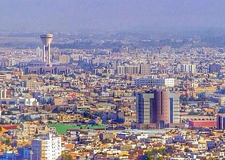
Tabuk is the capital city of the Tabuk Region in northwestern Saudi Arabia. It has a population of 594,350. It is close to the Jordan–Saudi Arabia border and houses the largest air force base in Saudi Arabia.

<span class="mw-page-title-main">Ma'an</span> City in Maan Governorate, Jordan

Ma'an is a city in southern Jordan, 218 kilometres (135 mi) southwest of the capital Amman. It serves as the capital of the Ma'an Governorate. Its population was approximately 41,055 in 2015. Civilizations with the name of Ma'an have existed at least since the Nabatean period—the modern city is just northwest of the ancient town. The city is an important transport hub situated on the ancient King's Highway and also on the modern Desert Highway.

<span class="mw-page-title-main">Hegra (Mada'in Salih)</span> Historical site in northwest Saudi Arabia

Hegra, known to Muslims as Al-Hijr, also known as Mada’in Salih, is an archaeological site located in the area of Al-'Ula within Medina Province in the Hejaz region, Saudi Arabia. A majority of the remains date from the Nabataean Kingdom. The site constitutes the kingdom's southernmost and second largest city after Petra, its capital city. Traces of Lihyanite and Roman occupation before and after the Nabatean rule, respectively, can also be found.

<span class="mw-page-title-main">Hejaz vilayet</span> Province of the Ottoman Empire from 1872 to 1916

The Vilayet of the Hejaz refers to the Hejaz region of Arabia when it was administered as a first-level province (vilayet) of the Ottoman Empire. At the beginning of the 20th century, it reportedly had an area of 96,500 square miles (250,000 km2). The Hejaz included all land from the southern border of the Vilayet of Syria, south of the city of Ma‛an, to the northern border of the Vilayet of Yemen, north of the city of Al Lith.

Ḥusayn Pasha ibn Ḥasan ibn Aḥmad ibn Riḍwān ibn Muṣṭafā ibn ʿAbd al-Muʿīn Pasha was the Ottoman governor of Gaza Sanjak, a district which extended from Jaffa and Ramla in the north to Bayt Jibrin in the southeast and Rafah in the south, with Gaza as its capital. Husayn belonged to the Ridwan family, who long held the governorship of Gaza. Husayn Pasha became governor in 1644 after succeeding his father 'Arab Hasan Pasha. He served, with a brief interruption by his son Ibrahim in 1660, until his imprisonment in 1662. Husayn Pasha also served intermittent terms as governor of Nablus and Jerusalem and as amir al-hajj. Gaza prospered under Husayn Pasha and its political importance rose so much so that the French consul considered it to be the virtual capital of Palestine. Husayn Pasha maintained friendly relations with the Bedouin tribes of the region, local Christian communities and the French. In 1662, Husayn Pasha was imprisoned by the Ottoman imperial authorities and executed in Damascus later that year or in Constantinople in 1663.

Muzayrib is a town in southern Syria, administratively part of the Daraa Governorate, located northwest of Daraa on the Jordan–Syria border. Nearby localities include al-Shaykh Saad and Nawa to the north, Da'el, Tafas and al-Shaykh Maskin to the northeast, and al-Yadudah to the southeast. According to the Syria Central Bureau of Statistics, Muzayrib had a population of 12,640 in the 2004 census. The town is also the administrative center of the Muzayrib nahiyah (subdistrict) consisting of nine villages with a combined population of 72,625. Muzayrib also has a community of Palestinian refugees.

<span class="mw-page-title-main">Ottoman Arabia</span> Ottoman rule in Arabia (1517–1918)

The Ottoman era in the history of Arabia lasted from 1517 to 1918. The Ottoman degree of control over these lands varied over these four centuries, with the fluctuating strength or weakness of the Empire's central authority.

<span class="mw-page-title-main">History of the Hajj</span>

The hajj is a pilgrimage to Mecca performed by millions of Muslims every year, coming from all over the Muslim world. Its history goes back many centuries. The present pattern of the Islamic Hajj was established by Islamic prophet Muhammad, around 632 CE, who reformed the existing pilgrimage tradition of the pagan Arabs. According to Islamic tradition, the hajj dates from thousands of years earlier, from when Abraham, upon God's command, built the Kaaba. This cubic building is considered the most holy site in Islam and the rituals of the hajj include walking repeatedly around it.

<span class="mw-page-title-main">Amir al-hajj</span> Islamic historical title for leader of the pilgrimage

Amir al-hajj was the position and title given to the commander of the annual Hajj pilgrim caravan by successive Muslim empires, from the 7th century until the 20th century. Since the Abbasid period, there were two main caravans, one departing from Damascus and the other from Cairo. Each of the two annual caravans was assigned an amir al-hajj whose main duties were securing funds and provisions for the caravan, and protecting it along the desert route to the Muslim holy cities of Mecca and Medina in the Hejaz.

Husayn Pasha ibn Makki served as the Ottoman wali of Damascus (1757) and Marash (1762), and the sanjak-bey of his native Gaza (1763–1765).

Farrukh Pasha ibn Abdullah was the Ottoman governor of Nablus and Jerusalem in the early 17th century, and founder of the Farrukh dynasty, which held the governorship of Nablus and other posts for much of the 17th century.

The 1757 Hajj caravan raid was the plunder and massacre of the Hajj caravan of 1757 on its return to Damascus from Mecca by Bedouin tribesmen. The caravan was under the protection of an Ottoman force led by the Wali of Damascus, Husayn Pasha, and his deputy Musa Pasha, while the Bedouin were led by Qa'dan al-Fayez of the Bani Sakher tribe. An estimated 20,000 pilgrims were either killed or died of hunger or thirst as a result of the raid.

<span class="mw-page-title-main">Dhat al-Hajj</span> Archaeological site in the Tabuk Province of Saudi Arabia

Dhat al-Hajj is an archaeological site in the Tabuk Province of Saudi Arabia, located north of Tabuk and 16 kilometers (9.9 mi) south of the border with Jordan. Beginning sometime in the Middle Ages, Dhat al-Hajj served as a rest stop and watering place on the Hajj caravan route connecting Egypt and Syria to the Islamic holy cities of Mecca and Medina. The Ottomans fortified the site in the late 16th century. It fell into ruin by the early 18th century and was taken over by Bedouin tribesmen, though it was restored in later decades. The fort is a three-story square structure built around a courtyard and reservoir.

<span class="mw-page-title-main">Al-Sharat</span> Highland region in modern southern Jordan and northwestern Saudi Arabia

Ash-Sharāt or Ash-Sharāh (Arabic: ٱلشَّرَاة, also known as Bilād ash-Sharāt or Jibāl ash-Sharāt, is a highland region in modern-day southern Jordan and northwestern Saudi Arabia. It was formerly a sub-district in Bilad al-Sham during the 7th–11th centuries CE.

<span class="mw-page-title-main">Mudawwara</span> Village in Maan Governorate, Jordan

Mudawwara is the most southerly settlement in Jordan. It is administratively part of the Ma'an Governorate. The village had a population of 691 in the 2015 census.

<span class="mw-page-title-main">Qasr al-Qatraneh</span>

Qasr al-Qatraneh is an Ottoman structure which largely served to provide water and protection on the Syrian pilgrimage route between the Levant and the Gulf. It is located in modern-day Jordan, just off of the country's Desert Highway, approximately 90 kilometres south of Amman and northwest of the town of Qatraneh. It is one of at least ten khans that have been identified and documented along the Syrian pilgrimage route in Jordan.

The sieges of Tiberias occurred in late 1742 and the summer of 1743 when the Ottoman governor of Damascus, Sulayman Pasha al-Azm, twice attempted and failed to eliminate the increasingly powerful, Tiberias-based multazim, Zahir al-Umar, and destroy his fortifications.

References

  1. 1 2 3 4 5 6 Petersen 2012, p. 141.
  2. 1 2 3 4 Blackburn, Richard (2005). Journey to the Sublime Porte: The Arabic Memoir of a Sharifian Agent's Diplomatic Mission to the Ottoman Imperial Court in the Era of Suleyman the Magnificent; The Relevant Text from Quṭb al-Dīn al-Nahrawālī's al-Fawāʼid al-sanīyah fī al-riḥlah al-Madanīyah wa al-Rūmīyah. Orient-Institut. pp. 20–21. ISBN   9783899134414.
  3. 1 2 Wahab, Robert Alexander (1911). "Hejaz"  . In Chisholm, Hugh (ed.). Encyclopædia Britannica . Vol. 13 (11th ed.). Cambridge University Press. p. 218.
  4. 1 2 3 Petersen 2012, p. 137.
  5. 1 2 3 4 5 6 7 8 9 10 Petersen 2012, p. 138.
  6. 1 2 3 4 5 Bakhit 1982, p. 222.
  7. 1 2 3 4 5 6 7 8 9 10 11 Petersen 2012, p. 139.
  8. 1 2 Khairallah, Shereen (1998). "Railway Networks of the Middle East to 1948". The Syrian Land: Processes of Integration and Fragmentation : Bilād Al-Shām from the 18th to the 20th Century. Franz Steiner Verlag. p. 89. ISBN   9783515073097.
  9. Petersen 2012, pp. 139–140.
  10. 1 2 Petersen 2012, p. 140.

Bibliography