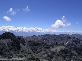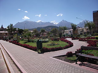
Ancash is a department of northern Peru. It is bordered by the departments of La Libertad on the north, Huánuco and Pasco on the east, Lima on the south, and the Pacific Ocean on the west. Its capital is the city of Huaraz, and its largest city and port is Chimbote. The name of the region originates from the Quechua word anqash, from anqas ('blue') or from anka ('eagle').

Huaraz, founded as San Sebastián de Huaraz, is a city in Peru. It is the capital of the Ancash Region and the seat of government of Huaraz Province. The urban area's population is distributed over the districts of Huaraz and Independencia. The city is located in the middle of the Callejon de Huaylas Valley and on the right side of the river Santa. The city has an elevation of approximately 3050 metres above sea level. The built-up area covers 8 km2 and has a population of 120,000 inhabitants, making it the second largest city in the central Peruvian Andes after the city of Huancayo. It is the 22nd largest city in Peru. Huaraz is the seat of the province's Roman Catholic Bishop and the site of the cathedral.
The Santa Valley is an inter-andean valley in the Ancash Region in the north-central highlands of Peru. Due to its location between two mountain ranges, it is known as Callejón de Huaylas, the Alley of Huaylas, whereas "Huaylas" refers to the territorial division's name during the Viceroyalty of Peru.

Lake Conococha is a South American lake located in the Andes mountains of northwestern Peru. It is located in the region of Ancash near the junction of the roads going from Callejón de Huaylas to Chiquián.

Caraz is a town in the Caraz District in the southeastern part of Huaylas Province of the Ancash Region in Peru.

The Huaraz Province is one of twenty provinces of the Ancash Region in Peru. It was created on August 5, 1857 during the presidency of Ramón Castilla. Geographically, the province is located over the Callejón de Huaylas and the western slopes of the Cordillera Negra.

Tuco,Tuku,Tucu or Huanaco Punta is a mountain in the Andes in South America. Its summit is 5,479 m (17,976 ft)) high and it is one of the southernmost peaks in the snow-capped Cordillera Blanca in northwestern central Peru. Tuco is located in the Ancash Region, Bolognesi Province, Aquia District and in the Recuay Province, Catac District. It is situated northeast of Caullaraju, between Challhua in the west and Pastoruri in the east.

Ocshapalca is a mountain in the Cordillera Blanca in the Andes of Peru, about 5,888 m (19,318 ft) high. It is situated in the Ancash Region, Huaraz Province, on the border of the districts Independencia District and Tarica. Ocshapalca lies between the mountain Hatunkunka in the west and Ranrapalca in the east.

Shacsha,Shaqsha,, Huantsán Chico or Huanchan is a mountain in the Cordillera Blanca in the Andes of Peru, about 5,703 metres (18,711 ft) high,. It is situated in the Ancash Region, Huaraz Province, Olleros District. Shacsha lies southwest of Huantsán, west of Uruashraju and southeast of the town of Huaraz.

Jatuncocha is a lake in the Cordillera Blanca in the Andes of Peru located in the Ancash Region, Huaylas Province, Santa Cruz District. It is situated at a height of 3,886 m (12,749 ft) comprising an area of 0.486550 km2 (486,550 m2). Jatunccocha lies in the Santa Cruz gorge between the peaks of Quitaraju in the north and Caraz in the south, northeast of a smaller lake named Ichiccocha.

Tullpacocha or Tulpacocha is a lake in Peru located in the Ancash Region, Huaraz Province, Independencia District. Tullpacocha lies in the Cordillera Blanca, southeast of Palcaraju and Pucaranra, southwest of Chinchey and Tullparaju and northwest of Andavite, at the very end of the Quilcayhuanca gorge.

Tullparaju is a mountain in the Cordillera Blanca in the Andes of Peru, about 5,787 metres (18,986 ft) high. It is situated in the Ancash Region, Huaraz Province, Independencia District, and in the Huari Province, Huari District. Tullparaju lies southeast of the mountains Pucaranra and Chinchey and northeast of Andavite. It is situated at the end of the Quilcayhuanca valley, northeast of the lake Tullpacocha.

Churup or Tsurup is a mountain in the Cordillera Blanca in the Andes of Peru, about 5,495 metres (18,028 ft) high. It is situated in the Ancash Region, Huaraz Province, Independencia District, north-east of Huaraz. Churup is situated south of the mountain Ranrapalca, between the Rima Rima in the north-west and Collapaco and Huamashraju in the south-east, at the entrance to the Quilcayhuanca valley. Lake Churup lies at the foot of the mountain.

Uruashraju or Verdecocha is a mountain in the Cordillera Blanca of the Andes of Peru, about 5,722 metres (18,773 ft) high. It is located in the Ancash Region, Huaraz Province, Olleros District, and in the Huari Province, Chavín de Huantar District. Uruashraju lies south of Huantsán, east of Cashán and Shacsha, and southeast of Lake Tararhua.

Carhuascancha or Tumarinaraju is a mountain in the Cordillera Blanca in the Andes of Peru with an elevation of 5,648 metres (18,530 ft) or 5,668 metres (18,596 ft) above sea level. It is situated in the Ancash Region, Huari Province, Huantar District, and in the Huaraz Province, Huaraz District. Carhuascancha lies north-west of Huantsán.

Jatuncunca, Janyaraju or Jangyraju is a mountain in the Cordillera Blanca of the Andes of Peru, about 5,600 metres (18,373 ft) high. It is located in the Ancash Region, Huaraz Province, on the border of the districts Independencia and Tarica. Jatuncunca lies west of Ocshapalca.

Pucagaga Punta or Pucagaga is a mountain in the Cordillera Blanca in the Andes of Peru, 5,461 metres (17,917 ft) high. It is situated in the Ancash Region, Huaraz Province, Independencia District, northeast of Huaraz. Pucagaga lies south of Ranrapalca, next to Churup, northeast of it.

Rúrec, also spelled Rurec, is a 5,700-metre-high (18,701 ft) mountain in the southern part of the Cordillera Blanca in the Andes of Peru. It is located in the Ancash Region, Huaraz Province, Olleros District, and in the Huari Province, Chavín de Huantar District. Rúrec is located south of Huantsán.

Andavite or Chopiraju is a 5,518-metre-high (18,104 ft) mountain in the Cordillera Blanca in the Andes of Peru. It is located northeast of the village of Pitec, between Huaraz and Huari provinces in Ancash. Andavite lies northwest of Cayesh and southeast of Tullparaju. It is situated at the end of the Quilcayhuanca valley, southeast of a lake named Tullpacocha.

Quimarumi, also known as Minas, is a 5,459-metre-high (17,910 ft) mountain in the Cordillera Blanca in the Andes of Peru. It is located in the Ancash Region, Huaraz Province, Huaraz District. Quimarumi lies on a ridge between the Quilcayhuanca valley and the Shallap valley, northwest of Carhuascancha and northeast of Qullapaqu.


