Huaraz Waras | |
|---|---|
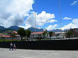 Main square in Huaraz with the Cordillera Blanca in the background | |
 | |
| Country | |
| Region | Ancash |
| Province | Huaraz |
| Capital | Huaraz |
| Government | |
| • Mayor | Eliseo Rori Mautino Ángeles (2019-2022) |
| Area | |
• Total | 432.99 km2 (167.18 sq mi) |
| Elevation | 3,052 m (10,013 ft) |
| Population | |
• Total | 52,592 |
| • Density | 120/km2 (310/sq mi) |
| Time zone | UTC-5 (PET) |
| UBIGEO | 020101 |
Huaraz District is one of twelve districts of the province Huaraz in Peru. [1]