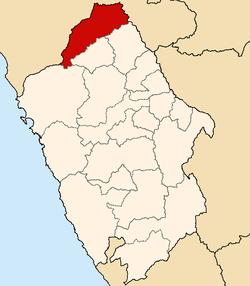
Huandoval | |
---|---|
Country | |
Region | Ancash |
Province | Pallasca |
Founded | May 9, 1923 |
Capital | Huandoval |
Government | |
• Mayor | Manuel Alberto Paredes Reyes |
Area | |
• Total | 116 km2 (45 sq mi) |
Elevation | 3,035 m (9,957 ft) |
Population | |
• Total | 1,174 |
• Density | 10/km2 (26/sq mi) |
Time zone | UTC-5 (PET) |
UBIGEO | 021505 |
Huandoval District is one of eleven districts of the province Pallasca in Peru. [1]
San Miguel de Aco District is one of eleven districts of the province Carhuaz in Peru.
San Nicolás District is one of three districts of the province Carlos Fermín Fitzcarrald in Peru.
Lacabamba District is one of eleven districts of the province Pallasca in Peru.
Pampas District is one of eleven districts of the province Pallasca in Peru.
Santa Rosa District is one of eleven districts of the province Pallasca in Peru.
Alfonso Ugarte District is one of ten districts of the province Sihuas in Peru.
Chingalpo District is one of ten districts of the province Sihuas in Peru.
Huayllabamba District is one of ten districts of the province Sihuas in Peru.
Quiches District is one of ten districts of the province Sihuas in Peru.
Sicsibamba District is one of ten districts of the province Sihuas in Peru.
Casca District is one of eight districts of the province Mariscal Luzuriaga in Peru.
Eleazar Guzmán Barrón District is one of eight districts of the province Mariscal Luzuriaga in Peru.
Llama District is one of eight districts of the province Mariscal Luzuriaga in Peru.
Musga District is one of eight districts of the province Mariscal Luzuriaga in Peru.
Aco District is one of seven districts of the province Corongo in Peru.
Corongo District is one of seven districts of the province Corongo in Peru.
La Pampa District is one of seven districts of the province Corongo in Peru.
Yanac District is one of seven districts of the province Corongo in Peru.
Yupan District is one of seven districts of the province Corongo in Peru.
The Roman fish salting factory was a salting factory established on the seafront of Algeciras, southeastern Spain by the Romans. It belonged to the fishing village of San Nicolás, part of what was called Caetaria. A site of archaeological and historical interest, it was declared a Bien de Interés Cultural site on 27 June 2002.
Coordinates: 8°19′54″S77°58′28″W / 8.331677°S 77.9745°W
This Ancash Region geography article is a stub. You can help Wikipedia by expanding it. |