Huata District, Huaylas

Last updated
Huata
COA Huata District in Huaylas Province.png
Location of the district Huata in Huaylas.png
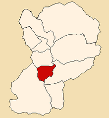
Location of Huata in the Huaylas province
Country Flag of Peru.svg  Peru
Region Ancash
Province Huaylas
FoundedJanuary 2, 1857
Capital Huata
Subdivisions 1 village, 13 hamlets and 40 anexos
Government
   Mayor Miguel Abilio Terry Guerrero
Area
  Total
70.69 km2 (27.29 sq mi)
Elevation
2,736 m (8,976 ft)
Population
 (2002 est.)
  Total
1,941
  Density27/km2 (71/sq mi)
Time zone UTC-5 (PET)
UBIGEO 021203
Website munihuata.gob.pe

The Huata District (Spanish : Distrito de Huata) is the smallest of the 10 districts of the Huaylas Province in the Ancash Region of Peru. The capital of the district is the village of Huata. [1]

Contents

History

The district was founded on January 2, 1857.

Location

The district is located in the central part of the province at an elevation of 2,736m in the black mountains (Spanish : Cordillera Negra), neighboring district is the Caraz district in which the provinces capital Caraz is located, 17 km from the village of Huata.

Political division

The Huata District is divided into 1 village (Spanish : pueblos, singular: pueblo), 6 hamlets (Spanish : caseríos, singular: caserío) and 40 (Spanish : anexos, singular: anexo):

Villages

Hamlets

Anexos

Capital

The capital of the Huata district is the city of Huata.

Climate

The district has a temperate and dry climate with a temperature varying from 12 to 19 degrees Celsius.

Traditional festivals

References

  1. Official web site of the Huata District in the Huaylas province Archived 2007-04-24 at the Wayback Machine

9°00′58″S77°51′39″W / 9.01611°S 77.86083°W / -9.01611; -77.86083