Independencia District, Huaraz

Last updated
Independencia
Huaraz - Laguna Churup 1.JPG
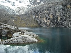
Churup Lake, Independencia District
COA Independencia District in Huaraz Province.png
Independencia District, Huaraz
Country Flag of Peru.svg  Peru
Region Ancash
Province Huaraz
FoundedNovember 16, 1992
Capital Centenario
Government
   Mayor Gregorio Emiliano Mezarina Paredes
Area
  Total
342.95 km2 (132.41 sq mi)
Elevation
3,049 m (10,003 ft)
Population
  Total
61,705
  Density180/km2 (470/sq mi)
Time zone UTC-5 (PET)
UBIGEO 020105

Independencia District is one of twelve districts of the province Huaraz in Peru. [1]

Contents

Geography

The Cordillera Blanca traverses the district. Some of the highest peaks of the district are Pallqarahu, Pukaranra, Ranrapallqa and Rurichinchay. Other mountains are listed below: [2]

See also

References

  1. (in Spanish) Instituto Nacional de Estadística e Informática. Banco de Información Distrital Archived 2008-04-23 at the Wayback Machine . Retrieved April 11, 2008.
  2. escale.minedu.gob.pe - UGEL map of the Huaraz Province (Ancash Region)

9°30′53″S77°31′39″W / 9.5146°S 77.5275°W / -9.5146; -77.5275