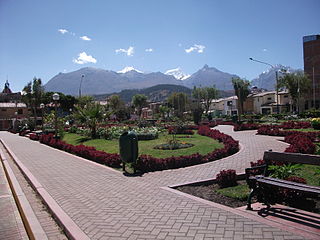
Ancash is a region of northern Peru. It is bordered by La Libertad Region on the north, Huánuco and Pasco regions on the east, the Lima Region on the south, and the Pacific Ocean on the west. Its capital is the city of Huaraz, and its largest city and port is Chimbote. The name of the region originates from the Quechua word anqash, from anqas (blue) or from anka (eagle).

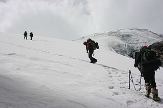
The Huaraz Province is one of twenty provinces of the Ancash Region in Peru. It was created on August 5, 1857 during the presidency of Ramón Castilla. Geographically, the province is located over the Callejón de Huaylas and the western slopes of the Cordillera Negra.
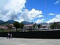
Independencia District is one of twelve districts of the province Huaraz in Peru.

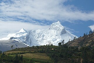
Huantsán,Huantsan or Tunsho is a mountain in the Andes of Peru. It is located in Ancash Region and is part of the Cordillera Blanca mountain range, a sub-range of the Andes. It has four peaks, with a maximum elevation of 6,369 metres (20,896 ft) above sea level.
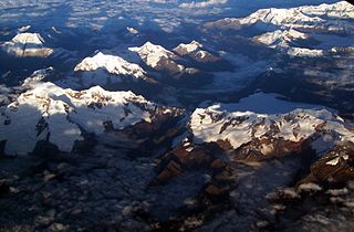
Chinchey, also known as Rurichinchay, is a 6,309-metre-high (20,699 ft) mountain in the Cordillera Blanca in the Andes of Peru. It is located in the region of Ancash, most precisely between the districts of Aco, Independencia, and Huari.
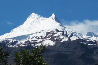
Copa is a mountain in the Andes of Peru whose summit reaches about 6,188 metres (20,302 ft) above sea level. It is situated in the Ancash Region, Asunción Province, Chacas District, and in the Carhuaz Province, Marcará District, south-east of Hualcán.

Ranrapalca is a mountain in the Cordillera Blanca range in the Andes of Peru. It has an elevation of 6,162 m (20,217 ft). It is located in the region of Ancash, east of Ocshapalca.

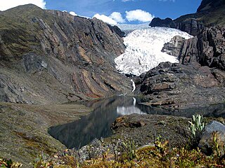
Ocshapalca is a mountain in the Cordillera Blanca in the Andes of Peru, about 5,888 m (19,318 ft) high. It is situated in the Ancash Region, Huaraz Province, on the border of the districts Independencia District and Tarica. Ocshapalca lies between the mountain Hatunkunka in the west and Ranrapalca in the east.

Shacsha,Shaqsha,, Huantsán Chico or Huanchan is a mountain in the Cordillera Blanca in the Andes of Peru, about 5,703 metres (18,711 ft) high,. It is situated in the Ancash Region, Huaraz Province, Olleros District. Shacsha lies southwest of Huantsán, west of Uruashraju and southeast of the town of Huaraz.
Vallunaraju or Wallunaraju is a mountain in the Cordillera Blanca in the Andes of Peru, about 5,686 metres (18,655 ft) high and located in Huaraz Province, Ancash. Vallunaraju lies south west of Ranrapalca and Ocshapalca.

Huamashraju,Wamashraju,, Yanahuacra or Rajo Colta is a mountain in the Cordillera Blanca in the Andes of Peru, about 5,434 metres (17,828 ft) high. It is situated in the Ancash Region, Huaraz Province, Huaraz District. Huamashraju lies east of the town of Huaraz, west of Huantsán and northwest of Shacsha and Cashan.
Rima Rima, is a 5,248-metre-high (17,218 ft) mountain in the Cordillera Blanca in the Andes of Peru. It is situated in the Ancash Region, Huaraz Province, Independencia District, northeast of Huaraz (Waras). Rima Rima lies southeast of Wallunarahu, on the ridge southwest of Ranrapallqa.
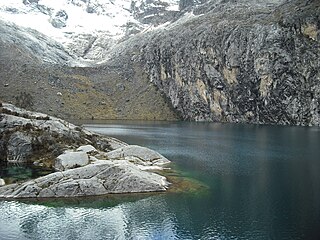
Yanacocha is a lake in the Cordillera Blanca in the Andes of Peru located in the Ancash Region, Asunción Province, Chacas District. It is situated at a height of about 4,250 metres (13,944 ft), about 470 m long and 161 m at its widest point. Yanacocha lies north-west of the mountain Perlilla, north-east of the mountain Pomabamba, south-west of the lakes Huegroncocha and Runtococha and north-east of the lakes Lauricocha and Paqarisha.

Tullparaju is a mountain in the Cordillera Blanca in the Andes of Peru, about 5,787 metres (18,986 ft) high. It is situated in the Ancash Region, Huaraz Province, Independencia District, and in the Huari Province, Huari District. Tullparaju lies southeast of the mountains Pucaranra and Chinchey and northeast of Andavite. It is situated at the end of the Quilcayhuanca valley, northeast of the lake Tullpacocha.

Quilcayhuanca, Quillcay,Quilcay or Qelkaywanka is a river in the Ancash Region in Peru. It is a right affluent of the Santa River.

Uruashraju or Verdecocha is a mountain in the Cordillera Blanca of the Andes of Peru, about 5,722 metres (18,773 ft) high. It is located in the Ancash Region, Huaraz Province, Olleros District, and in the Huari Province, Chavín de Huantar District. Uruashraju lies south of Huantsán, east of Cashán and Shacsha, and southeast of Lake Tararhua.

Pucagaga Punta or Pucagaga is a mountain in the Cordillera Blanca in the Andes of Peru, 5,461 metres (17,917 ft) high. It is situated in the Ancash Region, Huaraz Province, Independencia District, northeast of Huaraz. Pucagaga lies south of Ranrapalca, next to Churup, northeast of it.
Rúrec, also spelled Rurec, is a 5,700-metre-high (18,701 ft) mountain in the southern part of the Cordillera Blanca in the Andes of Peru. It is located in the Ancash Region, Huaraz Province, Olleros District, and in the Huari Province, Chavín de Huantar District. Rúrec is located south of Huantsán.
Vicos or Paccharuri is a 5,315 m (17,438 ft) high mountain in the Cordillera Blanca in the Andes of Peru. It is situated in the Ancash Region, Carhuaz Province, Marcara District. Paccharuri lies in the Huascarán National Park, southwest of Copa and southeast of Lake Lejiacocha.