Olleros District, Huaraz

Last updated
Olleros
Oratorio de los Andes.jpg
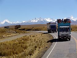
The Cordillera Blanca with Shaqsha (center) as seen from the southwest
Olleros District, Huaraz
Country Flag of Peru.svg  Peru
Region Ancash
Province Huaraz
FoundedOctober 16, 1933
Capital Olleros
Government
   Mayor Sixto Feliciano Blacido León
Area
  Total
222.91 km2 (86.07 sq mi)
Elevation
3,336 m (10,945 ft)
Population
  Total
2,761
  Density12/km2 (32/sq mi)
Time zone UTC-5 (PET)
UBIGEO 020108

Olleros District is one of twelve districts of the province Huaraz in Peru. [1]

Contents

Geography

The Cordillera Blanca traverses the district. Some of the highest peaks of the district are listed below: [2]

Ethnic groups

The people in the district are mainly indigenous citizens of Quechua descent. Quechua is the language which the majority of the population (67.54%) learnt to speak in childhood, 32.17% of the residents started speaking using the Spanish language (2007 Peru Census). [3]

References

  1. (in Spanish) Instituto Nacional de Estadística e Informática. Banco de Información Distrital Archived 2008-04-23 at the Wayback Machine . Retrieved April 11, 2008.
  2. escale.minedu.gob.pe - UGEL map of the Huaraz Province (Ancash Region)
  3. inei.gob.pe Archived 2013-01-27 at the Wayback Machine INEI, Peru, Censos Nacionales 2007, Frequencias: Preguntas de Población: Idioma o lengua con el que aprendió hablar (in Spanish)

9°37′59″S77°28′59″W / 9.63306°S 77.48306°W / -9.63306; -77.48306