
The N1 is a national route in South Africa that runs from Cape Town through Bloemfontein, Johannesburg, Pretoria and Polokwane to Beit Bridge on the border with Zimbabwe. It forms the first section of the famed Cape to Cairo Road.
Jan Kempdorp is an agricultural town situated in the centre of the Vaalharts Irrigation Scheme in the Northern Cape province of South Africa. It is situated 96 kilometres (60 mi) north of Kimberley, the provincial capital, and 43 kilometres (27 mi) west of Christiana in North West province.

The R25 is a provincial route in South Africa that connects Johannesburg with Groblersdal via Kempton Park, Bapsfontein and Bronkhorstspruit.

The R26 is a provincial route in Free State, South Africa that connects Rouxville with Villiers via Zastron, Wepener, Ladybrand, Ficksburg, Bethlehem & Reitz.

The R48 is a provincial route in South Africa that connects De Aar with Petrusburg on the N8 via Petrusville and Koffiefontein.

The R64 is a provincial route in South Africa that connects Kimberley with Bloemfontein via Boshof and Dealesville. It is slightly longer than the newer N8 route via Petrusburg, by about 10 kilometres.
The R323 is a Regional Route in South Africa that connects Riversdale in the south with Laingsburg in the north.

The R357 is a Regional Route in South Africa that connects Nieuwoudtville and Kimberley via Loeriesfontein and Prieska.
The R383 is a Regional Route in South Africa that connects Kenhardt with the N8 between Groblershoop and Griekwastad.
The R385 is a regional route in South Africa that connects Olifantshoek with Hopetown via Postmasburg and Douglas.

The R639 road is one of Ireland's regional roads. Once designated the N8 national primary road, it was reclassified in stages as the R639 following the progressive opening of sections of the M8 motorway, which rendered the single carriageway N8 redundant as a national primary road. By-passed sections of the old N8 were generally reclassified as R639 as soon as a new section of M8 opened, thereby increasing the length of the R639. With the completion of the M8 on 28 May 2010, the R639 now stretches from Durrow, County Laois to Cork, running through counties Laois, Kilkenny, Tipperary, Limerick and Cork.

The N8 is a national route in South Africa that connects Groblershoop with Maseru in Lesotho via Kimberley and Bloemfontein. It is maintained by the South African National Roads Agency.

The N10 is a national route in South Africa connecting Gqeberha on the Eastern Cape coast with the Namibian border at Nakop, via Cradock, De Aar and Upington.

The N18 is a national route in South Africa which runs from Warrenton through Vryburg and Mahikeng to Ramatlabama on the border with Botswana.

Schmidtsdrift is a town in Pixley ka Seme District Municipality in the Northern Cape province of South Africa. Situated 80 km west of Kimberley, it was originally a ford across the Vaal River which is now bridged on the N8 National Route from Kimberley to Campbell and Griquatown.
The R706 is a Regional Route in South Africa that connects Bloemfontein with Jagersfontein in the Free State.
The R708 is a Regional Route in South Africa that connects Jan Kempdorp in the Northern Cape with Clocolan in the Free State via Christiana, Hertzogville, Bultfontein, Theunissen, Winburg and Marquard.

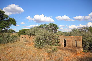
72 Motorised Brigade was a Formation of 7th Infantry Division, a combined arms force consisting of infantry, armour and artillery.
The M20 is a short metropolitan route in the Greater Johannesburg metropolitan area, South Africa. It connects Randburg in the western part of Johannesburg with Edenvale in the east.
