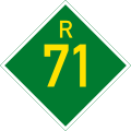
R71 (South Africa)

Last updated

SA road R71.svg
Provincial route R71
Map of the R71 (South Africa).svg
Route information
Maintained by SANRAL and RAL
Length201 km (125 mi)
Major junctions
West endSA road R101.svg R101 in Polokwane
Major intersectionsSA road R81.svg R81 in Polokwane

SA road N1 jct.svg N1 in Polokwane
SA road R36.svg R36 in Tzaneen

SA road R526.svg R526 in Gravelotte
SA road R40.svg R40 at Phalaborwa
East endPhalaborwa Gate of the Kruger National Park
Location
Country South Africa
Major cities Polokwane, Tzaneen, Gravelotte, Phalaborwa
Highway system
SA road R70.svg R70 SA road R72.svg R72

The R71 is a provincial route in Limpopo, South Africa that connects Polokwane with the Kruger National Park via Tzaneen and Phalaborwa. [1]

Contents

The R71 is used daily by people who work or reside in Dalmada, Mothiba, Nobody, Moria, Mankweng, Turfloop and Boyne. The road is well known to touring bikers who frequently visit the province from all parts of the country, because of the scenic route through Magoebaskloof. [2]

Route

R71 (South Africa)
Detailed Route

The R71 begins at a junction with the R101 route in Polokwane Central (capital of Limpopo), just east of the R101's intersection with the R37 route. As the R101 leaves the east–west road and becomes the road northwards, the R71 begins by taking over the two one-way-streets (Grobler Street eastwards from the R101 and Thabo Mbeki Street westwards to the R101). [1]

Going eastwards, it meets the south-western terminus of the R81 route and just after, the two one-way streets become one road (Grobler Street) north of the suburb of Fauna Park. North of Polokwane Extension 28, the R71 meets the Polokwane Eastern Bypass (N1 national route) before continuing eastwards to exit the city. [1]

From the N1 Interchange in Polokwane, the R71 heads eastwards for 51 kilometres, bypassing the University of Limpopo, through Moria, to the town of Haenertsburg, where it meets the western terminus of the R528 route west of the Ebenezer Dam. The R528 is an alternative route as they both go north-east towards Tzaneen. [1]

At the R528 junction in Haenertsburg, the R71 becomes the Magoebaskloof Pass and continues north-east for 30 kilometres to reach a t-junction with the R36 route. The R71 joins the R36 and they are one road southwards for 4 kilometres into the town of Tzaneen, crossing the Groot Letaba River west of the Tzaneen Dam, up to the next off-ramp junction, where they meet the eastern terminus of the R528 route. [1]

As the R71 leaves the R36 road and meets the R528 for the second time, it becomes the road eastwards (Wolkberg Drive). It passes through Tzaneen Central to cross the Groot Letaba River again. It goes eastwards for 24 kilometres to meet the R529 route from Giyani north of Letsitele. The R529 and the R71 become one road for 1.7 kilometres, crossing the Groot Letaba River one more time before the R529 becomes its own road southwards while the R71 remains heading eastwards. [1]

From Letsitele, the R71 goes eastwards for 25 kilometres to meet the north-western terminus of the R526 route in Gravelotte. The R71 becomes the road north-east and proceeds eastwards for 51 kilometres, bypassing Murchison, following the Ga-Selati River, to meet the northern terminus of the R40 route and enter the town of Phalaborwa. After being the main road through Phalaborwa, the R71 reaches the Phalaborwa Gate of the Kruger National Park, marking its end. [1]

Related Research Articles

<span class="mw-page-title-main">N1 (South Africa)</span> National road in South Africa

The N1 is a national route in South Africa that runs from Cape Town through Bloemfontein, Johannesburg, Pretoria and Polokwane to Beit Bridge on the border with Zimbabwe. It forms the first section of the famed Cape to Cairo Road.

<span class="mw-page-title-main">Haenertsburg</span> Place in Limpopo, South Africa

Haenertsburg is a village situated on the edge of the Great Escarpment in the Limpopo Province of South Africa, on the R71 road between Polokwane and Tzaneen en route to the Kruger National Park.

<span class="mw-page-title-main">Tzaneen</span> Town in Limpopo, South Africa

Tzaneen is a large tropical garden town situated in the Mopani District Municipality of the Limpopo province in South Africa. It is situated in a high rainfall fertile region with tropical and subtropical agriculture taking place in a 20,000 square kilometres (7,700 sq mi) region. It is Limpopo's second largest town after Polokwane.

<span class="mw-page-title-main">R33 (South Africa)</span> Road in South Africa

The R33 is a provincial route in South Africa that connects Pietermaritzburg with Lephalale via Greytown, Paulpietersburg, Carolina, Belfast and Vaalwater. It is a very long road, passing through 3 provinces.

<span class="mw-page-title-main">R36 (South Africa)</span>

The R36 is a provincial route in South Africa that connects the N1 at Bandelierkop with Ermelo, via Tzaneen and Lydenburg. It is co-signed with the N4 for 8 kilometres between Machadodorp and Patattanek, with a tollgate on this section. It used to extend further south past Ermelo to Amersfoort, but that section is now designated as part of the N11.

<span class="mw-page-title-main">R37 (South Africa)</span> Road in South Africa

The R37 is a provincial route in South Africa that connects Polokwane with Mbombela via Burgersfort and Lydenburg (Mashishing).

<span class="mw-page-title-main">R38 (South Africa)</span> Road in South Africa

The R38 is a provincial route in South Africa that connects Standerton with Kaapmuiden via Bethal, Carolina and Barberton. It is a main route through the province of Mpumalanga.

<span class="mw-page-title-main">R40 (South Africa)</span>

The R40 is a provincial route in South Africa that connects the Eswatini border at Bulembu via Barberton, Mbombela, Bushbuckridge, Acornhoek and Hoedspruit with Phalaborwa. The route spans two provinces and passes through several private game reserves.

<span class="mw-page-title-main">R44 (South Africa)</span> Road in South Africa

The R44 is a provincial route in Western Cape, South Africa that connects Piketberg with Kleinmond via Wellington, Stellenbosch, Somerset West and Strand. The coastal section between Kleinmond and Gordon's Bay is a very scenic ocean drive. The section between Gordon's Bay and Stellenbosch via Strand and Somerset West is a dual carriageway. The R44 is co-signed with the R46 between Gouda and Hermon in the Berg River valley.

<span class="mw-page-title-main">R63 (South Africa)</span> Road in South Africa

The R63 is a tarred provincial route in South Africa that connects Calvinia with Komga via Carnarvon, Victoria West, Graaff-Reinet, Somerset East and King William's Town. It is cosigned with the N10 between Eastpoort and Cookhouse for 24 kilometres.

<span class="mw-page-title-main">R81 (South Africa)</span> South African provincial route

The R81 is a provincial route in Limpopo, South Africa that connects Polokwane with the R524 at Nyavani via Giyani.

<span class="mw-page-title-main">N4 (South Africa)</span> National road in South Africa

The N4 is a national route in South Africa that runs from Skilpadshek on the Botswana border, past Rustenburg, Pretoria, eMalahleni and Mbombela, to Komatipoort on the Mozambique border. The entire route is a toll road.

<span class="mw-page-title-main">N10 (South Africa)</span> National road in South Africa

The N10 is a national route in South Africa connecting Gqeberha on the Eastern Cape coast with the Namibian border at Nakop, via Cradock, De Aar and Upington.

<span class="mw-page-title-main">N11 (South Africa)</span> National road in South Africa

The N11 is a national route in South Africa which runs from the Botswana border at Groblersbrug, through Mokopane, Middelburg, Ermelo and Newcastle to end at the N3 just after Ladysmith.

The R101 is a Regional Route in South Africa that is the designation for some of the old sections of roads that were previously the N1, prior to upgrading. It only has 2 sections, from Bellville to Worcester and from Johannesburg to Polokwane.

The R513 is a Regional Route in South Africa that connects Hartbeespoort with Bronkhorstspruit via Akasia, Pretoria North and Cullinan.

<span class="mw-page-title-main">R518 (South Africa)</span> Road in South Africa

The R518 is a Regional Route in South Africa that connects Lephalale with Zebediela via Mokopane.

The R529 is a Regional Route in Limpopo, South Africa that connects Giyani with Lenyenye via Letsitele.

The M6 road is a long metropolitan route in the City of Tshwane in Gauteng, South Africa. It connects Pretoria West with a rural area east of Pretoria via Pretoria CBD, Brooklyn, Lynnwood and Wapadrand.

The M8 road is a metropolitan route in the City of Tshwane in Gauteng, South Africa. It connects Capital Park with Mamelodi via Gezina, Villieria and Eersterust.

References

  1. 1 2 3 4 5 6 7 Falkner, John (May 2012). South African Numbered Route Description and Destination Analysis (Report). National Department of Transport. p. 60. Archived from the original on 6 June 2014. Retrieved 13 August 2014.
  2. "RDDA South African Numbered Route Description and Destination Analysis". National Department of Transport. May 2012. Retrieved 25 March 2021.