R37 (South Africa)

Last updated

SA road R37.svg
Provincial route R37
Map of the R37 (South Africa).svg
Route information
Maintained by SANRAL
Length304 km (189 mi)
Major junctions
Northwest endSA road R101.svg R101 in Polokwane
Major intersectionsSA road N1 jct.svg N1 in Polokwane
SA road R555.svg R555 in Burgersfort
SA road R36.svg R36 in Lydenburg
SA road N4 jct.svg N4 near Mbombela
Southeast endSA road R40.svg R40 in Nelspruit
Location
Country South Africa
Major cities Polokwane, Burgersfort, Lydenburg, Mbombela
Highway system
SA road R36.svg R36 SA road R38.svg R38

The R37 is a provincial route in South Africa that connects Polokwane with Mbombela via Burgersfort and Lydenburg (Mashishing). [1]

Contents

Route

The R37 begins in Polokwane Central (Capital of Limpopo), at a junction with the two one-way streets that form the R101 route (Grober Street & Thabo Mbeki Street), just west of the R101's intersection with the R71 route. It begins by going southwards as Kerk Street to form a junction with the Polokwane Eastern Bypass (N1 national route) and become the western border of the Polokwane Game Reserve. [1]

The R37 heads southwards for 30 kilometres as the Chuniespoort Pass to meet the northern terminus of the R579 road. At this junction, it turns to the south-east and proceeds for 7 kilometres to meet the eastern terminus of the R518 road north of Lebowakgomo. At this junction, the R37 turns to the east and becomes the first section of the Orrie Baragwanath Pass. It goes eastwards for 25 kilometres to reach a junction south of Ga-Makgoba, where the Orrie Baragwanath Pass becomes the road to the north-east towards Ofcolaco while the R37 remains as the easterly road. Just after, the R37 crosses the Olifants River. [1]

From the Olifants River crossing, the R37 heads south-east for 77 kilometres to enter the town of Burgersfort, after crossing the Steelpoort River, and reach a junction with the R555 road. The R555 and the R37 form one road south-east for almost 2 km up to the junction after Burgersfort Mall, where the R555 becomes its own road north-east while the R37 remains as the road heading south-south-east. The R37 heads south for 58 kilometres through farm orchards as the Watervalsrivier Pass, leaving the Limpopo Province and entering the Mpumalanga Province, to the city of Lydenburg (Mashishing). [1]

Long Tom Pass on the R37 R37-Long Tom Pass-001.jpg
Long Tom Pass on the R37

In Lydenburg's northern suburbs, the R37 meets the R36 road and the two routes form one road southwards into the city centre as De Clerq Street, then east as 1st Street, before the R36 becomes its own road southwards towards Machadodorp at the Viljoen Street junction. The R37 continues eastwards as Voortrekker Street before heading up the Long Tom Pass. As the Long Tom Pass, it goes eastwards for 46 kilometres, as the pass zig-zags, to meet the southern terminus of the R532 road just south of the town of Sabie. The R532 to Sabie takes over as the Long Tom Pass. [1]

From the R532 junction south of Sabie, the R37 goes south-south-east for 47 kilometres, meeting the eastern terminus of the R539 road, to reach the city of Mbombela (Capital of Mpumalanga). It first reaches an intersection with the Mbombela Northern Bypass (N4 national route; Maputo Corridor) before entering the suburb of Riverside and proceeding to reach its terminus at a junction with the R40 road (Madiba Drive), just next to the R40's Crocodile River crossing. [1]

Related Research Articles

<span class="mw-page-title-main">R33 (South Africa)</span> Road in South Africa

The R33 is a provincial route in South Africa that connects Pietermaritzburg with Lephalale via Greytown, Paulpietersburg, Carolina, Belfast and Vaalwater. It is a very long road, passing through 3 provinces.

<span class="mw-page-title-main">R36 (South Africa)</span>

The R36 is a provincial route in South Africa that connects the N1 at Bandelierkop with Ermelo, via Tzaneen and Lydenburg. It is co-signed with the N4 for 8 kilometres between Machadodorp and Patattanek, with a tollgate on this section. It used to extend further south past Ermelo to Amersfoort, but that section is now designated as part of the N11.

<span class="mw-page-title-main">R38 (South Africa)</span>

The R38 is a provincial route in South Africa that connects Standerton with Kaapmuiden via Bethal, Carolina and Barberton. It is a main route through the province of Mpumalanga.

<span class="mw-page-title-main">R40 (South Africa)</span>

The R40 is a provincial route in South Africa that connects the Eswatini border at Bulembu via Barberton, Mbombela, Bushbuckridge, Acornhoek and Hoedspruit with Phalaborwa. The route spans two provinces and passes through several private game reserves.

<span class="mw-page-title-main">R71 (South Africa)</span>

The R71 is a provincial route in Limpopo, South Africa that connects Polokwane with the Kruger National Park via Tzaneen and Phalaborwa.

<span class="mw-page-title-main">R81 (South Africa)</span> South African provincial route

The R81 is a provincial route in Limpopo, South Africa that connects Polokwane with the R524 at Nyavani via Giyani.

The R104 is a regional route in South Africa that is the designation for some of the old sections of roads that were previously the N4, prior to upgrading. It connects Rustenburg in the North West province with eMalahleni in Mpumalanga province via Mooinooi, Hartbeespoort, Pretoria and Bronkhorstspruit. There are two additional sections in Mpumalanga province: a 50km section connecting Middelburg and Wonderfontein and a 17km section passing through Mbombela.

<span class="mw-page-title-main">N4 (South Africa)</span> National road in South Africa

The N4 is a national route in South Africa that runs from Skilpadshek on the Botswana border, past Rustenburg, Pretoria, eMalahleni and Mbombela, to Komatipoort on the Mozambique border. The entire route is a toll road.

<span class="mw-page-title-main">N11 (South Africa)</span> National road in South Africa

The N11 is a national route in South Africa which runs from the Botswana border at Groblersbrug, through Mokopane, Middelburg, Ermelo and Newcastle to end at the N3 just after Ladysmith.

<span class="mw-page-title-main">N17 (South Africa)</span> National road in South Africa

The N17 is a national route in South Africa which runs from Johannesburg to Oshoek (Ngwenya) on the border with Eswatini. It passes through Springs, Bethal and Ermelo.

<span class="mw-page-title-main">Burgersfort</span> Place in Limpopo, South Africa

Burgersfort is located in the valley of the Spekboom River at the edge of the Bushveld Complex in the Fetakgomo Tubatse Local Municipality of the Limpopo province, near the border with the Mpumalanga province. The town was named after a hexagonal fort built there during the 1876-77 Second War against the Bapedi of Chief Sekhukhune, and was named after President TF Burgers of the ZAR. The town serves as a meeting point for two major roads, the R37 and R555. The region is rich in platinum and platinum group metals. The town's neighbouring towns are Mashishing (60 km), Steelpoort (16 km) and Ohrigstad (26 km).

The R101 is a Regional Route in South Africa that is the designation for some of the old sections of roads that were previously the N1, prior to upgrading. It only has 2 sections, from Bellville to Worcester and from Johannesburg to Polokwane.

<span class="mw-page-title-main">R518 (South Africa)</span> Road in South Africa

The R518 is a Regional Route in South Africa that connects Lephalale with Zebediela via Mokopane.
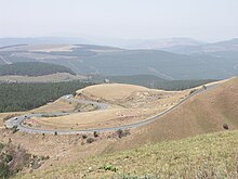
The R526 is a Regional Route in South Africa that connects Gravelotte with The Oaks via Mica.

The R533 is a Regional Route in South Africa.

The R536 is a Regional Route in South Africa.

The R539 is a Regional Route in Mpumalanga, South Africa. It connects the R36 between Waterval Boven and Mashishing (Lydenburg) with the R37 between Sabie and Nelspruit.

The R540 is a Regional Route in Mpumalanga, South Africa that connects Belfast with Lydenburg via Dullstroom.

The R555 is a Regional Route in South Africa that connects Springs with Ohrigstad via Delmas, Ogies, Witbank, Middelburg, Stoffberg and Burgersfort.

The M8 road is a metropolitan route in the City of Tshwane in Gauteng, South Africa. It connects Capital Park with Mamelodi via Gezina, Villieria and Eersterust.

References

  1. 1 2 3 4 5 6 "RDDA SOUTH AFRICAN NUMBERED ROUTE DESCRIPTION AND DESTINATION ANALYSIS". NATIONAL DEPARTMENT OF TRANSPORT. May 2012. Retrieved 25 March 2021.