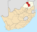
The West Coast District Municipality is a district municipality located in the Western Cape province of South Africa. Its municipality code is DC1. Moorreesburg is the seat of the district. As of 2011 it had a total population of 391,766.

Matzikama Local Municipality is a local municipality which governs the northernmost part of the Western Cape province of South Africa, including the towns of Vredendal, Vanrhynsdorp, Klawer and Lutzville, and the surrounding villages and rural areas. As of 2011 it had a population of 67,147. It forms part of the West Coast District Municipality, and has municipality code WC011.

The Olifants River,Lepelle, iBhalule or Obalule is a river in South Africa and Mozambique, a tributary of the Limpopo River. It falls into the Drainage Area B of the Drainage basins of South Africa. The historical area of the Pedi people, Sekhukhuneland, is located between the Olifants River and one of its largest tributaries, the Steelpoort River.
The Olifants River is a river in the northwestern area of the Western Cape Province of South Africa. The upper and main catchment area of the Olifants river is around Ceres and the Cederberg mountains. The Clanwilliam and Bulshoek dams are located on the river and provide water for the towns and farms along the watercourse. The river is approximately 285 km long with a catchment area of 46,220 km2 and flows into the Atlantic Ocean at Papendorp, 250 km north of Cape Town.
Groot River or Grootrivier may refer to:

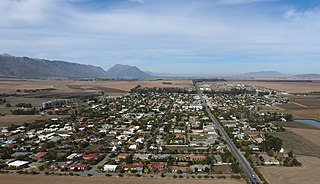
Vredendal is a town in the northern Olifants River Valley in the Western Cape province of South Africa, with a population of 16,164 people. It is situated 250 kilometres (160 mi) north of Cape Town on the banks of the Olifants River at the southern edge of Little Namaqualand.

Olifants River is a river in the Klein Karoo area of the Western Cape, South Africa.

The Outeniqua Mountains, named after the Outeniqua Khoikhoi who lived there, is a mountain range that runs a parallel to the southern coast of South Africa, and forms a continuous range with the Langeberg to the west and the Tsitsikamma Mountains to the east. It was known as Serra de Estrella to the Portuguese. The mountains are part of the Garden Route of South Africa.
Porterville is a town in the Western Cape province of South Africa.

Citrusdal is a town of 5,000 people in the Olifants River Valley in the Western Cape province of South Africa. It is situated at the base of the Cederberg mountains about 160 kilometres (100 mi) north of Cape Town. Agriculture in the area is dominated by citrus fruit farming, hence the town's name. Natural hot water springs occur in the area.

The Southern African Ndebele are an Nguni ethnic group native to South Africa who speak Southern Ndebele, which is distinct from the Zimbabwean Ndebele language.
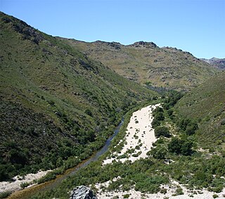
The Groot River is a river in the Western Cape Province, South Africa. It is part of the Olifants/Doring River system. It is not to be confused with the Groot River of Eastern Cape or the Groot River of Southern Cape provinces.

The Motlatse River, Blyde River, or Umdhlazi River is a river in the Mpumalanga and Limpopo provinces of South Africa. It has a northwards course in steep-sided valleys and ravines of the Mpumalanga Drakensberg, before it enters the lowveld region of the Limpopo province. It has its ultimate origins at around 2,000 m altitude in the Hartebeesvlakte conservation area, to the north of Long Tom Pass. It runs through the Blyde River Canyon.

The Levubu River or Levuvhu is located in the northern Limpopo province of South Africa. Some of its tributaries, such as the Mutshindudi River and Mutale River rise in the Soutpansberg Mountains.
The Doring River is a river in the Western Cape Province, South Africa. It is part of the Olifants/Doring River system.
The Ga-Selati River or Selati River is a river in Limpopo, South Africa.

The Bronkhostspruit,, is a river in Gauteng, province South Africa. It is a tributary of the Wilge River, Olifants River basin that gives its name to Bronkhorstspruit town.

The Letaba River, also known as Leţaba, Lehlaba or Ritavi, is a river located in eastern Limpopo Province, South Africa. It is one of the most important tributaries of the Olifants River.

The Wolkberg is a mountain range in Tzaneen, Limpopo Province, South Africa. It is a northern termination and a subrange of the Drakensberg mountain range which lines up from Eastern Cape, Lesotho, Kwazulu Natal and Mpumalanga. At 2200m (7200ft) above sea level, it is the highest mountain range in Limpopo, together with the Iron crown mountain. Its Meteorological significance is that it brings along cold fronts and is a source of cold winters throughout the Limpopo province, the cold front gets transferred from greater Drakensberg mountains in Kwazulu Natal all the way to the Wolkberg. Without the Wolkberg, Limpopo will not experience cold winters at all. The range extends for about 30 km (19 mi) in a NW/SE direction north of Sekhukhuneland. The nearest towns are Haenertsburg and Tzaneen.
The Riet River is a river in the Western Cape Province, South Africa. It is part of the Olifants/Doring River system.